Satellites Predict Forest Fires Better Than Experts

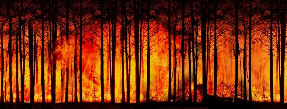
Featured image: by Gerd Altmann from Pixabay.

Paper: Satellite Hydrology Observations as Operational Indicators of Forecasted Fire Danger Across the Contiguous United States

Authors: Alireza Farahmand, E. Natasha Stavros, John T. Reager, Ali Behrangi, James T. Randerson, and Brad Quayle.

Forest Fires are a natural part of the ecosystem that clear out old and overgrown vegetation and recycle nutrients back into the soil.  However, increasing growth into these forested areas has increased the wildland fire hazards to people and their homes and businesses. This has subsequently increased the use of resources and funds to battle and restore damage from these fires. In the United States alone, federal wildfire suppression expenditures tripled from $0.4 billion per year to $1.4 billion per year in the last century. These economic impacts inspired researchers from the California Institute of Technology, University of Arizona, University of California – Irvine and the United States Department of Agriculture to see if they could improve wildfire prediction beyond our current limited methods using subjective expert knowledge and weather forecasts.

Continue reading “Satellites Predict Forest Fires Better Than Experts”

Looking for life on Mars: what can the valleys that once flowed into Jezero crater tell us about the best rocks to sample?

Featured image: Artist depiction of the Mars 2020 Perseverance Rover on Mars. Public domain (NASA/JPL-Caltech).

Paper: Fluvial Regimes, Morphometry, and Age of Jezero Crater Paleolake Inlet Valleys and Their Exobiological Significance for the 2020 Rover Mission Landing Site.

Authors: Nicolas Mangold, Gilles Dromart, Veronique Ansan, Francesco Salese, Maarten G. Kleinhans, Marion Masse, Cathy Quantin-Nataf, and Kathryn M. Stack.

On Mars, we see a very different landscape to that on Earth. Although now an arid planet, great scars visible from space – such as the colossal Valles Marineris, which dwarfs Earth’s Grand Canyon – hint at a once watery world. But scientists still aren’t sure whether water on Mars might once have hosted life. On the 30th of July, NASA will launch the Mars 2020 mission, which will gather clues about the planet’s past and seek signs of ancient life on Mars. An essential part of such a space mission is extensive planning, so that scientists can target the most important rocks for study and sampling when the rover gets to Mars. A recent study by Nicolas Mangold and colleagues did just that by looking closely at the landing site for this next Mars mission, known as Jezero crater.

Continue reading “Looking for life on Mars: what can the valleys that once flowed into Jezero crater tell us about the best rocks to sample?”

Evidence of pollution all the way to the poles

Featured Image: Lake Hazen in front of the Grant Land Mountains – photo courtesy Kyra St. Pierre, a co-author of the Sun et al. paper.

Paper: Glacial melt inputs of organophosphate ester flame retardants to the largest High Arctic lake

Authors: Sun, Yuxin, Amilia O. De Silva, Kyra A. St Pierre, Derek C. G. Muir, Christine Spencer, Igor Lehnherr, John J. MacInnis

Far from human habitation Lake Hazen sits north of the Arctic Circle surrounded by pristine, treeless mountains. But even there, the telltale chemical fingerprints of human pollution can be found.

Spring and summer in the far North are a short three-month period of reawakening, glacial melt, and permafrost thaw. During these months, meltwater transports anything that has collected on top of glaciers, like particles, nutrients, and contaminants deposited from the atmosphere, flowing down rivers and into glacial lakes. 

Continue reading “Evidence of pollution all the way to the poles”

Cave formations show link between ice ages and the tilt of Earth’s axis

Paper: Persistent influence of obliquity on ice age terminations since the Middle Pleistocene transition

Featured image: Stalagmites captured by mareke on Pixabay

Authors: Petra Bajo, Russell N. Drysdale, Jon D. Woodhead, John C. Hellstrom, David Hodell, Patrizia Ferretti, Antje H.L. Voelker, Giovanni Zanchetta, Teresa Rodrigues, Eric Wolff, Jonathan Tyler, Silvia Frisia, Christoph Spötl, Anthony E. Fallick

Our planet has been circling and spinning in a wobbly dance around the Sun for billions of years. The exact motions of this dance- governed by Earth’s near-circular orbit (eccentricity), the tilt of its axis, and the orientation of the tilted axis in space (precession) fluctuate predictably. Variations in this planetary dance have changed the amount and distribution of sunlight reaching Earth’s surface through time, and have determined when the planet experienced long periods of cold temperatures and growth of massive ice caps on the continents (ice ages). However, scientists have not been so sure about which planetary motion is the most important for the timing of ice ages. New research uses climate information stored in caves to precisely link these motions to ice ages, showing that axis tilt may be the most important position in the dance when it comes to pulling Earth’s climate out of those frigid times.  

Continue reading “Cave formations show link between ice ages and the tilt of Earth’s axis”

We’re Not in Kansas Anymore: Documenting Historical Tornadoes in Northern Eurasia

Feature image: “Tornado Alley” by Nikolas Noonan on unsplash.com (https://unsplash.com/photos/n_3kdpSkrJo)

Paper: Tornadoes in Northern Eurasia: From the Middle Age to the Information Era
Authors: A. Chernokulsky, M. Kurgansky, I. Mokhov, A. Shikhov, I. Azhigov, E. Selezneva, D. Zakharchenko, B. Antonescu, and T. Kühne

When most people are asked to picture a tornado in their mind, they probably imagine the violent column of swirling wind and debris tearing through an open field in rural Kansas, as depicted in the classic 1939 film The Wizard of Oz. However, while the United States Midwest, so-called “Tornado Alley”, is the most well-known tornado hot-spot in the world, tornadoes touch down on every continent except Antarctica. A recent study by Chernokulsky and his team has established a comprehensive history of tornadoes that have occurred in an area commonly neglected in tornado research: northern Eurasia.

Continue reading “We’re Not in Kansas Anymore: Documenting Historical Tornadoes in Northern Eurasia”

Great Success with Mixed Perennial Grasses for Bioenergy Crops

Paper: Climate Benefits of Increasing Plant Diversity in Perennial Bioenergy Crops
Authors: Yi Yang, Evelyn C. Reilly, Jacob M. Jungers, Jihui Chen, Timothy M. Smith

An Advanced Bioenergy plant.
Source: Ammodramus / CC BY-SA via Wikimedia Commons.

Climate change, primarily caused by fossil-fuel-based CO2 emissions, could trigger disastrous consequences, including extreme weather and mass species extinctions. Bioenergy (a renewable energy derived from plants) can reduce greenhouse gas emissions by replacing fossil fuel with biomass.  Atmospheric carbon is consumed via photosynthesis by bioenergy crops, such as wood, grain crops, and perennial grasses.  Perennial grasses are good candidates for bioenergy crops because they can be directly combusted or converted to ethanol.

Continue reading “Great Success with Mixed Perennial Grasses for Bioenergy Crops”

Thickets and patches: woody plants are changing water availability in dry landscapes

Featured Image: Sparse woody plant encroachment, known as xerification, occurs here in the Chihuahuan Desert north of Coyame, in Chihuahua, Mexico. Source: Ricraider / CC BY-SA via Wikimedia Commons.

Paper: Woody Plant Encroachment has a Larger Impact than Climate Change on Dryland Water Budgets

Authors: A.P. Schreiner-McGraw, E.R. Vivoni, H. Ajami, O.E. Sala, H.L. Throop, and D.P.C. Peters

Almost half of the land on Earth is arid, with little precipitation. Arid lands are home to roughly 20% of the world’s human population, and to much of the world’s livestock as well. Arid lands are changing rapidly, both with respect to land cover and water availability. While the effects of climate change on arid places have attracted a lot of attention, the encroachment of woody plants into grasslands is also rapidly transforming arid landscapes. New research shows that the effects of woody plant encroachment are even more important than climate change for the water budget of arid ecosystems.

Continue reading “Thickets and patches: woody plants are changing water availability in dry landscapes”

Tiny but Mighty! Nanosized Drivers of Explosive Volcanism

Paper: Can nanolites enhance eruption explosivity?

Authors: F. Cáceres, F. B. Wadsworth, B. Scheu, M. Colombier, C. Madonna, C. Cimarelli, K-U. Hess, M. Kaliwoda, B. Ruthensteiner, D. B. Dingwell

Explosive volcanic eruptions have punctuated our planet’s geological record for millions of years. The explosive nature of these eruptions can lead to thousands of cubic kilometers (that’s a billion Olympic swimming pools) of material travelling hundreds of miles across our landscapes and into our atmosphere. Approximately 630,000 years ago, the most recent eruption from the Yellowstone volcanic center sent ash and dust from Wyoming to southern Texas, USA. More recently, the 1815 eruption of Mt. Tambora, Indonesia, led to 1816 being historically known as the “Year Without a Summer”. The “Year without a summer” was started when volcanic materials entered the atmosphere and induced a volcanic winter, which led to extreme weather, agricultural stresses, and food shortages across the globe.

Continue reading “Tiny but Mighty! Nanosized Drivers of Explosive Volcanism”

Pioneering plants tell us when volcanoes last erupted

Featured image: vegetated lava flows on Le Grand Brûlé, with the profile of Piton de la Fournaise behind. Image credit: Mickaël Douineau on Flickr (CC BY-NC-ND 2.0).

Paper : Dating young (<1000 yr) lava flow eruptions of Piton de la Fournaise volcano from size distribution of long-lived pioneer trees Authors: Sébastien Albert, Olivier Flores, Laurent Michon and Dominique Strasberg

A newly formed lava flow may appear to be a sterile environment: devoid of vegetation and humus. But within years, the rocky wasteland erupts into life as a host of tenacious plants take hold. The size of plants rooted on solidified lava is now being used by volcanologists working on Piton de la Fournaise, a shield volcano on the Indian Ocean island of Réunion, to date past eruptions.

Continue reading “Pioneering plants tell us when volcanoes last erupted”

Tiny wobbles foreshadow big earthquakes

Featured image: A GPS station in the Sawtooth National Forest near Ketchum, Idaho. Photo by Scott Haefner (USGS).

Paper: Months-long thousand-kilometre-scale wobbling before great subduction earthquakes
Authors: J. R. Bedford, M. Moreno, Z. Deng, O. Oncken, B. Schurr, T. John, J. C. Báez, M. Bevis

We’re always on the lookout for earthquake precursors, indicators that the Earth might be gearing up for some shaking, and geophysicists think they might have found a new one: a small but measurable back-and-forth “wobble” of the land starting several months before very big earthquakes hit.

Continue reading “Tiny wobbles foreshadow big earthquakes”