Making Mountains Out of Molehills? Long-Term Geomorphic Surface Impacts of Mountaintop Removal Mining

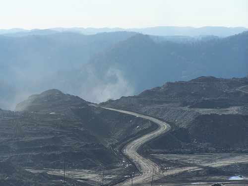
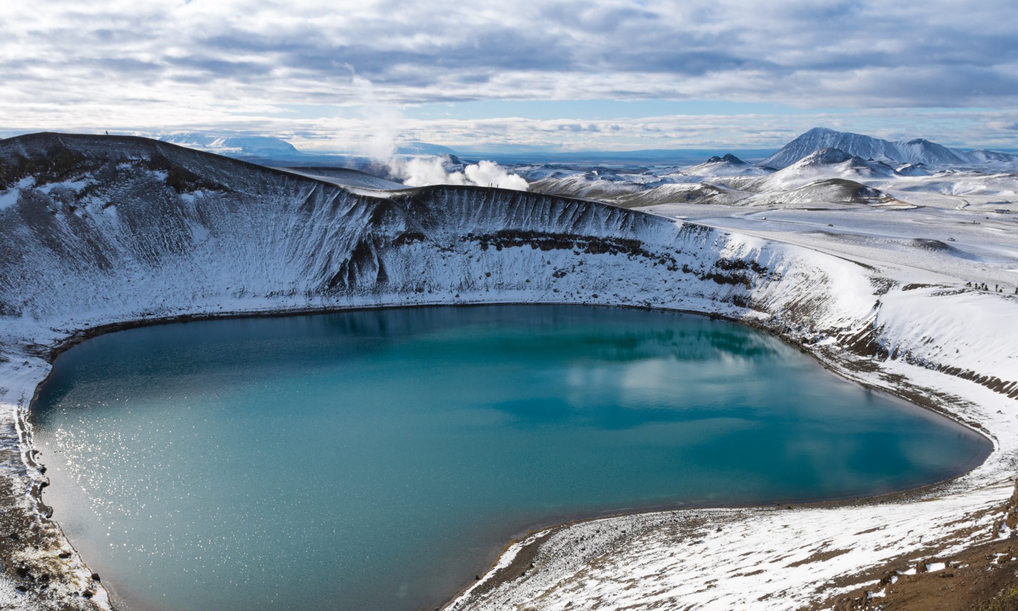
Featured Image:  Mountaintop removal mining site in Appalachia. Copyright: CC BY-SA 4.0 via. wikimedia commons.

Report: Peripheral gully and landslide erosion on an extreme anthropogenic landscape produced by mountaintop removal coal mining (2020)

Authors: Miles Reed & Dr. Steve Kite

There’s a general consensus that coal mining is ‘bad’ for the environment, but beyond carbon emissions, what is its visible, physical impact on our surroundings? What lasting damage does mining create on the Earth’s surface? The answer is that it has a tremendous impact; specifically, mining in Appalachia is linked to distorting the natural flow of water on the landscape, which creates ripple (no pun intended) effects on the greater environment. A recent study by Reed and Kite details those effects on Appalachian landscapes, directly linking mountaintop mining to erosion and landslides. Now, as worries about access to safe, clean water being jeopardized by fossil fuel production abound nationwide, exploring the impacts of mountaintop mining on Appalachian freshwater becomes incredibly important with immediate and personal impacts.

Continue reading “Making Mountains Out of Molehills? Long-Term Geomorphic Surface Impacts of Mountaintop Removal Mining”

It’s magnetic! Probing the predictability of ancient rainfall using a mountainous ridge of red stone

Featured image: From Fig. 1 in Ao et al. (2021). An image of the Late Oligocene-age red mudstone that is the subject of this study, between bracketing sandstone sections. This mudstone outcrop (known as the Duittingou section) is located in the Lanzhou Basin, China, in the northeastern Tibetan Plateau. Image licensed under CC BY-NC.

Paper: Eccentricity-paced monsoon variability on the northeastern Tibetan Plateau in the Late Oligocene high CO2 world

Authors: Hong Ao, Diederik Liebrand, Mark J. Dekkers, Peng Zhang, Yougui Song, Qingsong Liu, Tara Jonell, Qiang Sun, Xinzhou Li, Xinxia Li, Xiaoke Qiang, Zhisheng An

The intensity and frequency of rainfall affects food supply around the world, the structural integrity of buildings and homes, and flooding in the impermeable “concrete jungles” of cities. However, not much is known about how rainfall has fluctuated naturally in the distant past, making it more difficult for scientists to predict how climate change will affect future precipitation. Recently, an international team of authors addressed a small part of this problem by uncovering how rainfall in Asia changed under different climates far back in time. Their scientific adventure started once they identified a particularly special rock formation in China, where invisible traces of ancient rainfall had been preserved.

Continue reading “It’s magnetic! Probing the predictability of ancient rainfall using a mountainous ridge of red stone”

Carbon to carbonates: capturing CO2 with rocks

Featured image: a field of basalt in Hawai’i Volcanoes National Park (National Park Service, public domain)

Paper: Potential CO2 removal from enhanced weathering by ecosystem respnses to powdered rock
Authors: Daniel S. Goll et al.

In the 2015 Paris Agreement, nations pledged to work toward a common goal of limiting global warming to less than 2°C compared to pre-industrial times. The Agreement doesn’t specify how the signatories should do this, though: levy a carbon tax? Shut down coal-fired power plants? Use a stainless steel straw? According to the best available climate science, we will need to be doing all of the above and then some. In fact, meeting the target of the Paris Agreement will require negative emissions, removing greenhouse gases from the atmosphere via some form of Negative Emissions Technology (NET).

Continue reading “Carbon to carbonates: capturing CO2 with rocks”

Mysteries of the deep (and bumpy) seafloor

Featured image: Elevation map of a seamount in the central Pacific, shown in a persepctive view. Image courtesy of the NOAA Office of Ocean Exploration and Research (public domain).

Paper: Fluid-rich subducting topography generates anomalous forearc porosity
Authors: Christine Chesley, Samer Naif, Kerry Key, Dan Bassett

Open any geology textbook, and you’re guaranteed to find a cartoon of a subduction zone showing how an incoming oceanic plate dives down beneath another tectonic plate (either continent or ocean) on its way back into Earth’s deep interior. These simple sketches typically show the top of the incoming plate as a smooth, gently curved line meeting and joining another smooth line at the base of the overriding plate – and that’s not exactly wrong, given the enormous scale of a subduction zone compared to the smallness of the drawing. But if you zoom in far enough on oceanic tectonic plates, the seafloor is often rough and bumpy. What happens, then, when rough seafloor heads into a subduction zone?

Continue reading “Mysteries of the deep (and bumpy) seafloor”

The only way is… down? Groundwater on Mars could support microbial life in the present day

Featured image: A person exploring the rocks of a cave on Earth, Pixabay.

Paper: Earth-like Habitable Environments in the Subsurface of Mars

Authors: J.D. Tarnas, J.F. Mustard, B. Sherwood Lollar, V. Stamenković, K.M. Cannon, J.-P. Lorand, T.C. Onstott, J.R. Michalski, O. Warr.

Mars exploration has been looking “up” recently: the Ingenuity helicopter performed the first powered flight on another planet, and veteran rover Curiosity gave us stunning images from the top of Mount Mercou. But if we want to look for life on Mars, it might be time for us to look down instead. New research suggests that life on present day Mars could be sustained by chemical energy produced through the interaction between water and rocks deep underground, like it is here on Earth.

Continue reading “The only way is… down? Groundwater on Mars could support microbial life in the present day”

Oxia Planum: ExoMars 2022 Landing Site

Featured Image: Artist’s impression of ESA’s ExoMars rover ‘Rosalind Franklin’ on the surface of Mars. Credit: ESA.

Paper: Oxia Planum: The Landing Site for the ExoMars “Rosalind Franklin” Rover Mission: Geological Context and Prelanding Interpretation

Authors: Quantin-Nataf et al., 2021

We are entering a new dawn of Mars exploration: Perseverance rover touched down on Mars earlier this year, which marks the start of what will be a decade-long effort to return samples from Mars. In 2022 the European Space Agency (ESA) will launch the ExoMars rover, which will team up with the ExoMars Trace Gas Orbiter (TGO) to find evidence of past or present life on Mars.

Continue reading “Oxia Planum: ExoMars 2022 Landing Site”

Prehistoric Microbial Meals Found in the Australian Outback

Featured Image: Rock fracture from the Dresser Formation, Australia. Fluid inclusions are trapped in the white stripes. Image courtesy Ser Amantio di Nicolao, used with permission.

Paper: Ingredients for microbial life preserved in 3.5 billion-year-old fluid inclusions

Authors: Helge Mißbach, Jan-Peter Duda, Alfons M. van den Kerkhof, Volker Lüders, Andreas Pack, Joachim Reitner, Volker Thiel

Just a few weeks ago NASA made a historic landing of the Perseverance rover on Mars.  This rover symbolizes our human drive for exploration and the need to find the origins of life to answer the big question—are we alone in the universe?  In addition to extraterrestrial investigation and research, we can address this fundamental question here on our own planet by digging into extreme environments that are analogs for ancient Earth or other planets.  These unusual environments, such as hydrothermal vents in our deepest oceans, boiling hot springs in Yellowstone, and prehistoric lakes in South America, can give us glimpses of ancient information and clues about to the ingredients of life.  By discovering our own origins of life, we can begin to understand how it may evolve on other planets.

Continue reading “Prehistoric Microbial Meals Found in the Australian Outback”

The strange case of the Kansas earthquake

Featured image: Karst rocks in Segovia, Spain. Photo by Luis Fernández García, CC-BY-SA 2.1.

Paper: Injection-induced earthquakes near Milan, Kansas controlled by karstic networks
Authors: Charlène Joubert, Reza Sohrabi, Justin L. Rubinstein, Gunnar Jansen, Stephen A. Miller

On November 12th, 2014, a magnitude 4.9 earthquake rattled the city of Milan, Kansas. This event was the largest earthquake ever recorded in Kansas, adding to a trend of increasing seismic activity in the state since 2012. What could cause this kind of tectonic excitement in the stable central US?

Continue reading “The strange case of the Kansas earthquake”

Iceland’s constantly changing landscape: A Book Review

Featured Image: Lake in a volcano’s crater at Mývatn, Iceland. Photo by Philipp Wüthrich on Unsplash.

Book: Iceland: Tectonics, Volcanics, and Glacial Features, Geophysical Monograph 247 (First Edition, 2020)
Author: Dr. Tamie J. Jovanelly
Figure Illustrations: Nathan Mennen
Additional Text:
Emily Larrimore
Publisher:
American Geophysical Union, John Wiley & Sons, Inc.

I have always wanted to go to Iceland and travel the countryside marveling at the island’s unique geology and icy wonder. Reading through Iceland: Tectonics, Volcanics, and Glacial Features by Dr. Tamie J. Jovanelly, I felt like I got my chance to tour Iceland; this time with a very experienced guide. Dr. Jovanelly has been to Iceland more than ten times since 2006 to explore and study and her familiarity with the place and the people who live there is engrained in this text.

Continue reading “Iceland’s constantly changing landscape: A Book Review”

Looking for life on Mars: what can the valleys that once flowed into Jezero crater tell us about the best rocks to sample?

Featured image: Artist depiction of the Mars 2020 Perseverance Rover on Mars. Public domain (NASA/JPL-Caltech).

Paper: Fluvial Regimes, Morphometry, and Age of Jezero Crater Paleolake Inlet Valleys and Their Exobiological Significance for the 2020 Rover Mission Landing Site.

Authors: Nicolas Mangold, Gilles Dromart, Veronique Ansan, Francesco Salese, Maarten G. Kleinhans, Marion Masse, Cathy Quantin-Nataf, and Kathryn M. Stack.

On Mars, we see a very different landscape to that on Earth. Although now an arid planet, great scars visible from space – such as the colossal Valles Marineris, which dwarfs Earth’s Grand Canyon – hint at a once watery world. But scientists still aren’t sure whether water on Mars might once have hosted life. On the 30th of July, NASA will launch the Mars 2020 mission, which will gather clues about the planet’s past and seek signs of ancient life on Mars. An essential part of such a space mission is extensive planning, so that scientists can target the most important rocks for study and sampling when the rover gets to Mars. A recent study by Nicolas Mangold and colleagues did just that by looking closely at the landing site for this next Mars mission, known as Jezero crater.

Continue reading “Looking for life on Mars: what can the valleys that once flowed into Jezero crater tell us about the best rocks to sample?”