Taking the measure of the measurer

Featured image: A USGS “Did you feel it?” map for a M6.5 earthquake that occurred in the Monte Cristo Range in Nevada on May 15th, 2020 (public domain)

Paper: Which earthquake accounts matter?
Authors: Susan E. Hough and Stacey S. Martin

Seismologists who study earthquakes spend much of their time looking at wiggly lines that represent recordings of ground motion from seismometers, but in places where those data aren’t available, we often turn to what we call “macroseismic” data: eyewitness accounts from people who felt the shaking. But when we ask people on the ground, “Did you feel it?,” who is answering?

Continue reading “Taking the measure of the measurer”

Cracking the code of the caramel crust

Featured image: a view of the Calico Basin in the eastern part of the Mojave Desert. Photo by Fred Morledge, CC BY-SA 2.5, via Wikimedia Commons.

Paper: Thin crème brûlée rheological structure for the Eastern California Shear Zone
Authors: Shaozhuo Liu, Zheng-Kang Shen, Roland Bürgmann, & Sigurjón Jónsson

A recent paper by Liu and colleagues aims to answer a fundamental question in geodynamics: are Earth’s tectonic plates more like a jelly sandwich, or a crème brûlée? It may sound silly, but these two models for crustal strength describe how tectonic plates might respond to stress changes due to earthquakes.

Continue reading “Cracking the code of the caramel crust”

Etched in stone: tracing earthquakes through archaeological ruins

The Shore Temple at Mahabalipuram, Tamil Nadu, India

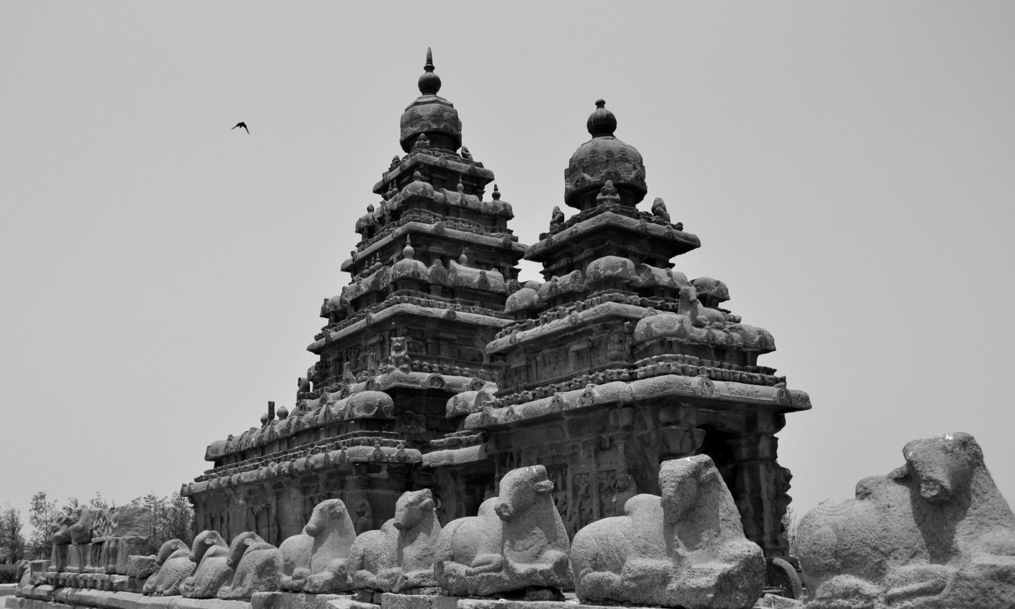
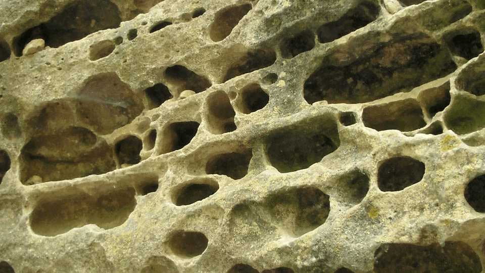
Feature image: Shore Temple at Mahabalipuram, Tamil Nadu, India by Nireekshit, CC BY-SA 3.0

Article: Archaeoseismological potential of the Indian subcontinent.

Authors: Miklós Kázmér, Ashit Baran Roy and Siddharth Prizomwala

India’s ancient monuments whisper more than just stories of past empires and civilizations: they also tell tales of its geological past. Evidence of earthquakes is etched in stone, displacements and warps that can help us identify past seismic events.

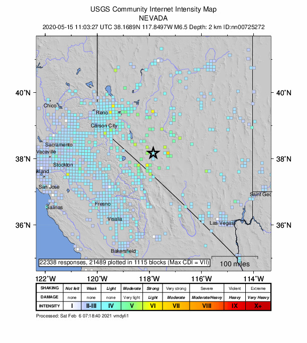
India’s documentation of earthquakes is sketchy, pieced together from historical data, monographs, and British records. In 1898, the first seismograph was established in Pune, Maharashtra, but serious instrumental recording only began when the 1967 Koyna Dam earthquake struck.Such a short record is not enough to map out active seismic regions or understand recurring earthquakes, so some scientists are turning to archaeological evidence.

Archaeoseismology studies past earthquakes by analysing damage to archaeological sites. How much damage an earthquake does to a structure depends on how hard or soft the ground beneath is, and damage may be mitigated through preventative building techniques. Earthquakes can result in shifts and tilts in masonry or brickwork, displaced walls, warped floors, missing sections, and sometimes, a complete collapse of the structure. The Earthquake Archaeological Effects (EAE) scale helps categorise the intensity of past earthquakes based on observations of structural damage.

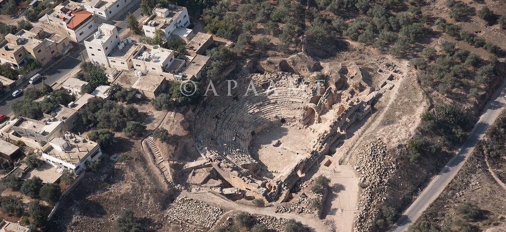
A recent paper by Kazmer et al., looks at earthquake damage to 3 late medieval UNESCO World Heritage sites: Mahabalipuram in Tamil Nadu (7th-8th CE), the Qutub Minar complex in Delhi (12th-19th CE), and Konark near Bhubaneshwar in Odisha state (13th CE). All three sites feature masonry buildings commonly seen in 7th and 12th centuries CE architecture across the Indian subcontinent. The seismic history of the subcontinent is understudied compared to the seismically active Himalayan terrain.

The tilt of masonry wall and floor at the Shore Temple in Mahabalipuram indicates liquefaction, a sudden loss of soil stability that can be caused by a seismic shock.. In the Qutub Minar complex, damage to the minar including masonry blocks at the top of Iltutmish’s tomb with gaps of about 5 cms  are attributed to an earthquake in 1803. At Konark, smaller temples around the Sun Temple display shifted blocks. Other temples are missing a shikhara or deul, the temple spire or tower, which might have been toppled by an earthquake.

Beyond categorising such damage, archaeoseismology can indicate the date or date interval, location, and intensity for both seismically active and less active regions. Comparisons with historical records can offer broader insights into the Indian subcontinent. The volcanic plateau that forms the Indian peninsula has long been considered a ‘stable’ region, yet all 3 sites in this study located on the ‘Indian shield’ indicate otherwise – the region has seen earthquake activity in the past. 

Over the years, monuments have undergone intensive restoration by various rulers, British colonial authorities and the Archaeological Survey of India to preserve them for future generations, but in the process, the evidence of past earthquakes has been erased. Kazmer and co-authors suggest that archaeoseismic studies are conducted before all large-scale restoration projects. That way, we can ensure both the historical and geological legacies are preserved for posterity.


Etched in stone: tracing earthquakes through archaeological ruins by Devayani Khare is licensed under a Creative Commons Attribution-ShareAlike 4.0 International License.

Shaken, rattled, and rolled

Featured image: an aerial photograph of the Capitolias/Beit-Ras theater, courtesy of the Aerial Photographic Archive of Archaeology in the Middle East (APAAME), CC-BY-NC-ND 2.0

Paper: Two inferred antique earthquake phases recorded in the Roman theater of Beit-Ras/Capitolias (Jordan)
Authors: M. Al-Tawalbeh, R. Jaradat, K. Al-Bashaireh, A. Al-Rawabdeh, A. Gharaibeh, B. Khrisat, and M. Kázmér

One of the biggest questions in earthquake seismology is whether we can see into the future, to forecast seismic activity based on what we know about faults and how they behave. We’re about as likely to accurately predict earthquakes as we are to see the future in a crystal ball, but one way we can improve our forecasts of seismic hazard actually involves looking in the other direction: back into the past.

Continue reading “Shaken, rattled, and rolled”

Building mountains

Featured image: Yushan (Jade Mountain) in Taiwan. From Wikimedia Commons by Kailing3 under a CC-BY-SA 3.0 license.

Paper: Coseismic Uplift of the 1999 Mw7.6 Chi‐Chi Earthquake and Implication to Topographic Change in Frontal Mountain Belts

Authors: R.Y. Chuang, C.H. Lu, C.J. Yang, Y.S. Lin, and T.Y. Lee

Journal: Geophysical Research Letters

The height of a mountain range results from a hard-fought battle between tectonic plates and the forces of erosion. Earthquakes generated by clashes between plates cause the upward motion of rock even as they shake the landscape, causing large and numerous landslides. When a large earthquake occurs, which process wins? Does more rock go up than come down, leading to a higher mountain range? Or does shaking-induced erosion remove more material than is uplifted by the earthquake? New research suggests that earthquakes might be able to build mountains up faster than landslides can bring them down.

Continue reading “Building mountains”

The strange case of the Kansas earthquake

Featured image: Karst rocks in Segovia, Spain. Photo by Luis Fernández García, CC-BY-SA 2.1.

Paper: Injection-induced earthquakes near Milan, Kansas controlled by karstic networks
Authors: Charlène Joubert, Reza Sohrabi, Justin L. Rubinstein, Gunnar Jansen, Stephen A. Miller

On November 12th, 2014, a magnitude 4.9 earthquake rattled the city of Milan, Kansas. This event was the largest earthquake ever recorded in Kansas, adding to a trend of increasing seismic activity in the state since 2012. What could cause this kind of tectonic excitement in the stable central US?

Continue reading “The strange case of the Kansas earthquake”

Marsquakes give scientists an InSight to Mars

Featured image: An artist’s concept of NASA’s InSight lander on Mars with a cutaway of the surface below. Credit: IPGP/Nicolas Sarter.

Paper: Constraints on the shallow elastic and anelastic structure of Mars from InSight seismic data

Authors: Philippe Lognonné et al.,

Scientists are able to ‘see’ the internal structure of the Earth based on seismic waves recorded during Earthquakes. Earthquakes send seismic waves out in all directions with two main types: (1) surface waves are the major culprits of Earthquake damage as they remain on the surface; (2) faster body waves can travel down within Earth’s interior. The body waves are the fastest seismic waves, consisting of the first (primary; P-wave) and second (secondary, S-wave) waves to arrive at a location away from the epicentre of an Earthquake.

Continue reading “Marsquakes give scientists an InSight to Mars”

Tiny wobbles foreshadow big earthquakes

Featured image: A GPS station in the Sawtooth National Forest near Ketchum, Idaho. Photo by Scott Haefner (USGS).

Paper: Months-long thousand-kilometre-scale wobbling before great subduction earthquakes
Authors: J. R. Bedford, M. Moreno, Z. Deng, O. Oncken, B. Schurr, T. John, J. C. Báez, M. Bevis

We’re always on the lookout for earthquake precursors, indicators that the Earth might be gearing up for some shaking, and geophysicists think they might have found a new one: a small but measurable back-and-forth “wobble” of the land starting several months before very big earthquakes hit.

Continue reading “Tiny wobbles foreshadow big earthquakes”

How to locate oceanic earthquakes without getting your feet wet

Photo of a fence offset by fault slip on the San Andreas during the 1906 San Francisco earthquake

Featured image: A fence broken by the 1906 San Francisco earthquake, by G. K. Gilbert. Public domain.

For the millions of people living near the San Andreas fault zone in California, the billion-dollar question is when the next “big one” is going to happen.

Continue reading “How to locate oceanic earthquakes without getting your feet wet”

What Caused the Flood that (Possibly) Gave Rise to an Empire?

Featured image: The Yellow River Breaches its Course by Ma Yuan, Public Domain

Paper: Uranium isotopic constraints on the nature of the prehistoric flood at the Lajia site, China
Authors: Le Li, Jun Chen, David William Hedding, Yuanhe Fu, Maolin Ye, Gaojun Li

A small sand deposit might hold the key to dating the rise of China’s first dynasty. Continue reading “What Caused the Flood that (Possibly) Gave Rise to an Empire?”