Hunting for Antibiotics in Caves

Featured Image courtesy Doronenko and Wikimedia Commons

Paper: High-Throughput Sequencing Analysis of the Actinobacterial Spatial Diversity in Moonmilk Deposits.

Authors: Marta Maciejewska , Magdalena Całusińska, Luc Cornet, Delphine Adam, Igor S. Pessi, Sandrine Malchair, Philippe Delfosse, Denis Baurain, Hazel A. Barton, Monique Carnol and Sébastien Rigali

Do you ever think about the microbes around you when you go caving? Me neither, but a team of scientists from Belgium did. 

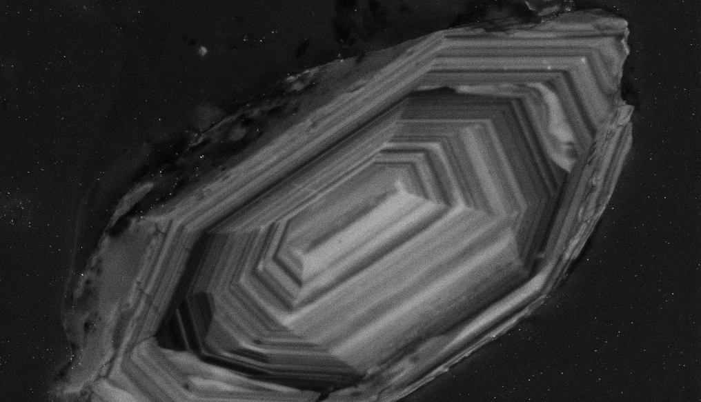
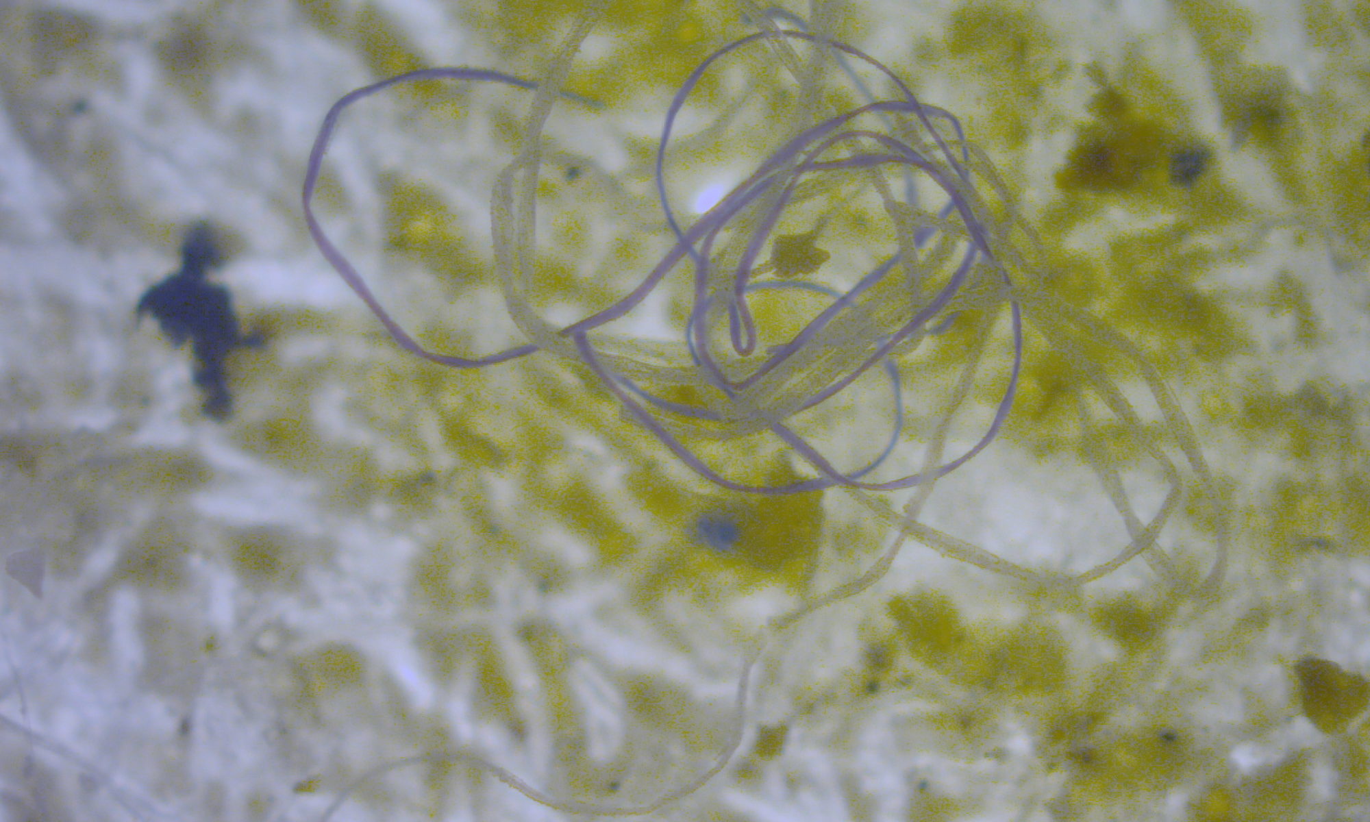
Actinobacteria are found in many places around the world, including volcanic terrains and ice caves. They are of particular importance to cave ecosystems and structure since the formation of speleothems (cave formations) like moon milk is thought to be aided by Actinobacteria. These microbes are known for their ability to produce filaments and aid calcium carbonate deposition and precipitation, which could be important for the mineral deposition that forms speleothems. 

Moonmilk deposits from Bergmilchkammer cave (1862/20), courtesy Doronenko and Wikimedia Commons

Despite the importance of microbes in caves, our understanding of microbial communities and spatial distribution within a cave is still fairly limited, i.e. we still don’t know which microbes dominate cave formations and where they live. An international team of scientists set out to answer these questions using three speleothems in the Grotte des Collemboles (English: Springtails’ Cave) in Belgium. Using sterile scalpels, the team scraped soft moonmilk deposits from the walls of the cave into tubes to understand whether different speleothems in the same cave have different bacterial communities.

Using high-throughput DNA sequencing, they found that all the moonmilk deposits had over 700 species in common but distinct communities of bacteria. At least 10% of the species on a particular speleothem were unique to it, and they identified over 4,000 species in total. Actinobacteria was the second-most abundant group (after Proteobacteria) across deposits and many Actinobacterial groups like Nocardia, Pseudonocardia and Streptomyces were found at every speleothem.

Within Actinobacteria, the genus Streptomyces showed the highest diversity (19 species) across all sites even though they only comprised 3% of the actinobacterial community. Interestingly, the team could only grow 5 of these Streptomyces in the lab, which reinforces the significant obstacles to culturing microorganisms still faced by microbiologists.

Streptomyces coelicolor colonies, courtesy Norwich Research Park Image Library

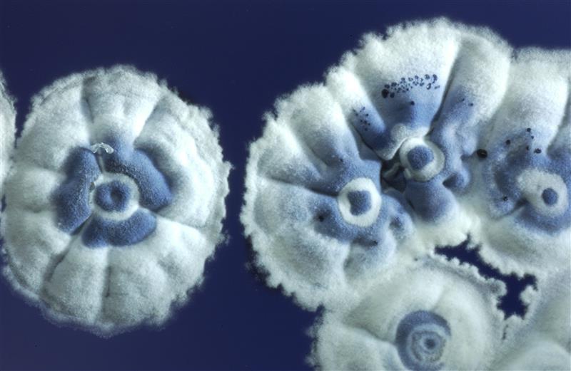
Streptomyces are already a prodigious source of antibiotics and other biologically important compounds, but could these speleothem communities be a source of novel antibiotic compounds? The answer might be worth exploring, given the diversity of Streptomyces found in just this one cave but also the emerging roles of other Actinobacteria in antibiotic production.

The difficulty of growing in situ the bacteria we find in cave formations might complicate our ability to study the compounds they produce, but such adventures could still offer fascinating insights into the microbial inhabitants of caves and how they help bind mineral formations together. The next time you go caving, hopefully you’ll think about the Actinobacteria that surround you!

Creative Commons License

Hunting for Antibiotics in Caves by Janani Hariharan is licensed under a Creative Commons Attribution-ShareAlike 4.0 International License.

Tiny Crystals, Big Story: Time capsules from the Early Mars

Featured Image: Zircon grain under the Scanning Electron Microscope (SEM). Image used with permission from Wikipedia (Emmanuel Roquette).

Article: The internal structure and geodynamics of Mars inferred from a 4.2-Gyr zircon record.

Authors: Maria M. Costa, Ninna K. Jensen, Laura C. Bouvier, James N. Connelly, Takashi Mikouchi, Matthew S. A. Horstwood, Jussi-Petteri Suuronen, Frédéric Moynier, Zhengbin Deng, Arnaud Agranier, Laure A. J. Martin, Tim E. Johnson, Alexander A. Nemchin, and Martin Bizzarro

While sitting in Geology 101 studying the geological time scale, most of us have gone through this experience where we imagined ourselves going back in time; visualizing mammoths passing by, dinosaurs hunting and fighting. But all these pictures start to become hazy and unclear when we reach close to 4 billion years. It is the time for which we have no rock records, and this is where zircons or what I would like to call “tiny survivors” comes in.

Continue reading “Tiny Crystals, Big Story: Time capsules from the Early Mars”

Water in the rocky layer cake beneath us

Konza Prairie Biological Station

Featured Image: Konza Prairie near Manhattan, Kansas, USA. Credit: David Litwin.

Paper: Toward a new conceptual model for groundwater flow in merokarst systems: Insights from multiple geophysical approaches.

Authors: Sullivan, P. L., Zhang, C., Behm, M., Zhang, F., & Macpherson, G. L.

The dissolution of limestone by atmospheric water forms a set of recognizable features collectively known as karst: enormous caves with stalactites and stalagmites, sinkholes, chasms, and narrow, towering  columns of rock. The hydrology of karst landscapes is often incredibly complex, as water can flow rapidly through dissolution-formed conduits below ground, and topography offers fewer clues to groundwater flow than in most other landscapes. While dramatic karstic landscapes have received a lot of scientific attention, even smaller limestone units can host karst features that affect hydrology.

Continue reading “Water in the rocky layer cake beneath us”

Cracking the code of the caramel crust

Featured image: a view of the Calico Basin in the eastern part of the Mojave Desert. Photo by Fred Morledge, CC BY-SA 2.5, via Wikimedia Commons.

Paper: Thin crème brûlée rheological structure for the Eastern California Shear Zone
Authors: Shaozhuo Liu, Zheng-Kang Shen, Roland Bürgmann, & Sigurjón Jónsson

A recent paper by Liu and colleagues aims to answer a fundamental question in geodynamics: are Earth’s tectonic plates more like a jelly sandwich, or a crème brûlée? It may sound silly, but these two models for crustal strength describe how tectonic plates might respond to stress changes due to earthquakes.

Continue reading “Cracking the code of the caramel crust”

Himalayan Glaciers: A Store House of Picturesque Landforms

Himalayan Glaciers A Store House of Picturesque Landforms

Featured image: Thajwas Glacier from Wikipedia under CC BY-SA 4.0.

Paper: Glacial-geomorphic study of the Thajwas glacier valley, Kashmir Himalayas, India

Authors: Reyaz Ahmad Dar, Omar Jaan, Khalid Omar Murtaza, Shakil Ahmad Romshoo

Glacial retreat caused by climate change is an urgent problem around the globe, as glaciers which hold 68.7% of our freshwater sources are rapidly melting. There are several regions around the world where snow covers the whole region almost all the year round. These places are not only a place for tourist destinations but are also covered with various landscape features which carry vital information related to past glacial activities, including both the advancement and the retreat of glaciers that occurred during the Late Glacial Maximum.

In a new research study on Thajwas Glacial Valley in Sonamarg which is located in the upper reaches of the Indus River in Kashmir Himalayas, the researchers studied the available glacial-geomorphic features of the region. The geomorphic landforms shaped by the glaciers provide scenic landscape beauty to the region. The reconstruction of palaeo-glacial features of the region is assisted by the development of different landforms in the valley such as cirques, characterized as amphitheatre shaped valleys, glacial troughs or U-shaped valleys, and terminal moraines which forms at the end of the glaciers.

The researchers developed a glacial-geomorphic map featuring all the available glacial landforms features of the valley as well as the behaviour of the past glaciers with the help of input from both field observations and geomorphic information collected from satellite imagery and Google Earth. The major bedrock lithological formation of the region consists of Panjal Volcanics composed of basaltic rocks interposed with pyroclastic materials produced by volcanic activities. Various glacial landform features have been mapped with ground-based observations in the area. Small-scale features such as erratic boulders, kettle holes, glacial meltwater streams, etc. have also been mapped for the region using images from Google Earth. These glacial landforms vary in size from one meter to more than hundreds of meters.

A schematic of glacial landforms. Source: Wikimedia

In the Kashmir Himalayas, the process of glaciation has resulted in complex topographical features as an outcome of landscape evolution. Evidences found for the advancement of glaciers in the Great Himalayan mountain range near the Kashmir Valley. This research suggests that the glaciers in the Kashmir Himalayan region are showing signs of depletion as well as recession as an impact of recent warming observed in the region. The satellite data revealed the expansion of Thajwas Valley at the expense of retreating cirques of tributary glaciers. The presence of steep slopes on the north-eastern side is evidence of fluvial incision i.e., the process of narrow erosion by a river far from its base level, with slight glacial erosion; on the other hand, the gentle slope found on the south-western side is a result of the retreat of the cirque due to erosion.

During the Late Quaternary period, the Valley of Kashmir has experienced cycles of glacial and interglacial activities. Global cooling led to the growth of the glaciers together with high rates of erosion which shaped the landscape of the region. Serrate ridge present in the area indicates a gradual lowering of the ice levels. Recessional moraines, kettle hole and outwash plains observed in the region indicates the deglaciation process owing to climate change. The region has experienced substantial glacial and climatic fluctuations during the Late Quaternary period. Using area scaling method the researchers estimated that the Thajwas glacier has lost 88% of its volume after its last advancement. Presently, the Thajwas glacier is estimated to have lost 81% of its surface area.

Our lives are indirectly dependent on the glaciers, as they control the climatic balance and other geographical phenomena occurring on the earth. Research into the retreat of these glaciers is imperative to understand how we can preserve this indispensable natural resource for a sustainable life.

Himalayan Glaciers: A Store House of Picturesque Landforms by Shilpa Saha is licensed under CC BY-SA 4.0 

There’s microplastics in the Arctic, and we can probably blame home laundry

Microplastic Thread

Featured image: Microplastic thread courtesy of M.Danny25 on Wikipedia under CC BY-SA 4.0.

Paper: Ross, P.S., Chastain, S., Vassilenko, E. et al. Pervasive distribution of polyester fibres in the Arctic Ocean is driven by Atlantic inputs. Nat Commun 12, 106 (2021). https://doi.org/10.1038/s41467-020-20347-1

The Arctic is full of plastic–polyester fibers to be exact. Peter S. Ross and his team found upwards of forty polyester fibers for every cubic meter of the Arctic Ocean’s surface. Their new study in Nature Communications also revealed that these fibers were more common in the East Arctic, which is fed by the Atlantic Ocean, than the West Arctic. The scientists suggest that the presence of these fibers coupled with their uneven distribution throughout the ocean could be due to an unlikely source: home laundry. 

Continue reading “There’s microplastics in the Arctic, and we can probably blame home laundry”

Tiny organisms’ race to the bottom of the ocean

Paper: Microbial dynamics of elevated carbon flux in the open ocean’s abyss

Authors: Kirsten Poff, Andy Leu, John Eppley, David Karl and Edward DeLong

Cells from blooms of phytoplankton, or tiny plants, can enhance carbon flux all the way down to the deepest parts of the ocean. The authors of this recent study measured the amount of carbon in sinking particles deep in the ocean at a station near Hawaii. Over the course of three years, scientists identified three time periods of unusually high carbon flux, or transport, at this depth, and found that the organisms that made up the sinking particles were significantly different between high flux events and the rest of the time period. The data showed higher abundances of surface-dwelling microorganisms, including phytoplankton, contributing to these particles during high-flux events.

Continue reading “Tiny organisms’ race to the bottom of the ocean”

Cohesive trends in carbon cycling over the last 66 million years

Paper: Reconciling atmospheric CO2, weathering, and calcite compensation depth across the Cenozoic

Featured image: Figure 1 from a related study: Boudreau et al., 2018 – a schematic which illustrates the carbonate/calcite compensation depth (CCD). Just as snow accumulates on mountains above the snowline and melts at lower elevations, white calcium carbonate shells and minerals (the sinking green discs in this image) accumulate on the seafloor above the CCD and dissolve below this depth.

Authors: Nemanja Komar and Richard E. Zeebe

For multiple decades, we have known that temperatures have largely cooled over the last 66 million years (during the Cenozoic, our current geological era). This insight comes from measuring oxygen isotopes in microfossil shells from ocean sediment cores that extend hundreds of meters into the deep ocean seafloor. Slight increases in the heavier oxygen isotope (which contains ten neutrons) relative to the lighter isotope (which contains eight neutrons) in these shells over time indicates cooling. However, it has been significantly more difficult to understand how the long-term geological carbon cycle has been intertwined with this temperature change. Since carbon and climate are inherently connected under modern and projected future climate change, it is crucial to understand these linkages. A new study by Komar and Zeebe expands a multi-faceted geological carbon and climate model to show how geological and geochemical evidence from ocean sediments that initially appears to be incompatible actually tells a cohesive story of carbon cycling and changes over the Cenozoic.

Continue reading “Cohesive trends in carbon cycling over the last 66 million years”

The Fate of Aquifers, and What Controls It

Paper: Divergent effects of climate change on future groundwater availability in key mid-latitude aquifers

Authors: Wen-Ying Wu, Min-Hui Lo, Yoshihide Wada, James S. Famiglietti, John T. Reager, Pat J.-F. Yeh, Agnès Ducharne, and Zong-Liang Yang

The ground I’m standing on feels solid, but it’s really full of porous rocks. The holes in these rocks are all different sizes, and water can flow through and between those with larger holes. Together, bodies of rocks that are saturated with water form aquifers. As groundwater supplies more than a third of the water humans use, groundwater and the aquifers that contain it are vital. They are especially vital in mid-latitude arid and semi-arid regions without enough surface water. In their recent research, Wen-Ying Wu and their collaborators studied the future of aquifers in such regions and what factors control it.

Continue reading “The Fate of Aquifers, and What Controls It”