The early evolution of the bird-hipped dinosaurs

Featured image: Landscape mountain sky by Enrique Lopez Garre, Pixabay License.

Paper: A paraphyletic ‘Silesauridae’ as an alternative hypothesis for the initial radiation of ornithischian dinosaurs

Authors: Rodrigo Muller and Maurício Garcia

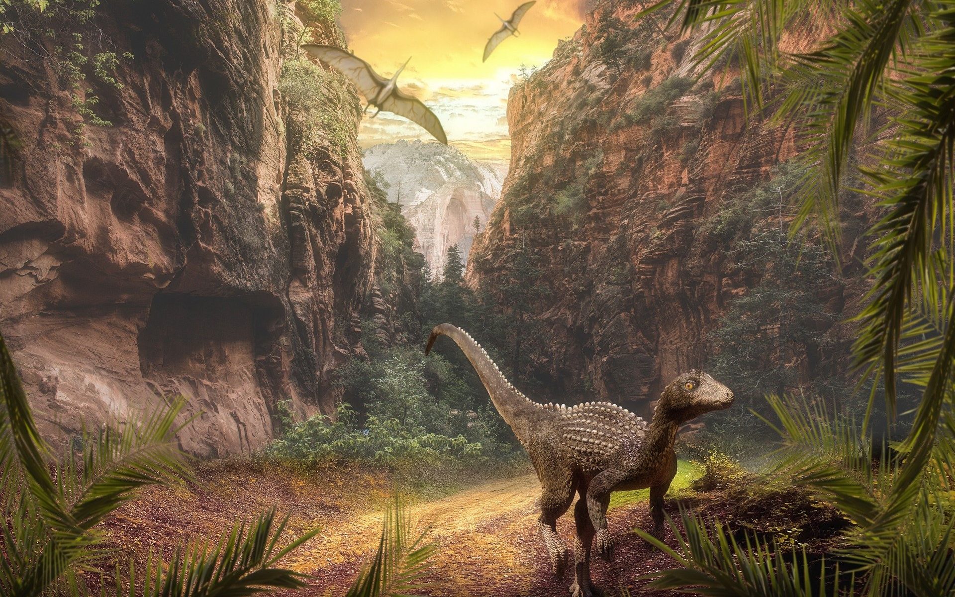
Dinosaurs dominated terrestrial ecosystems for nearly 170 million years in the Mesozoic. There were three major groups of dinosaurs. The long-necked sauropodomorphs, which included the largest animals ever to live on land, could grow as long as a Boeing 737 aircraft. The meat-eating theropods, which included the famous Tyrannosaurus rex, have evolved into the modern dinosaurs: birds. And the bird-hipped ornithischians, an assorted group of herbivorous dinosaurs, evolved some of the most bizarre anatomy known in evolutionary history. This ranged from the plate-backed Stegosaurus, to the thumb-spiked Iguanodon, and from the exaggerated crests of Triceratops to the walking coffee table that is Ankylosaurus.

Continue reading “The early evolution of the bird-hipped dinosaurs”

What lies beneath: tracing human migrations through stone tools, India

A map demonstrating possible migration routes of modern humans

Featured image: Katerina Douka, Michelle O’Reilly, Michael D. Petraglia – On the origin of modern humans: Asian perspectives; Science 08 Dec 2017: Vol. 358, Issue 6368, DOI: 10.1126/science.aai9067 [1], CC BY-SA 4.0 (Wikimedia Commons) with minor edits

Paper: Human occupation of northern India spans the Toba super-eruption ~74,000 years ago

Authors: Chris Clarkson, Clair Harris, Bo Li, Christina M. Neudorf, Richard G. Roberts, Christine Lane, Kasih Norman, Jagannath Pal, Sacha Jones, Ceri Shipton, Jinu Koshy, M.C. Gupta, D.P. Mishra, A.K. Dubey, Nicole Boivin & Michael Petraglia

Modern humans evolved around 200,000 years ago in Africa, and dispersed from there to other parts of the globe. The Out of Africa theory is a well-established model that explains the early dispersal of Homo sapiens or modern humans from Africa, into Asia and Oceania. Among the routes proposed is the Southern Route migration from East Africa to the Near East, across the Red Sea, and around Arabia and the Persian Plateau to India, and then finally with modern humans settling in Asia and Australasia. 

India’s geographic location is a key piece of this puzzle. Mitochondrial DNA of contemporary populations in India indicate that the country was an important stepping stone in the colonisation of Australasia. However, the timeline for the proposed Southern Route migration is still a matter of debate – could dating the arrival and settlement of modern humans in India provide some clues?

Continue reading “What lies beneath: tracing human migrations through stone tools, India”

When space is time: evolving soil hydrology on glacial moraines

Featured image: The Stein Glacier in the central Swiss Alps, where the study was conducted. Left panel © Google, right panels CC BY Florian Lustenberger in Hartmann et al. 2020.

Paper: Field observations of soil hydrological flow path evolution over 10 millennia

Authors: Hartmann , A., Semenova, E., Weiler, M., & Blume, T.

The way water flows through soil and sediments can be incredibly diverse. In the simplest case, water flows uniformly through all of the pore space between grains. Most soils act very differently though. Water moves quickly through certain pathways and not at all through other areas. This preferential flow of water has important consequences for the ability of the soil to hold water, and for the movement of nutrients and contaminants. Understanding what factors affect the evolution of preferential flow pathways can help scientists better understand how soils work now, and how they will respond to human induced changes into the future.

Continue reading “When space is time: evolving soil hydrology on glacial moraines”

Isotopes Begin to Unlock the Mystery of Methane Source in the Scheldt Estuary

Scheldt Estuary with tidal flats and water shown

Featured Image: Eastern Scheldt Estuary near Zeeland, Netherlands. Photo courtesy Wikimedia Commons/ Luka Peternel, CC BY-SA 4.0 license.

Paper: Carbon and Hydrogen Isotope Signatures of Dissolved Methane in the Scheldt Estuary

Authors: Caroline Jacques, Thanos Gkritzalis, Jean-Louis Tison, Thomas Hartley, Carina van der Veen, Thomas Röckmann, Jack J. Middelburg, André Cattrijsse, Matthias Egger, Frank Dehairs & Célia J. Sapart

Estuaries are dynamic coastal environments where freshwater and saltwater collide and mix. Across the world, estuaries regularly have higher methane concentrations in the water than would be expected from equilibrium with the atmosphere. If the water was in equilibrium, or at a happy balance, with the atmosphere, then there would be no net transfer of methane to the atmosphere. Because there is more methane than expected in the water, estuaries are a source of this potent greenhouse gas, methane (CH4), to the atmosphere. The problem is that the processes leading to the excess methane in the estuary’s surface water are not well known in many European estuaries.

Continue reading “Isotopes Begin to Unlock the Mystery of Methane Source in the Scheldt Estuary”

Tracing the origin of Earth’s water with meteorites

Paper: Earth’s water may have been inherited from material similar to enstatite chondrite meteorites

Authors: Laurette Piani, Yves Marrocchi, Thomas Rigaudier, Linel G. Vacher, Dorian Thomassin, Bernard Marty

To date, Earth is the only planetary object known to have extensive bodies of liquid water (H2O) at its surface. Water is fundamental to supporting life as we know it with every single organism on our planet requiring water to survive. Even our own human bodies are made up of 60-70% water. However, the origin of Earth’s water has long been debated.


Continue reading “Tracing the origin of Earth’s water with meteorites”

What’s in the Water?

Paper: Contemporary limnology of the rapidly changing glacierized
watershed of the world’s largest
High Arctic lake

Authors: K. A. St. Pierre, V. L. St. Louis, I. Lehnherr, S. L. Schiff, D. C. G. Muir , A. J. Poulain, J. P. Smol, C. Talbot, M. Ma, D. L. Findlay, W. J. Findlay, S. E . Arnott, Alex S . Gardner

As glaciers recede in the arctic, the increase in meltwater may significantly impact downstream ecosystems. Glacial ice can hold thousands of years’ worth of dust, nutrients, and other materials that are released during melting. As the rate of melt increases with a warming climate, the release has the potential to increase nutrient flows and sediment loads, alter pH, and impact other physical, chemical, and biological aspects of downstream watersheds. These changes could negatively impact water clarity and ecosystem function in lakes, rivers, and the ocean.

Continue reading “What’s in the Water?”

Water, but not a drop to drink: multiple salty lakes beneath the south pole of Mars?

Featured image: The south pole of Mars as seen by the HRSC Camera onboard the European Space Agency’s Mars Express mission. Image credit: ESA/DLR/FU Berlin.

Paper: Multiple subglacial water bodies below the south pole of Mars unveiled by new MARSIS data.

Authors: Sebastian Emanuel Lauro, Elena Pettinelli, Graziella Caprarelli, Luca Guallini, Angelo Pio Rossi, Elisabetta Mattei, Barbara Cosciotti, Andrea Cicchetti, Francesco Soldovieri, Marco Cartacci, Federico Di Paolo, Raffaella Noschese and Roberto Orosei.

“Water, water everywhere, but not a drop to drink”- or at least that might be the case beneath the south pole of Mars. In 2018, a team of scientists reported a potential subsurface lake of liquid water 1.5 km beneath the Martian south polar cap. Now, using more observations as well as new analysis methods previously used for ice sheets on Earth, the same team presents new evidence for a large subsurface lake as well as three other lakes in the same area. This raises further questions about how such lakes could be kept liquid in the cold environment of Mars, and whether they could provide a habitable environment for astrobiology.

Continue reading “Water, but not a drop to drink: multiple salty lakes beneath the south pole of Mars?”

Rivers underground

Featured Image: The River Styx emerging from Mammoth Cave by Daniel Schwen. From Wikipedia under a CC-BY-SA license.

Paper: Modeling cave cross‐section evolution including sediment transport and paragenesis
Authors: M.P. Cooper and M.D. Covington

It’s not easy to watch caves form. It happens slowly and out of view, so we know relatively little about cave passage erosion compared to our knowledge of how rivers at Earth’s surface work. New research suggests that the same physical erosion processes that cut river channels at the surface might also be at work underground, adding new depth to our understanding of cave genesis.

Continue reading “Rivers underground”

Strong Atmospheric Updrafts Increase the Danger Associated with Wildfires

Featured Image: Picture of a wildfire by skeeze on Pixabay

Paper: Extreme Pyroconvective Updrafts During a Megafire
Authors: B. Rodriguez, N. P. Lareau, D. E. Kingsmill, and C. B. Clements

Atmospheric updrafts, or columns of air moving quickly upward, are typically associated with severe thunderstorms and tornadoes and have been studied using radar and airplane data for decades. The extreme heat from large, intense fires can also cause updrafts, but this type of updraft has barely been studied by atmospheric science researchers. Understanding the formation and structure of fire-generated updrafts is important because they can be hazardous to aircraft, can loft embers far distances and spark new fires, and can even initiate fire-generated thunderstorms. A recent study has revealed just how powerful these updrafts above large fires can be.

Continue reading “Strong Atmospheric Updrafts Increase the Danger Associated with Wildfires”