Saving sandbars in the Grand Canyon

Grand Canyon sand bar

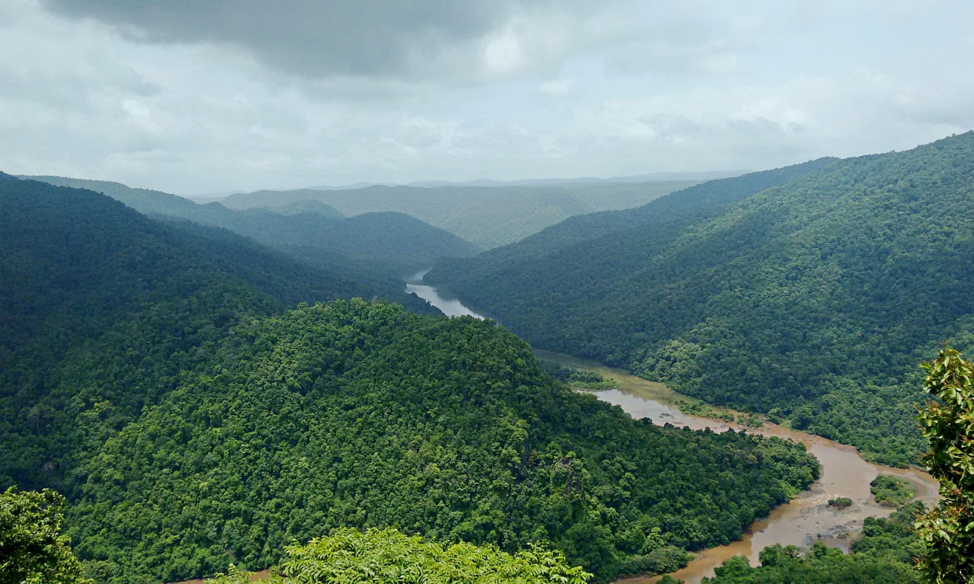
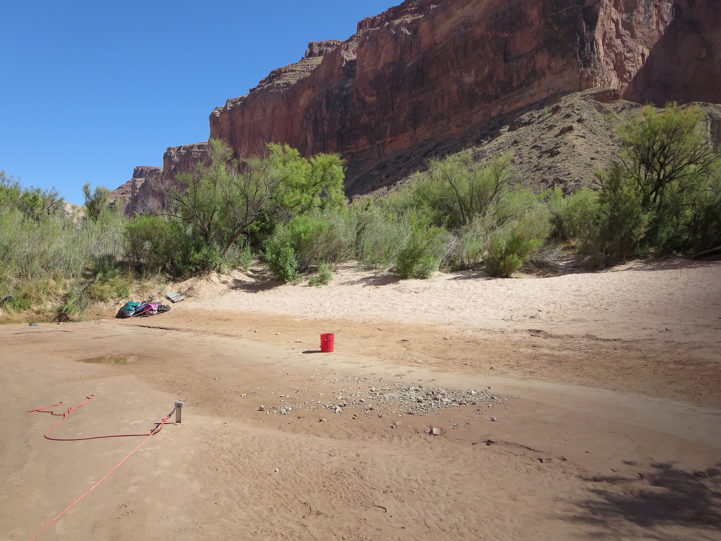
Featured image: A sandbar along the Colorado River in the Grand Canyon. Photo by the author. CC-BY-SA.

Paper: A morphodynamic model to evaluate long-term sandbar rebuilding using controlled floods in the Grand Canyon

Authors: Erich R. Mueller and Paul E. Grams

Journal: Geophysical Research Letters

The Grand Canyon is famous for its stark, bare-bedrock landscapes. But those who make the hike, mule ride, or raft trip into its depths are rewarded with a different view: the green, inviting banks of the Colorado River where ancestral Puebloans once grew corn and where rafters now collect overturned boats between rapids. The Canyon owes its bucolic river-bottom landscape to an unsung hero: sand deposited during large floods that creates hospitable habitat for plants and aquatic animals. Since the building of Glen Canyon Dam just upstream in the 1950s, the Grand Canyon has been starved of sand, damaging its fragile ecosystems. Now, a new study quantifies how controlled floods could help restore sandbars to the Grand Canyon.

Continue reading “Saving sandbars in the Grand Canyon”

Wildfires are making our rivers longer

Featured image: Wildfire in Portugal by Michael Held on Unsplash

Paper: Ball, G., Regier, P., González-Pinzón, R. et al. Wildfires increasingly impact western US fluvial networks. Nat Commun 12, 2484 (2021). https://doi.org/10.1038/s41467-021-22747-3

The wildfire season is getting longer and more severe, and current models suggest that this trend will only continue as anthropogenic climate change gets worse. Wildfires dramatically alter the landscape they inundate, leaving vegetation charred and the atmosphere ashy. While jarring, there is one consequence of these natural disasters that isn’t fully understood: their effect on rivers and streams. While it may seem intuitive to think that wildfires disrupt the hydrologic cycle and cause rivers to dry up or shrink, Grady Ball and colleagues found the opposite: wildfires are making our rivers longer.

Continue reading “Wildfires are making our rivers longer”

Muddy waters lead to decreased oxygen in Chesapeake Bay

Featured Image: Plumes of muddy, sediment-laden water at the Chesapeake Bay Bridge near Annapolis, MD. Photo courtesy of Jane Thomas/ IAN, UMCES.

Paper: Seabed Resuspension in the Chesapeake Bay: Implications for Biogeochemical Cycling and Hypoxia
Authors: Julia Moriarty, Marjorie Friedrichs, Courtney Harris

A memorable feature of the Chesapeake Bay, the largest estuary in the USA, is that the water is very murky and looks like chocolate milk. Former Senator Bernie Fowler has conducted public “wade-ins” over the past 50 years in one of the Bay’s tributaries, seeing how deep the water is before he can no longer see his white tennis shoes, and let’s just say it is never very deep. This is because of the high concentrations of sediment, or small particles of sand and organic material, in the water. Besides making it harder for seagrasses to grow and serving as food for the economically-important oyster, sediment impacts the biological processes that determine how much oxygen and nutrients are available in the water for algae and fish.

Continue reading “Muddy waters lead to decreased oxygen in Chesapeake Bay”

Hillsides collapsing into Arctic streams can trigger CO2 release to the atmosphere

Permafrost thaw slumps draining into a river on the Peel Plateau in western Canada

Featured Image: Permafrost thaw slumps draining into a river on the Peel Plateau in western Canada. Photo courtesy Scott Zolkos, lead author of the paper.

Paper: Experimental Evidence That Permafrost Thaw History and Mineral Composition Shape Abiotic Carbon Cycling in Thermokarst-Affected Stream Networks

Authors: Zolkos, Scott & Suzanne E. Tank.

The rivers and streams of the Arctic transfer atmospheric heat into the surrounding permafrost (perennially frozen) soil. At the same time, surface soils up to 1 meter deep undergo annual freeze-thaw cycles. When warmer air arrives in the summer months, the combination of warming air and river water can thaw large chunks of ice-rich permafrost soil along the stream’s edge. Thawed permafrost breaks away from the surrounding hillsides and causes catastrophic slope failures, transporting huge amounts of sediment into the nearby waterways. As the stream water becomes murky it takes on the appearance of chocolate milk, and simultaneously, the geochemistry of the water changes.

Continue reading “Hillsides collapsing into Arctic streams can trigger CO2 release to the atmosphere”

Where the river flows: India’s catchment crisis

Dandeli river, Karnataka, India

Paper: Insights into riverscape dynamics with hydrological, ecological and social dimensions for water sustenance

Authors: T.V. Ramachandra, S. Vinay, S. Bharath, M.D.Subash Chandran, and Bharath H.Aithal

A catchment or watershed represents an intricate network of streams that coalesce into a river. In ecology, river networks are considered as ecosystems since they facilitate interactions between organisms and their environments. A healthy river ecosystem sustains the biodiversity of fringing forests and aquatic habitats, and enhances the landscape’s resilience to water resource development, droughts and climate change. Rivers provide water for domestic, agricultural and industrial use, and sustain native vegetation which in turn regulates the water cycle, and provides forest-based goods and services.

Continue reading “Where the river flows: India’s catchment crisis”

Evidence of pollution all the way to the poles

Featured Image: Lake Hazen in front of the Grant Land Mountains – photo courtesy Kyra St. Pierre, a co-author of the Sun et al. paper.

Paper: Glacial melt inputs of organophosphate ester flame retardants to the largest High Arctic lake

Authors: Sun, Yuxin, Amilia O. De Silva, Kyra A. St Pierre, Derek C. G. Muir, Christine Spencer, Igor Lehnherr, John J. MacInnis

Far from human habitation Lake Hazen sits north of the Arctic Circle surrounded by pristine, treeless mountains. But even there, the telltale chemical fingerprints of human pollution can be found.

Spring and summer in the far North are a short three-month period of reawakening, glacial melt, and permafrost thaw. During these months, meltwater transports anything that has collected on top of glaciers, like particles, nutrients, and contaminants deposited from the atmosphere, flowing down rivers and into glacial lakes. 

Continue reading “Evidence of pollution all the way to the poles”

Rivers of Memory: India

Paper: Evolution of modern river systems: an assessment of ‘landscape memory’ in Indian river systems

Authors: Vikrant Jain, Sonam, Ajit Singh, Rajiv Sinha, S. K. Tandon

“A river cuts through rock not because of its power, but because of its persistence.”

James N Watkins

In geomorphology, the persistence of rivers is etched into the very landscape – a memory of the forces that once shaped it, and continue to do so, slowly, and inexorably. Landscape memory, as Gary John Brierley once wrote, is the imprint of the past upon contemporary landscapes, which include geologic, climatic, and anthropogenic factors.

The rivers of the Indian subcontinent bear witness to forces that shaped them over millennia – and a recent publication in the Journal of International Geosciences traces the evolution of India’s river systems at different time scales.

Continue reading “Rivers of Memory: India”