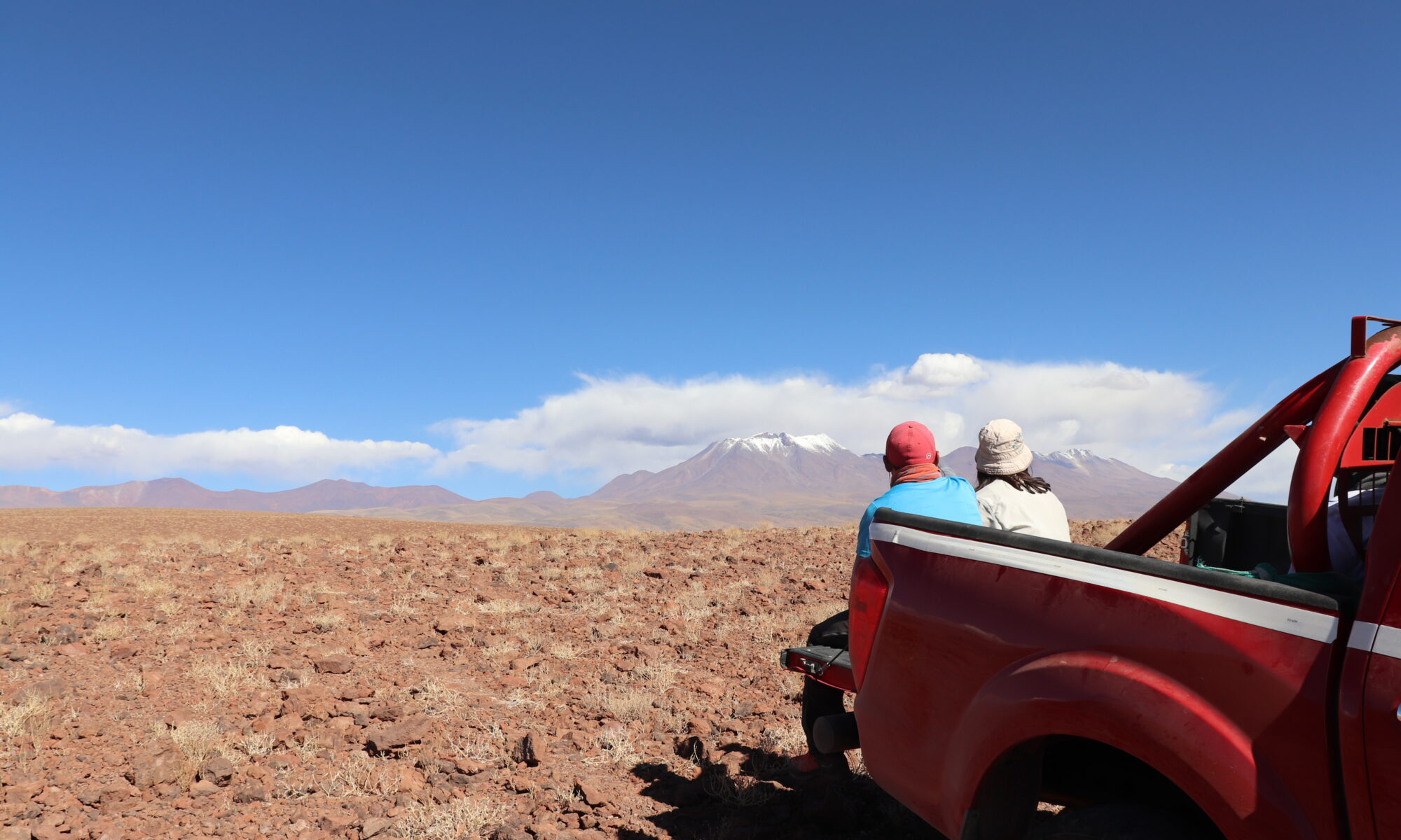
Algunas veces el magma fluye en calma; otras veces, explota. La candidata a Ph.D. Ivana Torres-Ewert trata de entender por qué con su máquina de hacer magma en la Universidad de Missouri-Kansas City (UMKC). Sus descubrimientos podrían ayudar a la comunidad a saber a dónde ir cuando un volcán explota y proporcionar un soporte para otras investigaciones sobre volcanes.
Sometimes magma calmly flows; other times, it explodes. Ph.D. candidate Ivana Torres-Ewert is figuring out why with her magma-making machine at the University of Missouri-Kansas City (UMKC). Her discoveries could help people know where to go when a volcano explodes and provide a foundation for further volcanic research.
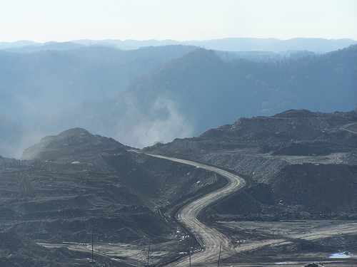
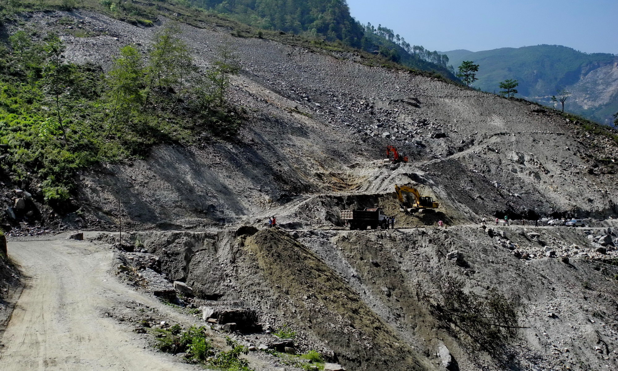
Featured Image: Mountaintop removal mining site in Appalachia. Copyright: CC BY-SA 4.0 via. wikimedia commons.
Report: Peripheral gully and landslide erosion on an extreme anthropogenic landscape produced by mountaintop removal coal mining (2020)
Authors: Miles Reed & Dr. Steve Kite
There’s a general consensus that coal mining is ‘bad’ for the environment, but beyond carbon emissions, what is its visible, physical impact on our surroundings? What lasting damage does mining create on the Earth’s surface? The answer is that it has a tremendous impact; specifically, mining in Appalachia is linked to distorting the natural flow of water on the landscape, which creates ripple (no pun intended) effects on the greater environment. A recent study by Reed and Kite details those effects on Appalachian landscapes, directly linking mountaintop mining to erosion and landslides. Now, as worries about access to safe, clean water being jeopardized by fossil fuel production abound nationwide, exploring the impacts of mountaintop mining on Appalachian freshwater becomes incredibly important with immediate and personal impacts.
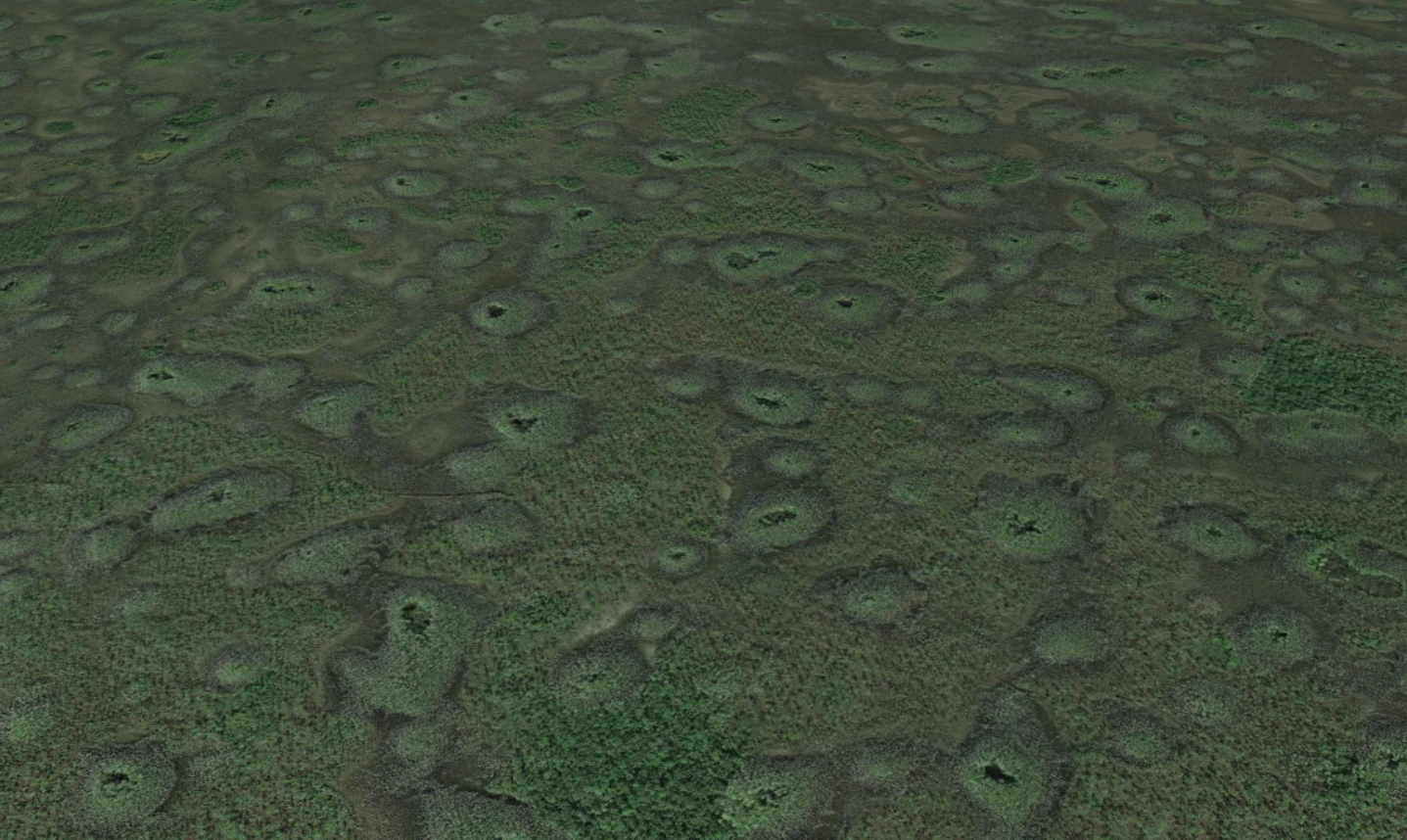
Patterns are abundant in nature, from evenly spaced termite mounds and vegetation patches to repeating series of ridges and valleys to sand dunes. The questions of why these patterns are so uniform and why they are found in disparate settings has been the subject of intense scientific interest over the last decades. Mathematical tools have given scientists the ability to study these “complex systems,” where behavior of the whole system emerges from interactions between smaller parts. While many different systems have been studied, recently researchers from the Duke University and the University of California at Davis investigated a patterned landscape with mysterious origins: the large, evenly spaced depressions in limestone bedrock that cover nearly 3000 square kilometers of the Big Cypress National Preserve in the Florida Everglades.
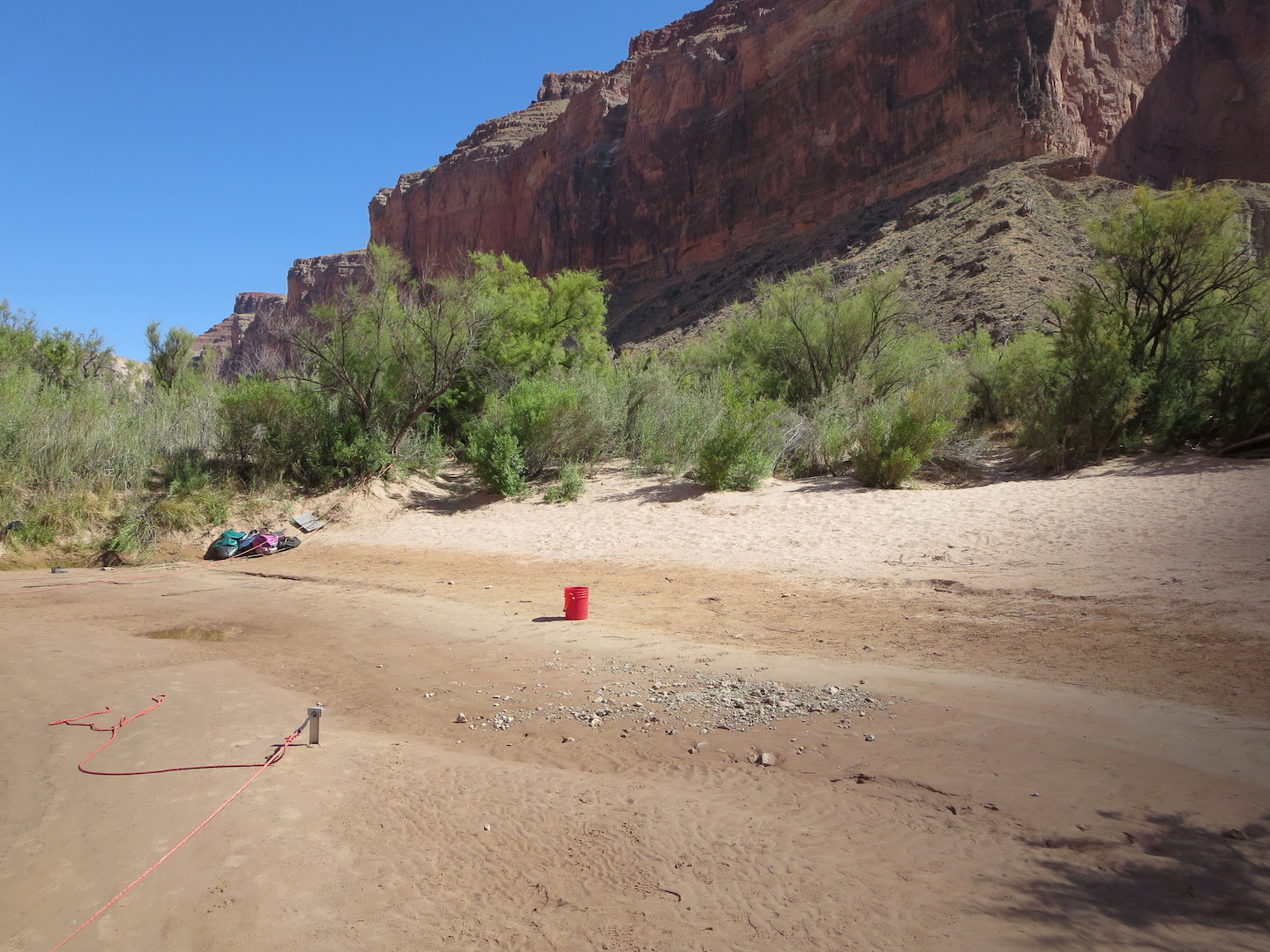
The Grand Canyon is famous for its stark, bare-bedrock landscapes. But those who make the hike, mule ride, or raft trip into its depths are rewarded with a different view: the green, inviting banks of the Colorado River where ancestral Puebloans once grew corn and where rafters now collect overturned boats between rapids. The Canyon owes its bucolic river-bottom landscape to an unsung hero: sand deposited during large floods that creates hospitable habitat for plants and aquatic animals. Since the building of Glen Canyon Dam just upstream in the 1950s, the Grand Canyon has been starved of sand, damaging its fragile ecosystems. Now, a new study quantifies how controlled floods could help restore sandbars to the Grand Canyon.
Authors: Dini, B., Bennett, G. L., Franco, A. M. A., Whitworth, M. R. Z., Cook, K. L., Senn, A., and Reynolds, J. M.
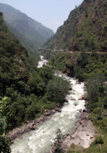
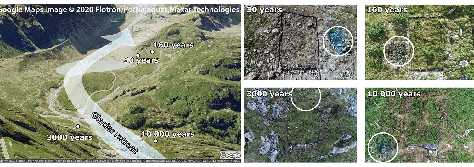
Nepal straddles the Himalayan arc – the collision boundary of the Indian and the Eurasian tectonic plates that crumbled to form the highest mountains in the world, the Himalayas. Its precarious location makes it among the most disaster-prone countries in the world. Its landscape has been shaped, and continues to be shaped by seismic activity – from landslides and earthquakes, to glacial lake outburst floods (GLOFs) where the glacier ice or rock debris at the periphery of a glacial lake break off, resulting in severe floods downslope.
Driving out from Kathmandu city towards Bhaktapur, towards Kodari at the Nepal-China border, the landscape transitions from pagoda-style temples, to settlements, further on to a bleak, boulder-strewn landscape. This is the Araniko highway, built on an old yak track, running alongside the Bhote Koshi river, known to the locals as a difficult, dangerous landscape prone to rockfalls and landslides, especially during the monsoons. Warning signs and steel wire mesh welded to the slopes to mitigate landslides define this stretch, and angular boulders mark where the valleys rise into mountains, and are testimony to the region’s disaster-prone legacy.
The Bhote Koshi river that flows along the Araniko highway is littered with boulders that have worked loose from the valley slopes. Image credit: Gerd Eichmann (CC BY-SA)
Boulder movement downslope happens due to different kinds of landslides, ranging from abrupt, free-falling rocks to slower flow-like movements. Large boulders are a threat to life and infrastructure, and may amplify landslides when they move downslope or cause floods if they block a river channel.
In fragile landscapes, understanding when and how boulders move downslope and into river networks could be essential to detecting hazards. A rolling stone or a boulder in this case gathers no moss, they say, but can it gather landslide data? A pilot study by Benedetta Dini et al., in the Bhote Koshi catchment, documents how technology can help detect land movement and find use as early warning systems.
Twenty-three long-range, wireless trackers were drilled into boulders along known landslide or debris flow channels. Movement could be triggered by different events including debris flow, large-scale events or collisions. The sensors were programmed to send routine GPS locations every 24 hours, and an accelerometer would report when the boulder moves. A camera was also set up with a field views across the channels to acquire an image every 30 min. Via image sequences, the location of the sensor-embedded boulders are able to compare to prominent trees to identify and validate the movement data. Based on changes in tilt and displacement of boulders, corresponding to movement within a mass of rocks or downslope respectively, the study found that the sensors could successfully detect both slow and rapid movements.
In conclusion, despite technical difficulties which could be a focus for future research, smart boulders have good potential as weather-proof, long-term, real-time, cost-effective monitoring tools, not just in Nepal but in other landslide-prone areas across the world.
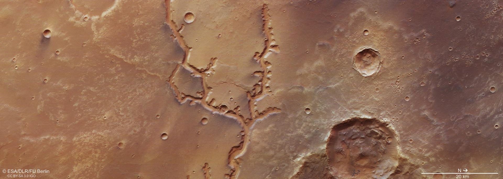
Featured image: The Nirgal Vallis river valley on Mars as seen by the HRSC Camera onboard the European Space Agency’s Mars Express mission.Image credit: ESA/DLR/FU Berlin.
Authors: Anna Grau Galofre, A. Mark Jellinek & Gordon R. Osinski.
“Some say the world will end in fire/ Some say in ice” begins the famous poem by Robert Frost. But what about how worlds begin? For years the theory of a “warm and wet” early Mars has been the conventional explanation for the vast valley networks formed billions of years ago that we can see on the surface today. Now, a new study suggests that at least some of these valleys could have formed under colossal ice sheets, in a distinctly more icy world.
Authors: R.Y. Chuang, C.H. Lu, C.J. Yang, Y.S. Lin, and T.Y. Lee
Journal:Geophysical Research Letters
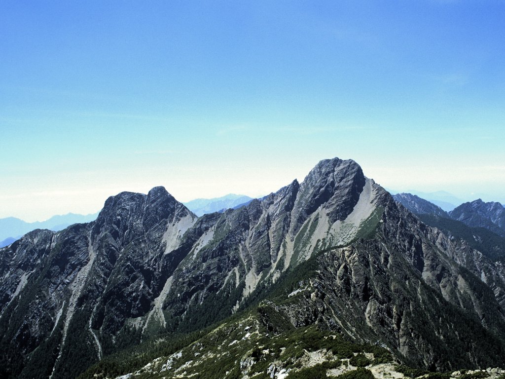
The height of a mountain range results from a hard-fought battle between tectonic plates and the forces of erosion. Earthquakes generated by clashes between plates cause the upward motion of rock even as they shake the landscape, causing large and numerous landslides. When a large earthquake occurs, which process wins? Does more rock go up than come down, leading to a higher mountain range? Or does shaking-induced erosion remove more material than is uplifted by the earthquake? New research suggests that earthquakes might be able to build mountains up faster than landslides can bring them down.
Authors: Hartmann , A., Semenova, E., Weiler, M., & Blume, T.
The way water flows through soil and sediments can be incredibly diverse. In the simplest case, water flows uniformly through all of the pore space between grains. Most soils act very differently though. Water moves quickly through certain pathways and not at all through other areas. This preferential flow of water has important consequences for the ability of the soil to hold water, and for the movement of nutrients and contaminants. Understanding what factors affect the evolution of preferential flow pathways can help scientists better understand how soils work now, and how they will respond to human induced changes into the future.
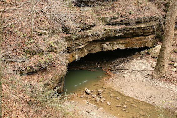
It’s not easy to watch caves form. It happens slowly and out of view, so we know relatively little about cave passage erosion compared to our knowledge of how rivers at Earth’s surface work. New research suggests that the same physical erosion processes that cut river channels at the surface might also be at work underground, adding new depth to our understanding of cave genesis.

