How sediments can save drowning river deltas

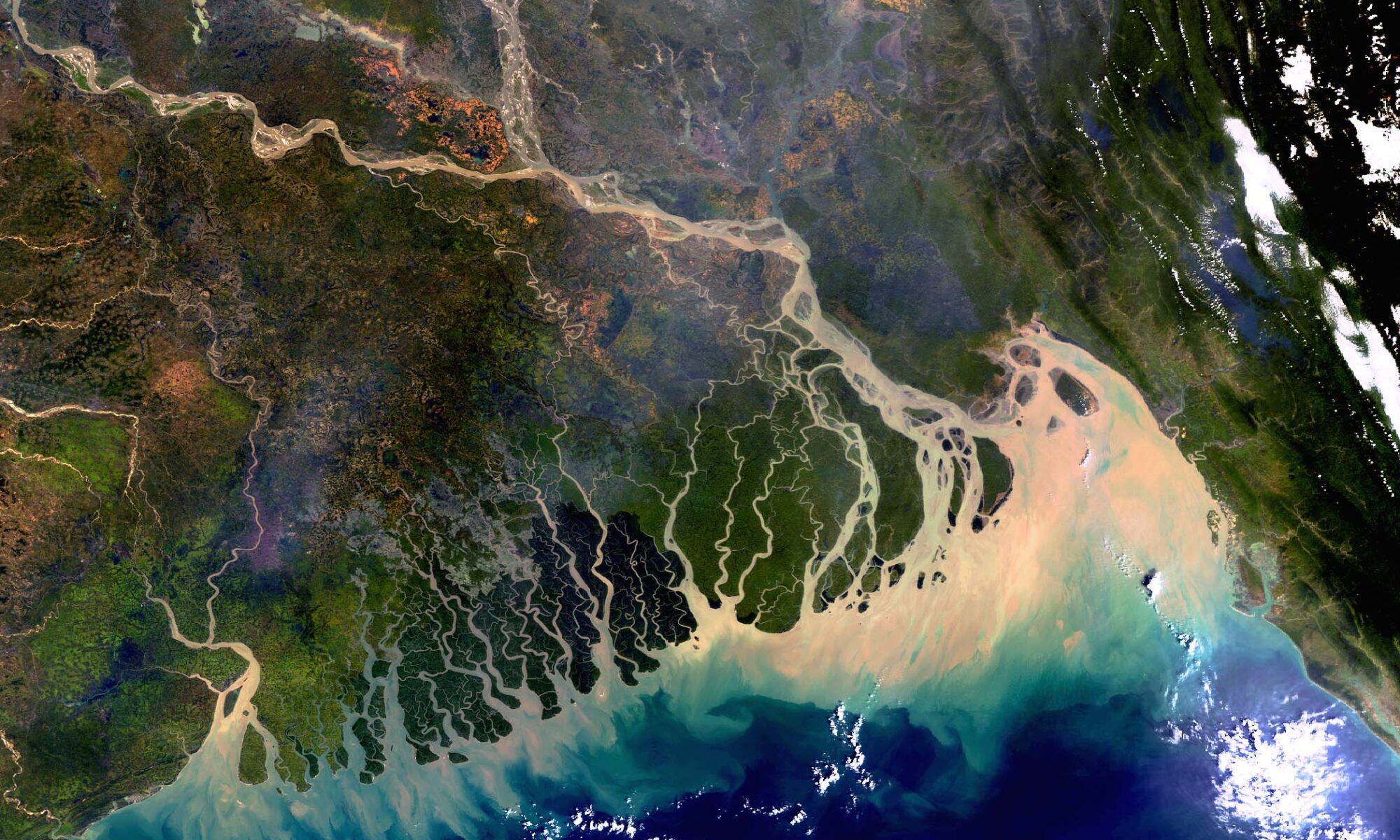
Featured image: A satellite image of the Ganges – Brahmaputra delta along the Bangladesh coastline.captured by the Envisat satellite of the European Space Agency (ESA). The image also shows sediment plumes in the coastal area. (Image credit: ESA CC BY-SA 3.0 IGO)

Paper: Sediment delivery to sustain the Ganges- Brahmaputra delta under climate change and anthropogenic impacts

Authors: Jessica L. Raff, Steven L. Goodbred Jr., Jennifer L. Pickering, Ryan S. Sincavage, John C. Ayers, Md. Saddam Hossain, Carol A. Wilson, Chris Paola, Michael S. Steckler, Dhiman R. Mondal, Jean-Louis Grimaud, Celine Jo Grall, Kimberly G. Rogers, Kazi Matin Ahmed, Syed Humayun Akhter, Brandee N. Carlson, Elizabeth L. Chamberlain, Meagan Dejter, Jonathan M. Gilligan, Richard P. Hale, Mahfuzur R. Khan, Md. Golam Muktadir, Md. Munsur Rahman, Lauren A. Williams

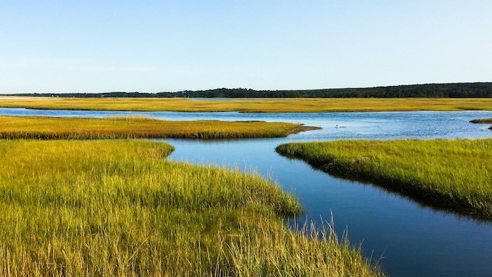
The Ganges – Brahmaputra delta is the largest river delta in the world, covering an area of 1,00,000 sq. km. About two-thirds of the delta lies in Bangladesh, and the rest in the Indian state of West Bengal. Today, sea level rise due to climate change poses a massive challenge to the delta region which more than 200 million people call home!

Continue reading “How sediments can save drowning river deltas”

How plants left a mark on history

Featuring image: Plants slowly eroding limestone. Picture from Jon Sullivan, public domain (C0).

Paper: Composition of continental crust altered by the emergence of land plants

Authors: C. J. Spencer, N. S. Davies, T. M. Gernon, X. Wang, W. J. McMahon, T. R. I. Morrell, T. Hincks, P. K. Pufahl, A. Brasier, M. Seraine and G.-M. Lu 

In the winter of 1990, the first Voyager spacecraft looked over its shoulder and snapped an iconic photo of Earth as a ‘pale blue dot’ in the vast cosmos. But when you look at it from Space, there is another very important colour: green. Plants cover a major portion of the landmasses. Besides bringing their bright chlorophyll colour to the continents, new research by Spencer and co-authors finds that plants have also slowly changed the composition of the Earth’s crust over hundreds of millions of years.

In a recent study, Spencer and co-workers were able to connect the development of land plants to changes in the geochemical composition of crustal rocks through the effects that plants had on landscapes, weathering, and sediments. Land plants arose during the early Ordovician period, about 440 million years ago, and today they cover approximately 84% of Earth’s landmasses. After they spread all over the continents, plants started to heavily influence the sedimentary cycles between continents and oceans.

Continue reading “How plants left a mark on history”

Saving sandbars in the Grand Canyon

Grand Canyon sand bar

Featured image: A sandbar along the Colorado River in the Grand Canyon. Photo by the author. CC-BY-SA.

Paper: A morphodynamic model to evaluate long-term sandbar rebuilding using controlled floods in the Grand Canyon

Authors: Erich R. Mueller and Paul E. Grams

Journal: Geophysical Research Letters

The Grand Canyon is famous for its stark, bare-bedrock landscapes. But those who make the hike, mule ride, or raft trip into its depths are rewarded with a different view: the green, inviting banks of the Colorado River where ancestral Puebloans once grew corn and where rafters now collect overturned boats between rapids. The Canyon owes its bucolic river-bottom landscape to an unsung hero: sand deposited during large floods that creates hospitable habitat for plants and aquatic animals. Since the building of Glen Canyon Dam just upstream in the 1950s, the Grand Canyon has been starved of sand, damaging its fragile ecosystems. Now, a new study quantifies how controlled floods could help restore sandbars to the Grand Canyon.

Continue reading “Saving sandbars in the Grand Canyon”

Muddy waters lead to decreased oxygen in Chesapeake Bay

Featured Image: Plumes of muddy, sediment-laden water at the Chesapeake Bay Bridge near Annapolis, MD. Photo courtesy of Jane Thomas/ IAN, UMCES.

Paper: Seabed Resuspension in the Chesapeake Bay: Implications for Biogeochemical Cycling and Hypoxia
Authors: Julia Moriarty, Marjorie Friedrichs, Courtney Harris

A memorable feature of the Chesapeake Bay, the largest estuary in the USA, is that the water is very murky and looks like chocolate milk. Former Senator Bernie Fowler has conducted public “wade-ins” over the past 50 years in one of the Bay’s tributaries, seeing how deep the water is before he can no longer see his white tennis shoes, and let’s just say it is never very deep. This is because of the high concentrations of sediment, or small particles of sand and organic material, in the water. Besides making it harder for seagrasses to grow and serving as food for the economically-important oyster, sediment impacts the biological processes that determine how much oxygen and nutrients are available in the water for algae and fish.

Continue reading “Muddy waters lead to decreased oxygen in Chesapeake Bay”

Small Sediment’s Big Impact on Flash Floods

Featured image by Hans from Pixabay.

Paper: Modeling the Effects of Sediment Concentration on the Propagation of Flash Floods in an Andean Watershed

Authors: María Teresa Contreras and Cristían Escauriaza

Climate change has altered weather patterns around the world and has even led to increased heavy rainfall in some regions.  This, combined with El Niño – a weather pattern produced by unusual winds that can cause some regions to experience heavier than normal rainfall – has led to high numbers of catastrophic flash floods in populated areas near the Andes mountains.  To add insult to injury, climate models predict increases in heavy rainfall events in the future, further worsening the chance for flash floods. New research from scientists working in Chile and the United States aims to model the impact of these floods on communities by simulating realistic flash flood conditions with different amounts of sediment, a potentially dangerous component of flash floods in mountainous regions.

Continue reading “Small Sediment’s Big Impact on Flash Floods”

Sediment riding on ice to the rescue of vulnerable salt marshes

Featured image by Jennifer Crowder from Pixabay.

Paper: Enhanced, climate-driven sedimentation on salt marshes
Authors: D.M. FitzGerald, Z.J. Hughes, I.Y. Georgiou, S. Black, A. Novak
Journal: Geophysical Research Letters

Accelerated sea level rise threatens to drown many of the world’s salt marshes, but sediment riding on ice rafts might be coming to the rescue. Continue reading “Sediment riding on ice to the rescue of vulnerable salt marshes”

Do melting glaciers release extra sediment?

Featured image: Pitztal Glacier, Austria by annca on Pixabay

Paper: Increased Subglacial Sediment Discharge in a Warming Climate: Consideration of Ice Dynamics, Glacial Erosion, and Fluvial Sediment Transport
Authors: Ian Delaney and Surendra Adhikari

The world’s glaciers are shrinking, sending great quantities of water downstream in a geologic instant. But new research shows a lesser-known effect of climate warming: a large increase in sediment released from melting glaciers that might rearrange the shape of Earth’s surface. Continue reading “Do melting glaciers release extra sediment?”