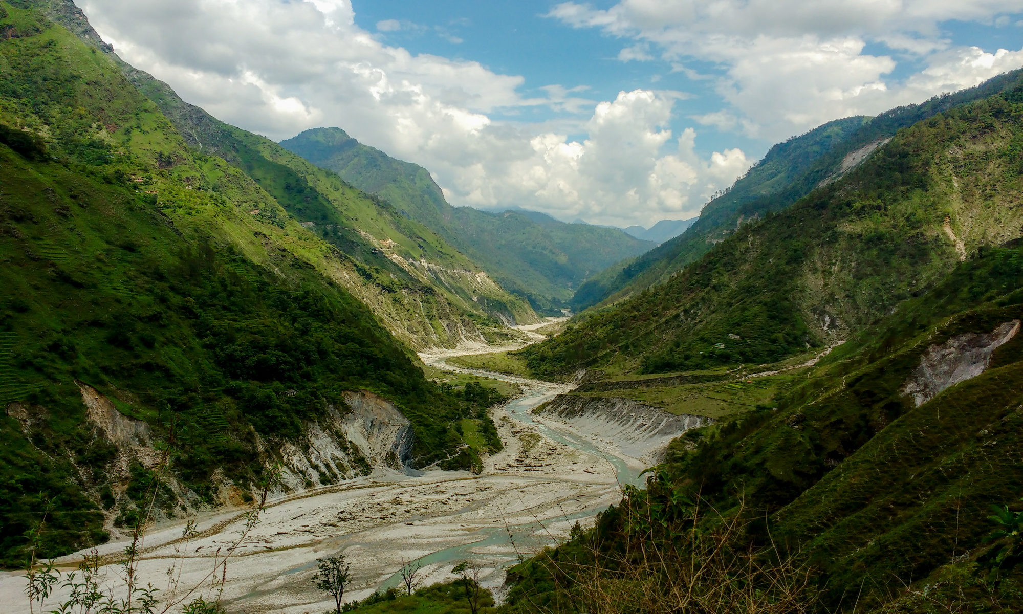
Featured Image: Gori Ganga River near Munisiari, Pithoragarh district, Uttarakhand from Wikipedia under CC BY-SA 4.0.
Paper: Lake Evolution, Hydrodynamic Outburst Flood Modeling and Sensitivity Analysis in the Central Himalaya: A Case Study
Authors: Ashim Sattar, Ajanta Goswami, Anil. V. Kulkarni and Adam Emmer
What could be worse than waking up one morning to find yourself drowning in water? People living in the Himalayan terrain experience this fear every time flash floods occur in the valleys. Glacial retreat induced by climate change led to the formation and evolution of glacial lakes in the Himalayan region. The emerging threats possessed by these lakes result in the incidence of Glacial Lake Outburst Floods (GLOF) which wash away villages along its path. One such incident took place in June 2013 in Kedarnath Valley in Uttarakhand, India with a death toll of as many as five to six thousand people. This eventually led to the strong need for risk assessment and management related to the occurrences of such GLOF events.
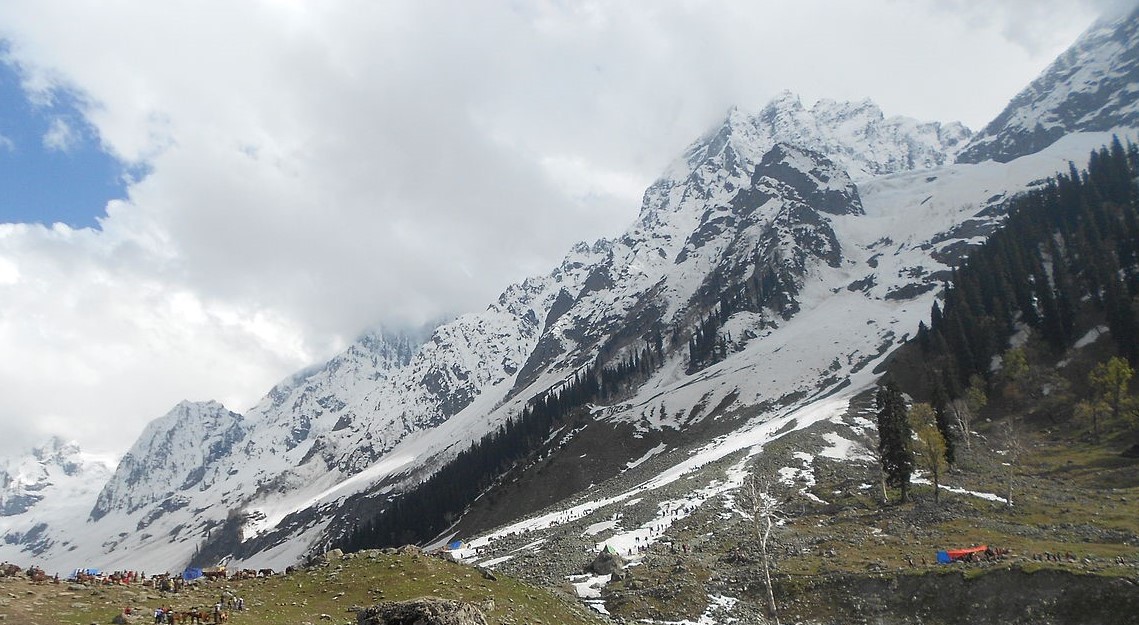
Featured image: Thajwas Glacier from Wikipedia under CC BY-SA 4.0.
Paper: Glacial-geomorphic study of the Thajwas glacier valley, Kashmir Himalayas, India
Authors: Reyaz Ahmad Dar, Omar Jaan, Khalid Omar Murtaza, Shakil Ahmad Romshoo
Glacial retreat caused by climate change is an urgent problem around the globe, as glaciers which hold 68.7% of our freshwater sources are rapidly melting. There are several regions around the world where snow covers the whole region almost all the year round. These places are not only a place for tourist destinations but are also covered with various landscape features which carry vital information related to past glacial activities, including both the advancement and the retreat of glaciers that occurred during the Late Glacial Maximum.
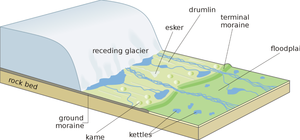
In a new research study on Thajwas Glacial Valley in Sonamarg which is located in the upper reaches of the Indus River in Kashmir Himalayas, the researchers studied the available glacial-geomorphic features of the region. The geomorphic landforms shaped by the glaciers provide scenic landscape beauty to the region. The reconstruction of palaeo-glacial features of the region is assisted by the development of different landforms in the valley such as cirques, characterized as amphitheatre shaped valleys, glacial troughs or U-shaped valleys, and terminal moraines which forms at the end of the glaciers.
The researchers developed a glacial-geomorphic map featuring all the available glacial landforms features of the valley as well as the behaviour of the past glaciers with the help of input from both field observations and geomorphic information collected from satellite imagery and Google Earth. The major bedrock lithological formation of the region consists of Panjal Volcanics composed of basaltic rocks interposed with pyroclastic materials produced by volcanic activities. Various glacial landform features have been mapped with ground-based observations in the area. Small-scale features such as erratic boulders, kettle holes, glacial meltwater streams, etc. have also been mapped for the region using images from Google Earth. These glacial landforms vary in size from one meter to more than hundreds of meters.
A schematic of glacial landforms. Source: Wikimedia
In the Kashmir Himalayas, the process of glaciation has resulted in complex topographical features as an outcome of landscape evolution. Evidences found for the advancement of glaciers in the Great Himalayan mountain range near the Kashmir Valley. This research suggests that the glaciers in the Kashmir Himalayan region are showing signs of depletion as well as recession as an impact of recent warming observed in the region. The satellite data revealed the expansion of Thajwas Valley at the expense of retreating cirques of tributary glaciers. The presence of steep slopes on the north-eastern side is evidence of fluvial incision i.e., the process of narrow erosion by a river far from its base level, with slight glacial erosion; on the other hand, the gentle slope found on the south-western side is a result of the retreat of the cirque due to erosion.
During the Late Quaternary period, the Valley of Kashmir has experienced cycles of glacial and interglacial activities. Global cooling led to the growth of the glaciers together with high rates of erosion which shaped the landscape of the region. Serrate ridge present in the area indicates a gradual lowering of the ice levels. Recessional moraines, kettle hole and outwash plains observed in the region indicates the deglaciation process owing to climate change. The region has experienced substantial glacial and climatic fluctuations during the Late Quaternary period. Using area scaling method the researchers estimated that the Thajwas glacier has lost 88% of its volume after its last advancement. Presently, the Thajwas glacier is estimated to have lost 81% of its surface area.
Our lives are indirectly dependent on the glaciers, as they control the climatic balance and other geographical phenomena occurring on the earth. Research into the retreat of these glaciers is imperative to understand how we can preserve this indispensable natural resource for a sustainable life.