In the 2015 Paris Agreement, nations pledged to work toward a common goal of limiting global warming to less than 2°C compared to pre-industrial times. The Agreement doesn’t specify how the signatories should do this, though: levy a carbon tax? Shut down coal-fired power plants? Use a stainless steel straw? According to the best available climate science, we will need to be doing all of the above and then some. In fact, meeting the target of the Paris Agreement will require negative emissions, removing greenhouse gases from the atmosphere via some form of Negative Emissions Technology (NET).
Featuring image: Oxygen was not always present in Earth’s atmosphere, but stated to accumulate only around 3.5 billion years ago. Pixabay, Public Domain (CC0)
Authors: S. Marchi, N. Drabon, T. Schulz, L. Schaefer, D. Nesvorny, W. F. Bottke, C. Koeberl and T. Lyons
Take a deep breath. Your lungs fill with air and vital oxygen. Not only you, but all higher life depends on oxygen. In the Archean aeon, which lasted from 4 to 2.5 billion years before present, Earth’s atmosphere contained no oxygen. How did oxygen accumulate in the atmosphere? A team of researchers discovered that the evolution of our atmosphere was strongly influenced by impacts of large meteorites when our planet was still young.
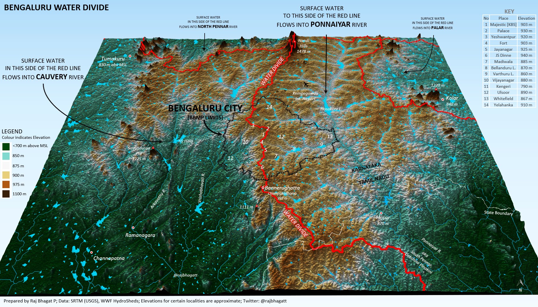
Featured Image: Raj Bhagatt P (published with permission from the author)
Castán Broto, V., Sudhira, H. and Unnikrishnan, H. (2021), WALK THE PIPELINE: Urban Infrastructure Landscapes in Bengaluru’s Long Twentieth Century. Int. J. Urban Reg. Res., 45: 696-715. https://doi.org/10.1111/1468-2427.12985
Can a pipeline that runs through an urban landscape weave narratives of water usage through space and time? A beautiful article published in the International Journal of Urban and Regional Research captures some of the stories along the oldest pipeline in Bengaluru, South India. The narratives talk of the urban and rural divide, the patterns of urban sprawl, the pre-colonial water management, and the scarcity faced today.
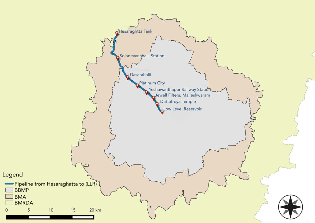
Before the pipeline, Bengaluru relied on an ancient network of seasonally-replenished tanks, reservoirs and open wells for its agrarian water supply. This network was engineered to harness the natural gradients of Bengaluru’s topography, and to ensure water reached different parts of the city. In 1894, the Chamarajendra waterworks laid down the first modern iron pipeline to source water from the Arkavathi river to Bengaluru’s colonial heart – and history was made. Based on old planning records and an analysis of historic maps, this pipeline today can be traced from the low-level reservoir at the heart of Bengaluru, passing through the neighbourhoods of Malleshwaram, Yeshwanthpur, and Dasarahalli, ending at the Hesaraghatta tank at the northwest corner of the city. Throughout history, the pipeline has affected the lives of people and other urban infrastructure along the way, and continues to do so.
In the 1960s, the Bangalore Water Supply and Sewerage Board (BWSSB) was created to meet the demands of the city. Yet with the ever-expanding urban stretches and the burgeoning population, water scarcity is among the major challenges faced by Bengaluru today. Pipelines from Tarabanahalli, and from Shivanasamudra, along with the old one from Hesaraghatta, transfer water from the rural outskirts to the heart of Bengaluru. In addition, groundwater resources and some water from the Arkavathi river is carried by tankers into the city, to supplement the 6,000 public borewells, and roughly 50,000 residential borewells. Despite water conservation efforts like rainwater harvesting and recycling, the water scarcity in Bengaluru has begun to have ecological and environmental impacts – and the impact will be disproportionately felt by the low-income groups, who can not afford private borewells, nor the cost of long-distance transfers.
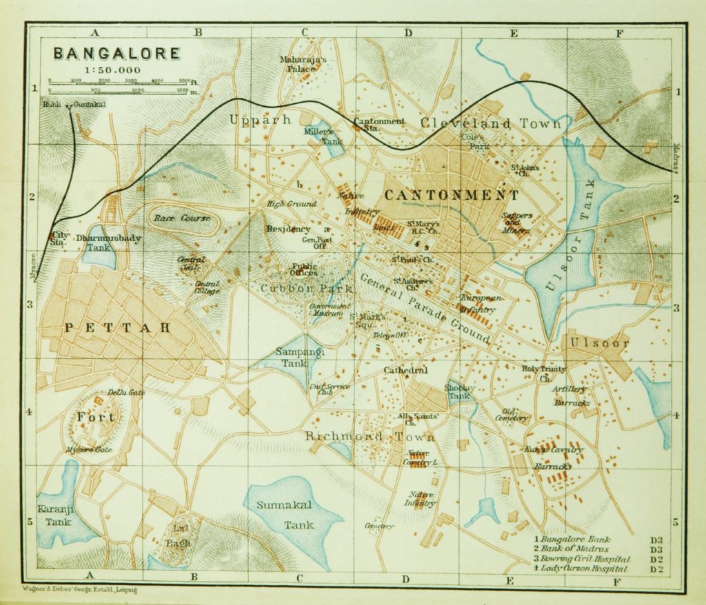
A 1914 map of Bengaluru by Baedekar showing some of the old tanks in the heart of the city. In the colonial era, as a cantonment, tanks and wells served much of the city’s water demands. Image: public domain.
The article goes on to reflect on the historical, socio-economic, and political aspects of the neighbourhoods through which the pipeline flows – almost like a travelogue with a bitter note. As the pipeline networks developed, they created a set of conditions for residential and industrial development. Some neighbourhoods benefit directly from the pipeline, whereas some don’t, and over time the pipeline has further marginalized the poorer populations from receiving a good supply of water. These disparities will only get starker in the years to come. Residential overcrowding, land misappropriation, pollution, and increasing demand for industry and residences affect the efficiency of the water network and strain the groundwater resources. As more technological solutions are sought, the local ecologies that sustained these past water systems – such as agricultural patches that helped replenish tanks, the numerous rainwater-filled lakes that have since disappeared due to encroachment, or are severely polluted and littered, have been ignored.
The article underlines a harsh truth – Bengaluru never had enough water. If we are to strategize our water infrastructures again, we need new technological approaches, new resources or to reverse the direction of services from the peri-urban area to the centre of the city and vice versa, with due cognizance of encroachment and violations by existing and future development. The traditional system of tanks and wells needs to be integrated into the broader network of water resources to meet the needs of an ever-expanding urban nexus.
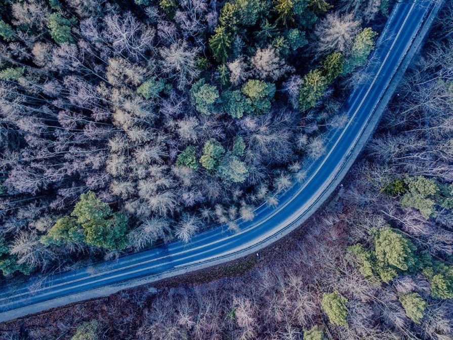
There has been a lot of talk about transportation as of late with America’s “Build Back Better Act”. While these political decisions are partially informed by scientific research around climate change, particularly in the United States (where 30% of greenhouse gas emissions result from transportation by road, rail, and air each year), the negative impacts of transportation infrastructure on the climate and local ecosystems are often lost in political discussions. In a new study in Scientific Reports, Kupka and colleagues discuss the broader impacts of highway maintenance on nearby forest soil ecosystems, finding that roadways themselves can increase carbon dioxide emissions by disrupting local carbon cycles.
Right now in Glasgow, Scotland, representatives of world governments and other parties are currently gathering yet again to negotiate political solutions to climate change at COP26. This is the 26th semi-annual Conference of the Parties on climate change, but the history of our understanding of the problem — and attempts to deal with it — goes back even further than that. Speaking strictly of the science of global warming and its effects, what do we know now that the participants of the first COP did not?
Authors: Yin Yau Yoyo Chu, Joseph R. Michalski, Shawn P. Wright, A. Alexander G. Webb.
Mars is a planet of extreme highs and lows containing the solar system’s largest volcano – Olympus Mons – and the largest canyon system – Valles Marineris. Tharsis and Elysium, the planet’s two largest volcanic provinces, are young surface features that were built by basaltic volcanism throughout the Amazonian, the most recent geological era on Mars.
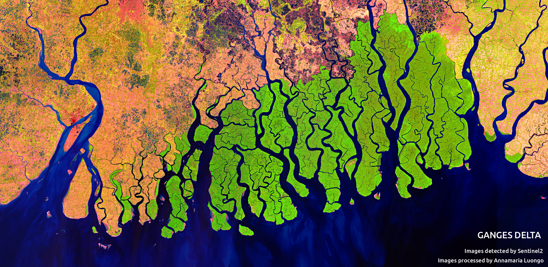
Feature image:Mosiac of the the Ganges Delta in false color created with imagery from the Sentinal 2 satilite. CC-By Annamaria Luongo, via Wikimedia Commons
Deltas are striking features on Earth’s surface, where rivers meet large water bodies. Their flow spreads out into many channels, depositing the sediment they have been carrying, potentially since their headwaters. This sediment creates and sustains the delta, which can be hundreds of miles across. Beyond being mesmerizing, deltas are essential to human civilization, past and present. Nearly half a billion people live on deltas around the world, where the deposited sediment hosts some of the most fertile agricultural land available.
It’s no secret that ExxonMobil is a major architect of the climate crisis. The oil giants have allocated incredible amounts of time and resources to undermining climate science while continuing to pollute the planet. Now, a recent One Earth publication by Geoffrey Supran and Naomi Oreskes unpacks the way Exxon has so successfully spread propaganda while borrowing techniques from another destructive industry: that of tobacco. Exxon and other oil companies (often supported by powerful right-wing think tanks) have embarked on a propaganda campaign that has morphed from outright denial into a campaign aimed at distracting us, dividing political opinion, and convincing us that climate action is hopeless. Supran and Oreskes delve into the evolution of Exxon’s harmful contribution to this narrative.
Authors: Olga V. Churakova Sidorova, Rolf T. W. Siegwolf, Marina V. Fonti, Eugene A. Vaganov, Matthias Saurer
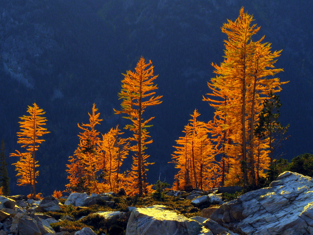
Seemingly straight out of a fairytale, ancient trees are able to convey details about Earth’s complex history to the scientists willing and able to listen. Deep in the Siberian Arctic lie the secrets of past weather events, ocean currents, and droughts that occurred thousands of years ago, locked away in petrified wood and in the oldest living larch trees. We often hear in the news how the Siberian forest is victim to extreme drought and fire—something that is new as of the recent century. But how “new” are these events, and what exactly is perpetuating this new cycle?
Featuring image: Pluto is an icy object in the outer solar system. Its surface it not only covered by ice, but also by an unidentified red material. The largest of these red areas is the Cthulhu region in the southern hemisphere. NASA/JHUAPL/SwRI, public domain (CC0)
Authors: M. Fayolle, E. Quirico, B. Schmitt, L. Jovanovic, T. Gautier, N. Carrasco, W. Grundy, V. Vuitton, O. Poch, S. Protopapa, L. Young, D. Cruikshank, C. Dalle Ore, T. Bertrand, A. Stern
Pluto is an icy object beyond Neptune. Its surface is not only covered by innocent pale ice, but also by mysterious dark-red fields. What lurks in these hellish regions and where do they come from?
Far behind Neptune’s orbit, the icy body Pluto orbits our Sun. Pluto got a lot of attention in 2006, when it lost its status as a planet. Since then, it remained as a trans neptunian objects (TNO) of major interest. In 2015, Pluto presented itself in high resolution pictures for the first time in history, when NASA’s space probe New Horizons explored the outer regions of our solar system. What the pictures showed, was not the expected icy desert, but multiple areas of deep red all over Pluto’s surface. The largest of them is located on the southern hemisphere. As a homage to the master of subtle horror, H. P. Lovecraft, the area is called Cthulhu region, because some of the most mysterious and powerful beings in Lovecraft’s world originate from Pluto (in Lovecraft’s stories called Yuggoth). Fayolle and co-workers tried to better understand the origin of these red materials by using laboratory experiments and numerical modelling in comparison with the data recorded by the New Horizons space probe.