Silver Doesn’t Grow on Trees: The Quest for the Ores that Formed Roman Coinage

Featured image: A silver Roman Denarius, featuring the likeness of emperor Marcus Aurelius. CC BY-SA 3.0 via Wikimedia Commons

Paper: Silver isotope and volatile trace element systematics in galena samples from the Iberian Peninsula and the quest for silver sources of Roman coinage

Authors: Jean Milot; Janne Blichert-Toft; Mariano Ayarzagüena Sanz; Chloé Malod-Dognin; Philippe Télouk; Francis Albarède

The Roman Empire was a superpower thousands of years ago, and with great power comes great (fiscal) responsibilities, including minting the money. To mint silver coins, the Romans needed vast amounts of silver, which historians and archeologists believe originated in the Iberian Peninsula, or present-day Spain and Portugal. However, the geologic origin of that silver is unknown as the depleted mines were abandoned long ago.

Continue reading “Silver Doesn’t Grow on Trees: The Quest for the Ores that Formed Roman Coinage”

Etched in stone: tracing earthquakes through archaeological ruins

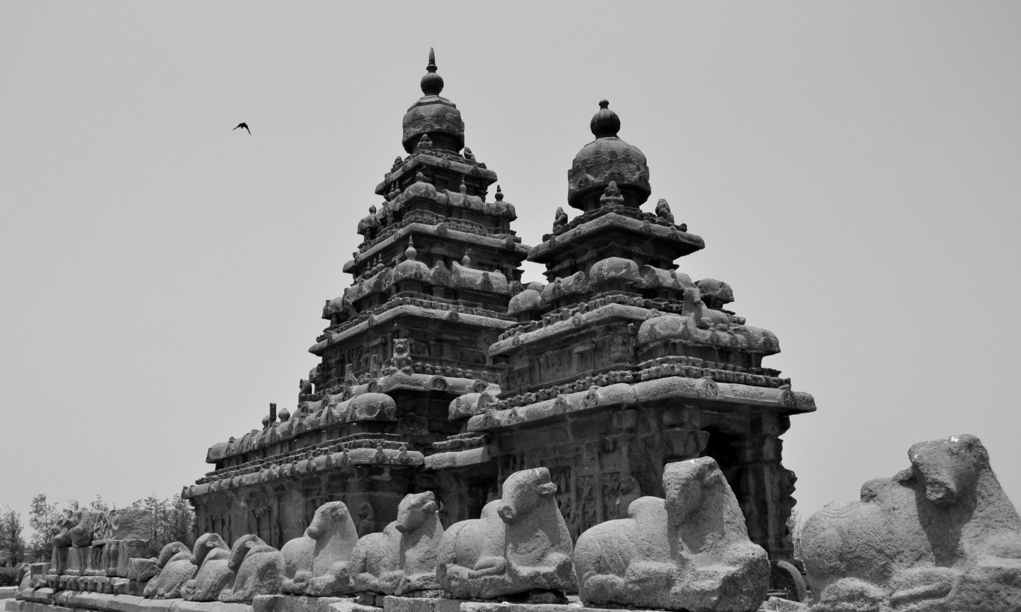
The Shore Temple at Mahabalipuram, Tamil Nadu, India

Feature image: Shore Temple at Mahabalipuram, Tamil Nadu, India by Nireekshit, CC BY-SA 3.0

Article: Archaeoseismological potential of the Indian subcontinent.

Authors: Miklós Kázmér, Ashit Baran Roy and Siddharth Prizomwala

India’s ancient monuments whisper more than just stories of past empires and civilizations: they also tell tales of its geological past. Evidence of earthquakes is etched in stone, displacements and warps that can help us identify past seismic events.

India’s documentation of earthquakes is sketchy, pieced together from historical data, monographs, and British records. In 1898, the first seismograph was established in Pune, Maharashtra, but serious instrumental recording only began when the 1967 Koyna Dam earthquake struck.Such a short record is not enough to map out active seismic regions or understand recurring earthquakes, so some scientists are turning to archaeological evidence.

Archaeoseismology studies past earthquakes by analysing damage to archaeological sites. How much damage an earthquake does to a structure depends on how hard or soft the ground beneath is, and damage may be mitigated through preventative building techniques. Earthquakes can result in shifts and tilts in masonry or brickwork, displaced walls, warped floors, missing sections, and sometimes, a complete collapse of the structure. The Earthquake Archaeological Effects (EAE) scale helps categorise the intensity of past earthquakes based on observations of structural damage.

A recent paper by Kazmer et al., looks at earthquake damage to 3 late medieval UNESCO World Heritage sites: Mahabalipuram in Tamil Nadu (7th-8th CE), the Qutub Minar complex in Delhi (12th-19th CE), and Konark near Bhubaneshwar in Odisha state (13th CE). All three sites feature masonry buildings commonly seen in 7th and 12th centuries CE architecture across the Indian subcontinent. The seismic history of the subcontinent is understudied compared to the seismically active Himalayan terrain.

The tilt of masonry wall and floor at the Shore Temple in Mahabalipuram indicates liquefaction, a sudden loss of soil stability that can be caused by a seismic shock.. In the Qutub Minar complex, damage to the minar including masonry blocks at the top of Iltutmish’s tomb with gaps of about 5 cms  are attributed to an earthquake in 1803. At Konark, smaller temples around the Sun Temple display shifted blocks. Other temples are missing a shikhara or deul, the temple spire or tower, which might have been toppled by an earthquake.

Beyond categorising such damage, archaeoseismology can indicate the date or date interval, location, and intensity for both seismically active and less active regions. Comparisons with historical records can offer broader insights into the Indian subcontinent. The volcanic plateau that forms the Indian peninsula has long been considered a ‘stable’ region, yet all 3 sites in this study located on the ‘Indian shield’ indicate otherwise – the region has seen earthquake activity in the past. 

Over the years, monuments have undergone intensive restoration by various rulers, British colonial authorities and the Archaeological Survey of India to preserve them for future generations, but in the process, the evidence of past earthquakes has been erased. Kazmer and co-authors suggest that archaeoseismic studies are conducted before all large-scale restoration projects. That way, we can ensure both the historical and geological legacies are preserved for posterity.


Etched in stone: tracing earthquakes through archaeological ruins by Devayani Khare is licensed under a Creative Commons Attribution-ShareAlike 4.0 International License.

Shaken, rattled, and rolled

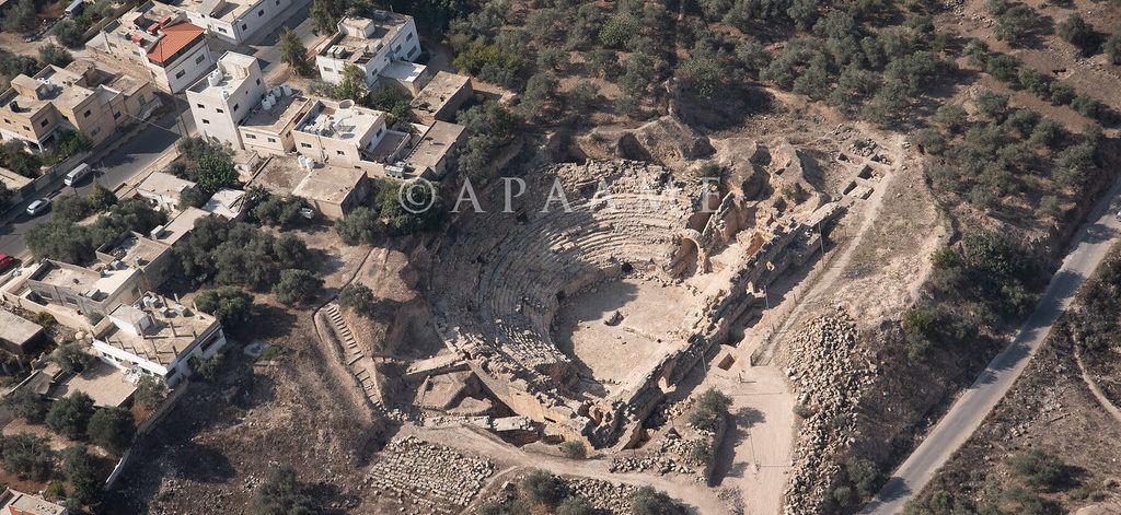
Featured image: an aerial photograph of the Capitolias/Beit-Ras theater, courtesy of the Aerial Photographic Archive of Archaeology in the Middle East (APAAME), CC-BY-NC-ND 2.0

Paper: Two inferred antique earthquake phases recorded in the Roman theater of Beit-Ras/Capitolias (Jordan)
Authors: M. Al-Tawalbeh, R. Jaradat, K. Al-Bashaireh, A. Al-Rawabdeh, A. Gharaibeh, B. Khrisat, and M. Kázmér

One of the biggest questions in earthquake seismology is whether we can see into the future, to forecast seismic activity based on what we know about faults and how they behave. We’re about as likely to accurately predict earthquakes as we are to see the future in a crystal ball, but one way we can improve our forecasts of seismic hazard actually involves looking in the other direction: back into the past.

Continue reading “Shaken, rattled, and rolled”

What lies beneath: tracing human migrations through stone tools, India

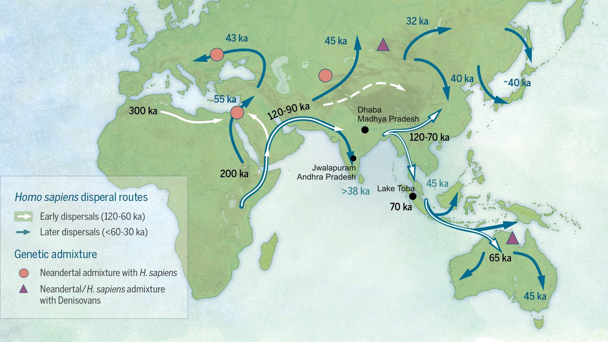
A map demonstrating possible migration routes of modern humans

Featured image: Katerina Douka, Michelle O’Reilly, Michael D. Petraglia – On the origin of modern humans: Asian perspectives; Science 08 Dec 2017: Vol. 358, Issue 6368, DOI: 10.1126/science.aai9067 [1], CC BY-SA 4.0 (Wikimedia Commons) with minor edits

Paper: Human occupation of northern India spans the Toba super-eruption ~74,000 years ago

Authors: Chris Clarkson, Clair Harris, Bo Li, Christina M. Neudorf, Richard G. Roberts, Christine Lane, Kasih Norman, Jagannath Pal, Sacha Jones, Ceri Shipton, Jinu Koshy, M.C. Gupta, D.P. Mishra, A.K. Dubey, Nicole Boivin & Michael Petraglia

Modern humans evolved around 200,000 years ago in Africa, and dispersed from there to other parts of the globe. The Out of Africa theory is a well-established model that explains the early dispersal of Homo sapiens or modern humans from Africa, into Asia and Oceania. Among the routes proposed is the Southern Route migration from East Africa to the Near East, across the Red Sea, and around Arabia and the Persian Plateau to India, and then finally with modern humans settling in Asia and Australasia. 

India’s geographic location is a key piece of this puzzle. Mitochondrial DNA of contemporary populations in India indicate that the country was an important stepping stone in the colonisation of Australasia. However, the timeline for the proposed Southern Route migration is still a matter of debate – could dating the arrival and settlement of modern humans in India provide some clues?

Continue reading “What lies beneath: tracing human migrations through stone tools, India”