Hillsides collapsing into Arctic streams can trigger CO2 release to the atmosphere

Permafrost thaw slumps draining into a river on the Peel Plateau in western Canada

Featured Image: Permafrost thaw slumps draining into a river on the Peel Plateau in western Canada. Photo courtesy Scott Zolkos, lead author of the paper.

Paper: Experimental Evidence That Permafrost Thaw History and Mineral Composition Shape Abiotic Carbon Cycling in Thermokarst-Affected Stream Networks

Authors: Zolkos, Scott & Suzanne E. Tank.

The rivers and streams of the Arctic transfer atmospheric heat into the surrounding permafrost (perennially frozen) soil. At the same time, surface soils up to 1 meter deep undergo annual freeze-thaw cycles. When warmer air arrives in the summer months, the combination of warming air and river water can thaw large chunks of ice-rich permafrost soil along the stream’s edge. Thawed permafrost breaks away from the surrounding hillsides and causes catastrophic slope failures, transporting huge amounts of sediment into the nearby waterways. As the stream water becomes murky it takes on the appearance of chocolate milk, and simultaneously, the geochemistry of the water changes.

Continue reading “Hillsides collapsing into Arctic streams can trigger CO2 release to the atmosphere”
Citizen science project identifies extensive mining pollution in central Peru

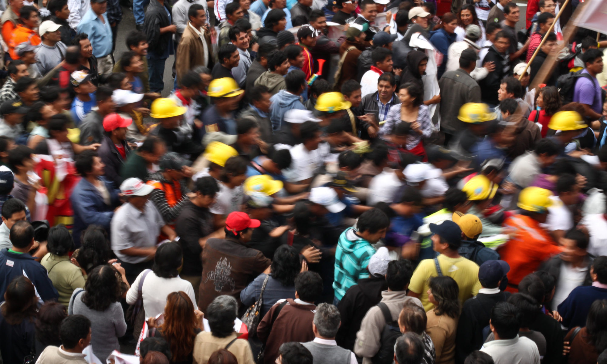
Featured image: Anti mining protesters in Downtown Lima, Peru. Photo credit: Geraint Rowland on Flickr (CC BY-NC 2.0).

Paper: Citizen science campaign reveals widespread fallout of contaminated dust from mining activities in the central Peruvian Andes
Authors: James B. Molloy, Donald T. Rodbell, David P. Gillikin, and Kurt T. Hollocher

At the heart of Cerro de Pasco, Peru, one of the highest cities on Earth, is an enormous open pit mine. People have been mining at the Cerro de Pasco site since pre-Incan times, but after silver was discovered there in the 1630s, it became one of the world’s richest and most heavily worked mines.

Continue reading “Citizen science project identifies extensive mining pollution in central Peru”

Evidence of pollution all the way to the poles

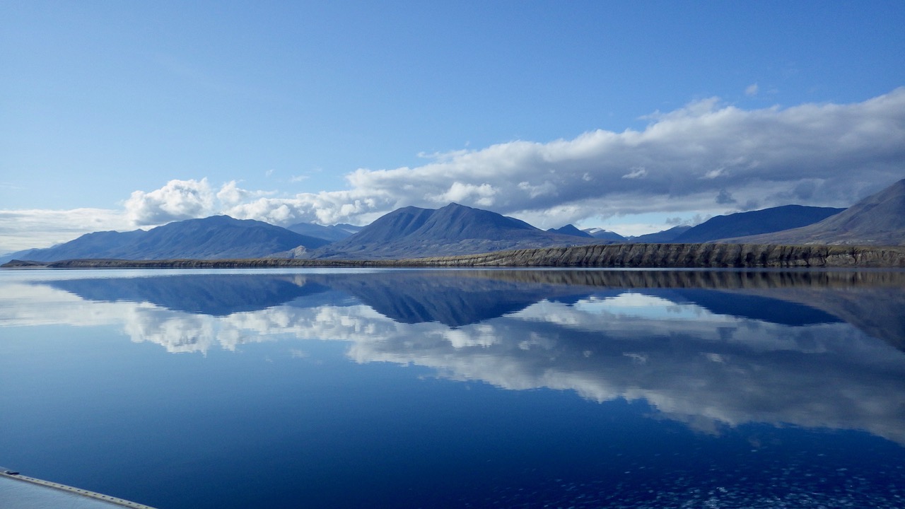
Featured Image: Lake Hazen in front of the Grant Land Mountains – photo courtesy Kyra St. Pierre, a co-author of the Sun et al. paper.

Paper: Glacial melt inputs of organophosphate ester flame retardants to the largest High Arctic lake

Authors: Sun, Yuxin, Amilia O. De Silva, Kyra A. St Pierre, Derek C. G. Muir, Christine Spencer, Igor Lehnherr, John J. MacInnis

Far from human habitation Lake Hazen sits north of the Arctic Circle surrounded by pristine, treeless mountains. But even there, the telltale chemical fingerprints of human pollution can be found.

Spring and summer in the far North are a short three-month period of reawakening, glacial melt, and permafrost thaw. During these months, meltwater transports anything that has collected on top of glaciers, like particles, nutrients, and contaminants deposited from the atmosphere, flowing down rivers and into glacial lakes. 

Continue reading “Evidence of pollution all the way to the poles”

Cave formations show link between ice ages and the tilt of Earth’s axis

Paper: Persistent influence of obliquity on ice age terminations since the Middle Pleistocene transition

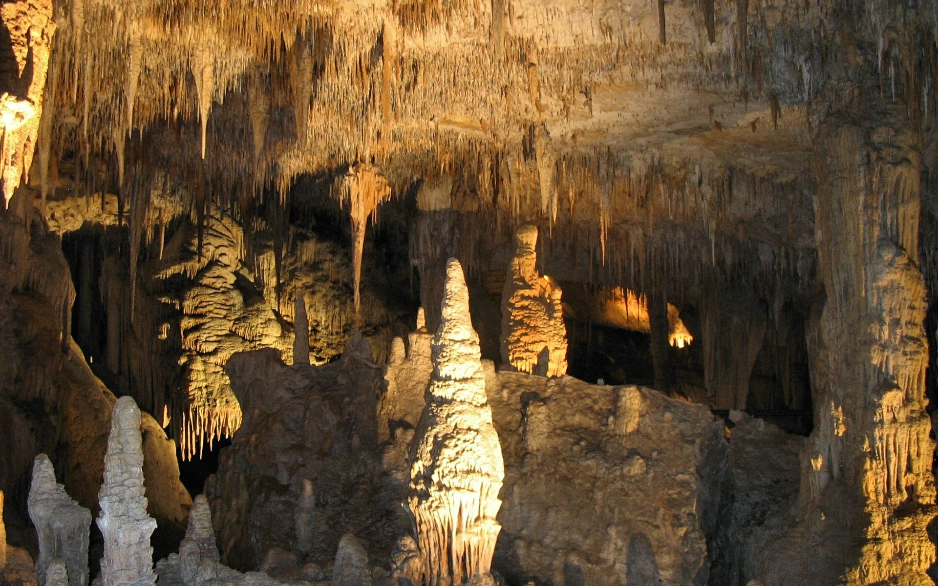
Featured image: Stalagmites captured by mareke on Pixabay

Authors: Petra Bajo, Russell N. Drysdale, Jon D. Woodhead, John C. Hellstrom, David Hodell, Patrizia Ferretti, Antje H.L. Voelker, Giovanni Zanchetta, Teresa Rodrigues, Eric Wolff, Jonathan Tyler, Silvia Frisia, Christoph Spötl, Anthony E. Fallick

Our planet has been circling and spinning in a wobbly dance around the Sun for billions of years. The exact motions of this dance- governed by Earth’s near-circular orbit (eccentricity), the tilt of its axis, and the orientation of the tilted axis in space (precession) fluctuate predictably. Variations in this planetary dance have changed the amount and distribution of sunlight reaching Earth’s surface through time, and have determined when the planet experienced long periods of cold temperatures and growth of massive ice caps on the continents (ice ages). However, scientists have not been so sure about which planetary motion is the most important for the timing of ice ages. New research uses climate information stored in caves to precisely link these motions to ice ages, showing that axis tilt may be the most important position in the dance when it comes to pulling Earth’s climate out of those frigid times.  

Continue reading “Cave formations show link between ice ages and the tilt of Earth’s axis”

Tiny wobbles foreshadow big earthquakes

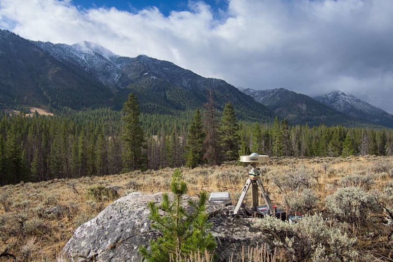
Featured image: A GPS station in the Sawtooth National Forest near Ketchum, Idaho. Photo by Scott Haefner (USGS).

Paper: Months-long thousand-kilometre-scale wobbling before great subduction earthquakes
Authors: J. R. Bedford, M. Moreno, Z. Deng, O. Oncken, B. Schurr, T. John, J. C. Báez, M. Bevis

We’re always on the lookout for earthquake precursors, indicators that the Earth might be gearing up for some shaking, and geophysicists think they might have found a new one: a small but measurable back-and-forth “wobble” of the land starting several months before very big earthquakes hit.

Continue reading “Tiny wobbles foreshadow big earthquakes”

Unexpected consequence of permafrost thaw: potentially less methane released into the atmosphere

Authors: Clarice R. Perryman, Carmody K. McCalley, Avni Malhotra, M. Florencia Fahnestock, Natalie N. Kashi, Julia G. Bryce, Reiner Giesler, Ruth K. Varner

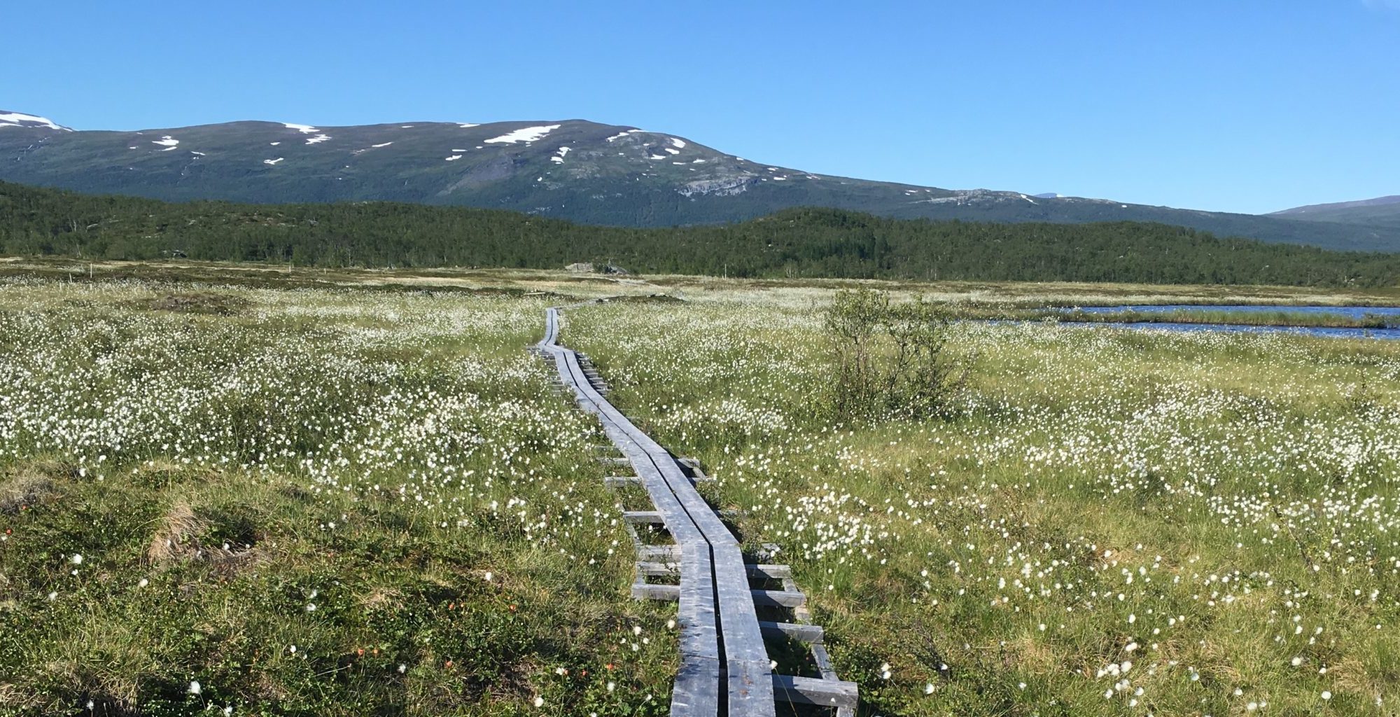
Permafrost is a blanket of soil that is frozen for more than two years and can trap its contents for hundreds to thousands of years. Now that permafrost soil is thawing. This is particularly significant in peatland permafrost because these wetlands sequester high amounts of carbon. As peatland permafrost degrades, methane emissions are expected to increase as the water table rises and provides a suitable environment for methane production by microbes.

Continue reading “Unexpected consequence of permafrost thaw: potentially less methane released into the atmosphere”

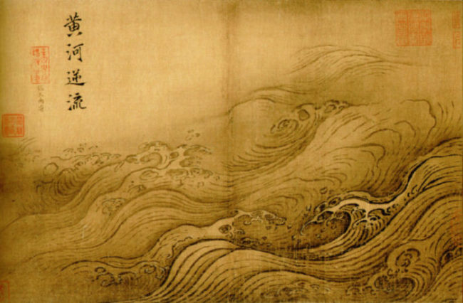
What Caused the Flood that (Possibly) Gave Rise to an Empire?

Featured image: The Yellow River Breaches its Course by Ma Yuan, Public Domain

Paper: Uranium isotopic constraints on the nature of the prehistoric flood at the Lajia site, China
Authors: Le Li, Jun Chen, David William Hedding, Yuanhe Fu, Maolin Ye, Gaojun Li

A small sand deposit might hold the key to dating the rise of China’s first dynasty. Continue reading “What Caused the Flood that (Possibly) Gave Rise to an Empire?”

How Algae Emissions Could Affect the Weather

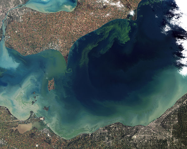
Featured image by Jesse Allen and Robert Simmon, Public Domain

Paper: Unprecedented DMSP Concentrations in a Massive Dinoflagellate Bloom in Monterey Bay, CA
Authors: Ronald P. Kiene, Brent Nowinski, Kaitlin Esson, Christina Preston, Roman Marin III, James Birch, Christopher Scholin, John Ryan, and Mary Ann Moran

Tiny marine organisms have been showing up in higher and higher numbers in bodies of water. These organisms also emit sulfur-containing compounds – and if they emit enough sulfur, their emissions could affect the climate. Continue reading “How Algae Emissions Could Affect the Weather”