
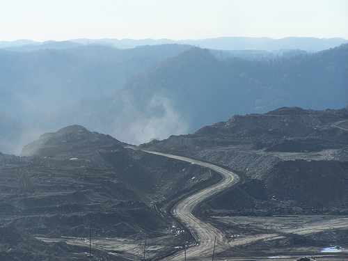
Featured Image: Mountaintop removal mining site in Appalachia. Copyright: CC BY-SA 4.0 via. wikimedia commons.
Report: Peripheral gully and landslide erosion on an extreme anthropogenic landscape produced by mountaintop removal coal mining (2020)
Authors: Miles Reed & Dr. Steve Kite
There’s a general consensus that coal mining is ‘bad’ for the environment, but beyond carbon emissions, what is its visible, physical impact on our surroundings? What lasting damage does mining create on the Earth’s surface? The answer is that it has a tremendous impact; specifically, mining in Appalachia is linked to distorting the natural flow of water on the landscape, which creates ripple (no pun intended) effects on the greater environment. A recent study by Reed and Kite details those effects on Appalachian landscapes, directly linking mountaintop mining to erosion and landslides. Now, as worries about access to safe, clean water being jeopardized by fossil fuel production abound nationwide, exploring the impacts of mountaintop mining on Appalachian freshwater becomes incredibly important with immediate and personal impacts.

Featured Image: A striking image of gullies (trenches formed by water flow that erode away at the soil on land, often due to storm, fire, or anthropogenic impacts). The green dots map the heads of these gullies. The black outline shows mountaintop removal sites; the illustration clearly shows that the edge of mining-affected areas affects the surrounding landscape, causing hillslope erosion and increasing the risk of landslides.
In Appalachia, mountaintop mining is environmentally controversial. It’s a coal mining practice where the top of a mountain is blasted open to allow coal seams just under the mountain’s cap to be extracted. This process dramatically alters the natural landscape and the mountain’s natural function in regulating water flows, mitigating storm-related flash floods and erosion from landslides. The excess debris produced during the coal extraction process is piled into the side of the surrounding valleys nearby, causing streams to be buried by fragmented rock and sediment. According to the EPA, debris from mountaintop removal mining had buried over 1200 miles of headwater streams within just a 2-decade period between 1992 and 2002. Today, that number is estimated to have at least doubled (Bernhardt et al).
Headwater streams are small bodies of water that are far upstream from a major river. They play a crucial role in ecosystems, as the first upstream water channels to collect water that eventually enters our major watersheds – think places that store water, such as ponds and aquifers. However, they’re easily affected by human activity, which impedes their ability to deliver nutrients downstream and to transport fish that migrate between upstream and downstream habitats. Reed and Kite’s work looked specifically at headwater streams, comparing differences between streams affected by mining and those that aren’t.
Potential damage from mining to headwater streams has received some attention previously from environmentalists and policymakers. Given the severity of the environmental impacts of mining, the Surface Mining Control and Reclamation Act of 1977 (SMCRA) requires that mining companies refill the mountaintops to “approximate original contour” – but what are the long-term impacts of such a major disturbance and transformation on the landscape? Given rebuilding exemptions for companies that can find higher land value from a flattened mountain, or previously mined areas that are now repurposed to golf courses, removing the existing old-growth forest, it’s hard to say how “approximate” the new landscape can be to its pre-existing form (McQuaid). Researchers have found examples of mining sites whose ridges were not filled back to their pre-mining heights (Zipper et al 1989).
Reed and Kite analyzed two field study sites with mountaintop mining in southern West Virginia to observe the erosion of valley fills. They used LiDAR (a form of remote sensing and mapping technology) for better resolution over traditional aerial imagery, looking at an area spanning from central West Virginia to eastern Kentucky, to map out the steepness of hillslopes in the Appalachian Plateaus’ terrain and to estimate their erosion rates. They found that water did indeed cause increased erosion rates in the valleys next to the mined mountains. Additionally, all the mining sites experienced increased water flow-induced erosion.
At mining-affected sites, they discovered stark physical differences in the flows of rivers compared to unmined areas. Affected streams had deeper channels and had increased quantities of rock and sediment deposited in their streamflow. The way the sediment flowed through these rivers was drastically changed, as water flowed more rapidly through the mining-affected streams, potentially exacerbating flooding risk. Increased sediment in the water is also ecologically detrimental.

Above graph: Hillshade map shows the red areas as high-elevation areas on the mountain, whereas the white areas are flattened mountaintops due to mountaintop mining processes.
The flow of water and the soil that makes up the Earth’s surface is essential for environmental and biogeochemical processes to function properly – mountains are intended to be sloped, not artificially bulldozed flat on top. Appalachia in particular has an abundance of freshwater; rock and debris landslides, as well as severe water erosion, create ecosystem damage. The water runoff from mines, carrying dissolved minerals, salts, and trace elements, can be harmful for biodiversity. From these mountaintop-mined sites, sediment can move through the narrow valleys and in turn flow into watersheds. Zipper et al. found that reclaimed mining sites are not fully reconfigured to their pre-mining structures, creating biodiversity as well as safety risks, given the landscape’s weakened structure especially for steeper slopes – which is further exacerbated during periods of heavy rainfall (1989).
While the exact extent of how such mining practices weakened landscape stability is not yet known, this research helps us to better establish the significance of the relationship between the amount of mined area and water runoff-based extreme soil erosion. It is crucial that we consider the impacts of mountaintop mining in the long-term. Post-mining measures, while well-intentioned, do not mitigate the original landscape devastation that this mining practice creates.
Works Cited
Reed, M., and Kite, S. (2020) Peripheral gully and landslide erosion on an extreme anthropogenic landscape produced by mountaintop removal coal mining. Earth Surf. Process. Landforms, 45: 2078– 2090. https://onlinelibrary-wiley-com.dartmouth.idm.oclc.org/doi/10.1002/esp.4867
Bernhardt, Emily S., et al. “Cumulative impacts of mountaintop mining on an Appalachian watershed.” Proceedings of the National Academy of Sciences, vol. 108, no. 52, 2011, pp. 20929–20934, https://doi.org/10.1073/pnas.1112381108.
McQuaid, John. “Mining the Mountains.” Smithsonian.Com, Smithsonian Institution, Jan. 2009, www.smithsonianmag.com/science-nature/mining-the-mountains-130454620/.
Zipper, Carl E., et al. “The practice of “approximate original contour” in the central Appalachians. II. Economic and environmental consequences of an alternative. Landscape and Urban Planning, vol. 18, no. 2, 1989, pp.139-152, https://doi.org/10.1016/0169-2046(89)90005-4.
Making Mountains Out of Molehills? by Joanne Liu is licensed under a Creative Commons Attribution 4.0 International License.