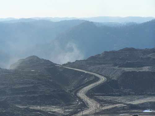
Featured Image: Mountaintop removal mining site in Appalachia. Copyright: CC BY-SA 4.0 via. wikimedia commons.
Report: Peripheral gully and landslide erosion on an extreme anthropogenic landscape produced by mountaintop removal coal mining (2020)
Authors: Miles Reed & Dr. Steve Kite
There’s a general consensus that coal mining is ‘bad’ for the environment, but beyond carbon emissions, what is its visible, physical impact on our surroundings? What lasting damage does mining create on the Earth’s surface? The answer is that it has a tremendous impact; specifically, mining in Appalachia is linked to distorting the natural flow of water on the landscape, which creates ripple (no pun intended) effects on the greater environment. A recent study by Reed and Kite details those effects on Appalachian landscapes, directly linking mountaintop mining to erosion and landslides. Now, as worries about access to safe, clean water being jeopardized by fossil fuel production abound nationwide, exploring the impacts of mountaintop mining on Appalachian freshwater becomes incredibly important with immediate and personal impacts.
Authors: Dini, B., Bennett, G. L., Franco, A. M. A., Whitworth, M. R. Z., Cook, K. L., Senn, A., and Reynolds, J. M.
Nepal straddles the Himalayan arc – the collision boundary of the Indian and the Eurasian tectonic plates that crumbled to form the highest mountains in the world, the Himalayas. Its precarious location makes it among the most disaster-prone countries in the world. Its landscape has been shaped, and continues to be shaped by seismic activity – from landslides and earthquakes, to glacial lake outburst floods (GLOFs) where the glacier ice or rock debris at the periphery of a glacial lake break off, resulting in severe floods downslope.
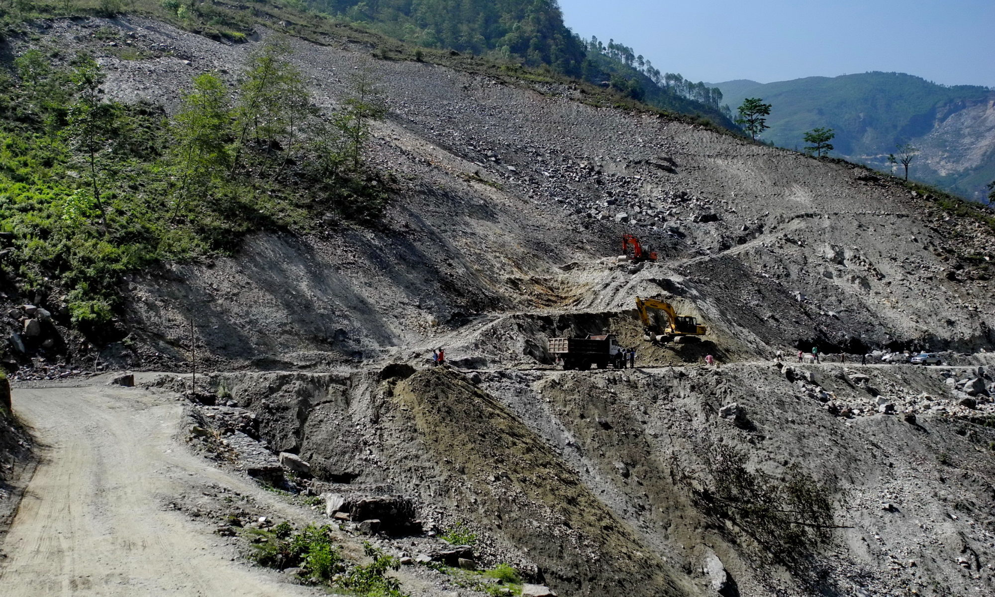
Driving out from Kathmandu city towards Bhaktapur, towards Kodari at the Nepal-China border, the landscape transitions from pagoda-style temples, to settlements, further on to a bleak, boulder-strewn landscape. This is the Araniko highway, built on an old yak track, running alongside the Bhote Koshi river, known to the locals as a difficult, dangerous landscape prone to rockfalls and landslides, especially during the monsoons. Warning signs and steel wire mesh welded to the slopes to mitigate landslides define this stretch, and angular boulders mark where the valleys rise into mountains, and are testimony to the region’s disaster-prone legacy.
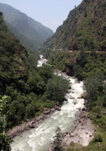
The Bhote Koshi river that flows along the Araniko highway is littered with boulders that have worked loose from the valley slopes. Image credit: Gerd Eichmann (CC BY-SA)
Boulder movement downslope happens due to different kinds of landslides, ranging from abrupt, free-falling rocks to slower flow-like movements. Large boulders are a threat to life and infrastructure, and may amplify landslides when they move downslope or cause floods if they block a river channel.
In fragile landscapes, understanding when and how boulders move downslope and into river networks could be essential to detecting hazards. A rolling stone or a boulder in this case gathers no moss, they say, but can it gather landslide data? A pilot study by Benedetta Dini et al., in the Bhote Koshi catchment, documents how technology can help detect land movement and find use as early warning systems.
Twenty-three long-range, wireless trackers were drilled into boulders along known landslide or debris flow channels. Movement could be triggered by different events including debris flow, large-scale events or collisions. The sensors were programmed to send routine GPS locations every 24 hours, and an accelerometer would report when the boulder moves. A camera was also set up with a field views across the channels to acquire an image every 30 min. Via image sequences, the location of the sensor-embedded boulders are able to compare to prominent trees to identify and validate the movement data. Based on changes in tilt and displacement of boulders, corresponding to movement within a mass of rocks or downslope respectively, the study found that the sensors could successfully detect both slow and rapid movements.
In conclusion, despite technical difficulties which could be a focus for future research, smart boulders have good potential as weather-proof, long-term, real-time, cost-effective monitoring tools, not just in Nepal but in other landslide-prone areas across the world.
