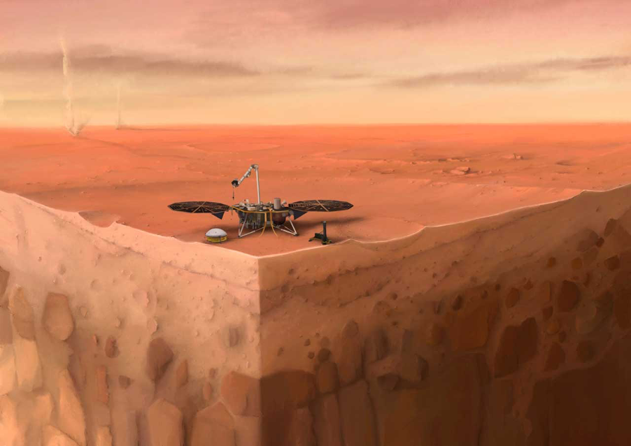
Citizen science project identifies extensive mining pollution in central Peru

Featured image: Anti mining protesters in Downtown Lima, Peru. Photo credit: Geraint Rowland on Flickr (CC BY-NC 2.0).

Paper: Citizen science campaign reveals widespread fallout of contaminated dust from mining activities in the central Peruvian Andes
Authors: James B. Molloy, Donald T. Rodbell, David P. Gillikin, and Kurt T. Hollocher

At the heart of Cerro de Pasco, Peru, one of the highest cities on Earth, is an enormous open pit mine. People have been mining at the Cerro de Pasco site since pre-Incan times, but after silver was discovered there in the 1630s, it became one of the world’s richest and most heavily worked mines.

Continue reading “Citizen science project identifies extensive mining pollution in central Peru”

How do you break up a continent?

Featured image: Lake Malawi, as seen from space. Image courtesy of ESA/MERIS, CC-BY-SA IGO.

Paper: Preferential localized thinning of lithospheric mantle in the melt-poor Malawi Rift
Authors: E. Hopper, J. B. Gaherty, D. J. Shillington, N. J. Accardo, A. A. Nyblade, B. K. Holtzman, C. Havlin, C. A. Scholz, P. R. N. Chindandali, R. W. Ferdinand, G. D. Mulibo, G. Mbogoni

Continental rifting, where one landmass slowly breaks apart into two pieces separated by a brand new ocean basin, is a fundamental part of plate tectonics. But it presents an apparent paradox: the tectonic forces pulling on the plates are thought to be much too weak to break the strong rocks of the continents.

Continue reading “How do you break up a continent?”

Where the river flows: India’s catchment crisis

Dandeli river, Karnataka, India

Paper: Insights into riverscape dynamics with hydrological, ecological and social dimensions for water sustenance

Authors: T.V. Ramachandra, S. Vinay, S. Bharath, M.D.Subash Chandran, and Bharath H.Aithal

A catchment or watershed represents an intricate network of streams that coalesce into a river. In ecology, river networks are considered as ecosystems since they facilitate interactions between organisms and their environments. A healthy river ecosystem sustains the biodiversity of fringing forests and aquatic habitats, and enhances the landscape’s resilience to water resource development, droughts and climate change. Rivers provide water for domestic, agricultural and industrial use, and sustain native vegetation which in turn regulates the water cycle, and provides forest-based goods and services.

Continue reading “Where the river flows: India’s catchment crisis”

Satellites Predict Forest Fires Better Than Experts

Featured image: by Gerd Altmann from Pixabay.

Paper: Satellite Hydrology Observations as Operational Indicators of Forecasted Fire Danger Across the Contiguous United States

Authors: Alireza Farahmand, E. Natasha Stavros, John T. Reager, Ali Behrangi, James T. Randerson, and Brad Quayle.

Forest Fires are a natural part of the ecosystem that clear out old and overgrown vegetation and recycle nutrients back into the soil.  However, increasing growth into these forested areas has increased the wildland fire hazards to people and their homes and businesses. This has subsequently increased the use of resources and funds to battle and restore damage from these fires. In the United States alone, federal wildfire suppression expenditures tripled from $0.4 billion per year to $1.4 billion per year in the last century. These economic impacts inspired researchers from the California Institute of Technology, University of Arizona, University of California – Irvine and the United States Department of Agriculture to see if they could improve wildfire prediction beyond our current limited methods using subjective expert knowledge and weather forecasts.

Continue reading “Satellites Predict Forest Fires Better Than Experts”

Looking for life on Mars: what can the valleys that once flowed into Jezero crater tell us about the best rocks to sample?

Featured image: Artist depiction of the Mars 2020 Perseverance Rover on Mars. Public domain (NASA/JPL-Caltech).

Paper: Fluvial Regimes, Morphometry, and Age of Jezero Crater Paleolake Inlet Valleys and Their Exobiological Significance for the 2020 Rover Mission Landing Site.

Authors: Nicolas Mangold, Gilles Dromart, Veronique Ansan, Francesco Salese, Maarten G. Kleinhans, Marion Masse, Cathy Quantin-Nataf, and Kathryn M. Stack.

On Mars, we see a very different landscape to that on Earth. Although now an arid planet, great scars visible from space – such as the colossal Valles Marineris, which dwarfs Earth’s Grand Canyon – hint at a once watery world. But scientists still aren’t sure whether water on Mars might once have hosted life. On the 30th of July, NASA will launch the Mars 2020 mission, which will gather clues about the planet’s past and seek signs of ancient life on Mars. An essential part of such a space mission is extensive planning, so that scientists can target the most important rocks for study and sampling when the rover gets to Mars. A recent study by Nicolas Mangold and colleagues did just that by looking closely at the landing site for this next Mars mission, known as Jezero crater.

Continue reading “Looking for life on Mars: what can the valleys that once flowed into Jezero crater tell us about the best rocks to sample?”

Evidence of pollution all the way to the poles

Featured Image: Lake Hazen in front of the Grant Land Mountains – photo courtesy Kyra St. Pierre, a co-author of the Sun et al. paper.

Paper: Glacial melt inputs of organophosphate ester flame retardants to the largest High Arctic lake

Authors: Sun, Yuxin, Amilia O. De Silva, Kyra A. St Pierre, Derek C. G. Muir, Christine Spencer, Igor Lehnherr, John J. MacInnis

Far from human habitation Lake Hazen sits north of the Arctic Circle surrounded by pristine, treeless mountains. But even there, the telltale chemical fingerprints of human pollution can be found.

Spring and summer in the far North are a short three-month period of reawakening, glacial melt, and permafrost thaw. During these months, meltwater transports anything that has collected on top of glaciers, like particles, nutrients, and contaminants deposited from the atmosphere, flowing down rivers and into glacial lakes. 

Continue reading “Evidence of pollution all the way to the poles”

Cave formations show link between ice ages and the tilt of Earth’s axis

Paper: Persistent influence of obliquity on ice age terminations since the Middle Pleistocene transition

Featured image: Stalagmites captured by mareke on Pixabay

Authors: Petra Bajo, Russell N. Drysdale, Jon D. Woodhead, John C. Hellstrom, David Hodell, Patrizia Ferretti, Antje H.L. Voelker, Giovanni Zanchetta, Teresa Rodrigues, Eric Wolff, Jonathan Tyler, Silvia Frisia, Christoph Spötl, Anthony E. Fallick

Our planet has been circling and spinning in a wobbly dance around the Sun for billions of years. The exact motions of this dance- governed by Earth’s near-circular orbit (eccentricity), the tilt of its axis, and the orientation of the tilted axis in space (precession) fluctuate predictably. Variations in this planetary dance have changed the amount and distribution of sunlight reaching Earth’s surface through time, and have determined when the planet experienced long periods of cold temperatures and growth of massive ice caps on the continents (ice ages). However, scientists have not been so sure about which planetary motion is the most important for the timing of ice ages. New research uses climate information stored in caves to precisely link these motions to ice ages, showing that axis tilt may be the most important position in the dance when it comes to pulling Earth’s climate out of those frigid times.  

Continue reading “Cave formations show link between ice ages and the tilt of Earth’s axis”

We’re Not in Kansas Anymore: Documenting Historical Tornadoes in Northern Eurasia

Feature image: “Tornado Alley” by Nikolas Noonan on unsplash.com (https://unsplash.com/photos/n_3kdpSkrJo)

Paper: Tornadoes in Northern Eurasia: From the Middle Age to the Information Era
Authors: A. Chernokulsky, M. Kurgansky, I. Mokhov, A. Shikhov, I. Azhigov, E. Selezneva, D. Zakharchenko, B. Antonescu, and T. Kühne

When most people are asked to picture a tornado in their mind, they probably imagine the violent column of swirling wind and debris tearing through an open field in rural Kansas, as depicted in the classic 1939 film The Wizard of Oz. However, while the United States Midwest, so-called “Tornado Alley”, is the most well-known tornado hot-spot in the world, tornadoes touch down on every continent except Antarctica. A recent study by Chernokulsky and his team has established a comprehensive history of tornadoes that have occurred in an area commonly neglected in tornado research: northern Eurasia.

Continue reading “We’re Not in Kansas Anymore: Documenting Historical Tornadoes in Northern Eurasia”

Great Success with Mixed Perennial Grasses for Bioenergy Crops

Paper: Climate Benefits of Increasing Plant Diversity in Perennial Bioenergy Crops
Authors: Yi Yang, Evelyn C. Reilly, Jacob M. Jungers, Jihui Chen, Timothy M. Smith

An Advanced Bioenergy plant.
Source: Ammodramus / CC BY-SA via Wikimedia Commons.

Climate change, primarily caused by fossil-fuel-based CO2 emissions, could trigger disastrous consequences, including extreme weather and mass species extinctions. Bioenergy (a renewable energy derived from plants) can reduce greenhouse gas emissions by replacing fossil fuel with biomass.  Atmospheric carbon is consumed via photosynthesis by bioenergy crops, such as wood, grain crops, and perennial grasses.  Perennial grasses are good candidates for bioenergy crops because they can be directly combusted or converted to ethanol.

Continue reading “Great Success with Mixed Perennial Grasses for Bioenergy Crops”

Thickets and patches: woody plants are changing water availability in dry landscapes

Featured Image: Sparse woody plant encroachment, known as xerification, occurs here in the Chihuahuan Desert north of Coyame, in Chihuahua, Mexico. Source: Ricraider / CC BY-SA via Wikimedia Commons.

Paper: Woody Plant Encroachment has a Larger Impact than Climate Change on Dryland Water Budgets

Authors: A.P. Schreiner-McGraw, E.R. Vivoni, H. Ajami, O.E. Sala, H.L. Throop, and D.P.C. Peters

Almost half of the land on Earth is arid, with little precipitation. Arid lands are home to roughly 20% of the world’s human population, and to much of the world’s livestock as well. Arid lands are changing rapidly, both with respect to land cover and water availability. While the effects of climate change on arid places have attracted a lot of attention, the encroachment of woody plants into grasslands is also rapidly transforming arid landscapes. New research shows that the effects of woody plant encroachment are even more important than climate change for the water budget of arid ecosystems.

Continue reading “Thickets and patches: woody plants are changing water availability in dry landscapes”