Revelando los misterios del magma

La comprensión del comportamiento del magma puede predecir erupciones y revelar paisajes históricos

Por: Ellen Beshuk

Algunas veces el magma fluye en calma; otras veces, explota. La candidata a Ph.D. Ivana Torres-Ewert trata de entender por qué con su máquina de hacer magma en la Universidad de Missouri-Kansas City (UMKC). Sus descubrimientos podrían ayudar a la comunidad a saber a dónde ir cuando un volcán explota y proporcionar un soporte para otras investigaciones sobre volcanes.

Continue reading “Revelando los misterios del magma”

Unlocking Magma’s Mysteries

Understanding magma’s behavior may predict eruptions and reveal historic landscapes

By: Ellen Beshuk

Sometimes magma calmly flows; other times, it explodes. Ph.D. candidate Ivana Torres-Ewert is figuring out why with her magma-making machine at the University of Missouri-Kansas City (UMKC). Her discoveries could help people know where to go when a volcano explodes and provide a foundation for further volcanic research.

Continue reading “Unlocking Magma’s Mysteries”

Water under Fire

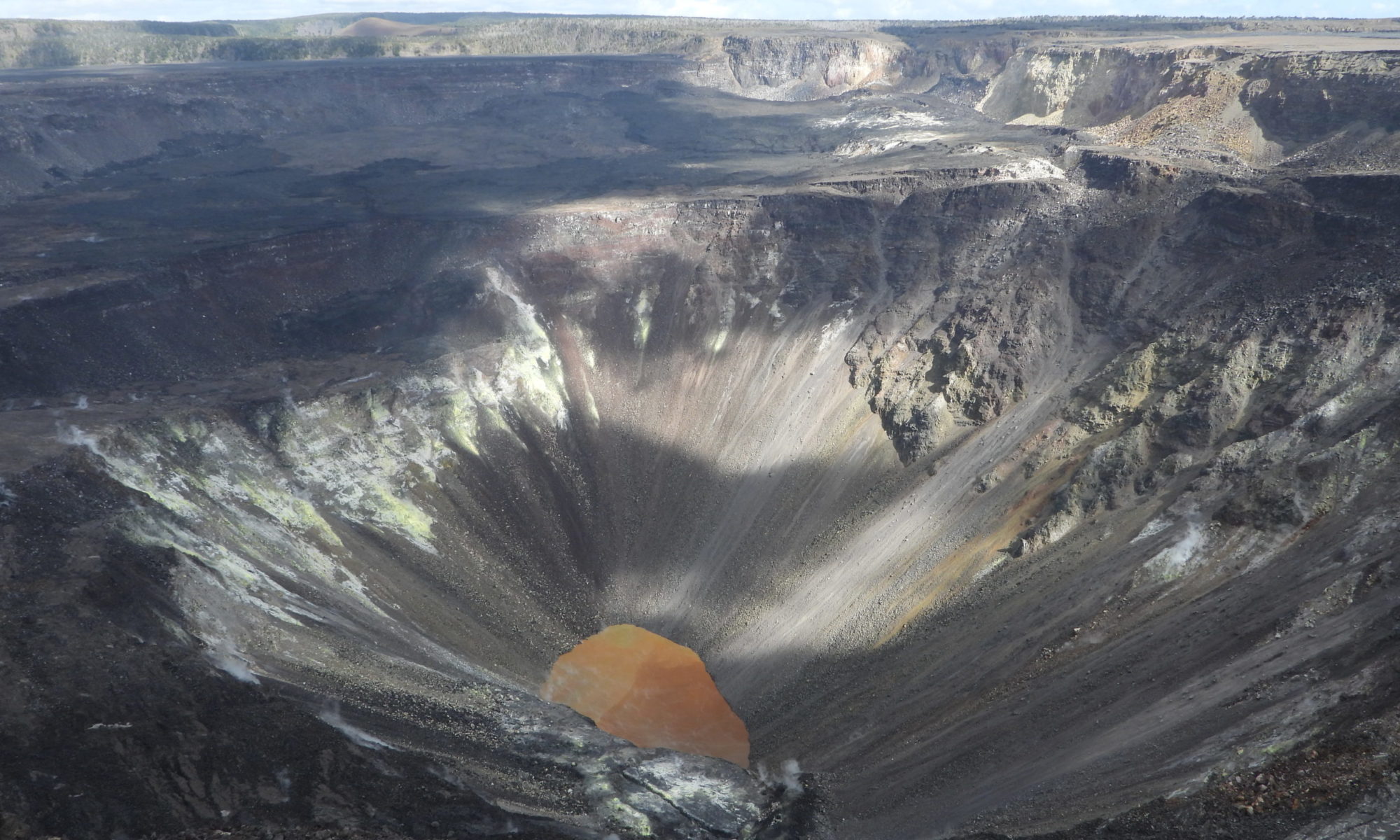
A small, orange-brown lake is set in a deep crater of grey-brown rock

Paper: Modeling Groundwater Inflow to the New Crater Lake at K¯ılauea Volcano, Hawai’i

Authors: SE Ingebritsen, AF Flinders, JP Kauahikaua, and PA Hsieh

Accompaniment to the Third Pod from the Sun episode

When we think of opposing forces in the natural world, fire and water come quickly to mind; elemental powers always at odds, one winning out over the other. There are a few interesting times and places, though, where they can co-exist, occupying some of the same spaces in the landscape.  Perhaps the most visible example of these in the geological world are hydrothermal systems in volcanically active regions, places where earth’s internal heat meets subterranean water with, at times, explosive results.    

For decades the crater at the summit of the Kilauea volcano in Hawai’i, one of the world’s most active volcanoes, was filled with a pool of lava. The constant flow of magma churning up from the volcano’s depths kept this lava lake supplied with fresh molten material.  

That is, until a major eruption in 2018 shifted the volcanic pipelines beneath the lake causing it to empty dramatically at the same time major fissure eruptions were sending waves of lava over residential areas near the eastern flank of the mountain. When a now-empty summit crater began to fill with water, no one was quite sure what to expect.  

Eruptions at Kilauea have been frequent occurrences over the last at least 200 years with varying frequency and intensity. Some of these events have led to what geologists call ‘phreatic eruptions’, highly explosive events that occur when erupting lava comes in contact with cold water causing a high energy eruption of steam, ash, and rock fragments. Often in Hawai’i this occurs when lava flows reach the ocean; however, in the 2018 eruption, groundwater posed a new concern. When the lava lake at the summit began to drop below the water table, both water and lava were essentially trying to fill in the same spaces. At that point there was speculation that some highly explosive events could be imminent as the lava reached the groundwater table and larger volumes of water began to flow into the crater. Relatively little was known about the groundwater table in the area and how long it would take to fill the now empty lakebed emptied of lava. 

Researchers from the U.S. Geological Survey (USGS) hurried to develop new conceptual and numerical computer models to predict how the balance between lava flow and groundwater flow would shift as these internal conduits in the mountain emptied of molten material and began to fill with water. The groundwater flow models were challenged by the temperatures and pressures involved in the Kilauea scenario and initial predictions ranging from 3 to 24 months were narrowed as the lake began to fill in July of 2019, about 14 months after the lava lake collapse. In a paper in the journal Groundwater they explain how water flow was delayed by many months by the inability of groundwater to move through the extremely hot rock. New observations of on the ground conditions, such as inflow, temperature, and evaporation rates helped to refine the existing model to better understand the potential for future interactions in the crater and give volcano observers better tools to predict these potentially hazardous magma-water interactions in future eruptions. 


Water under Fire by Avery Shinneman is licensed under a Creative Commons Attribution-ShareAlike 4.0 International License.
Understanding highly explosive basaltic eruptions using simulations

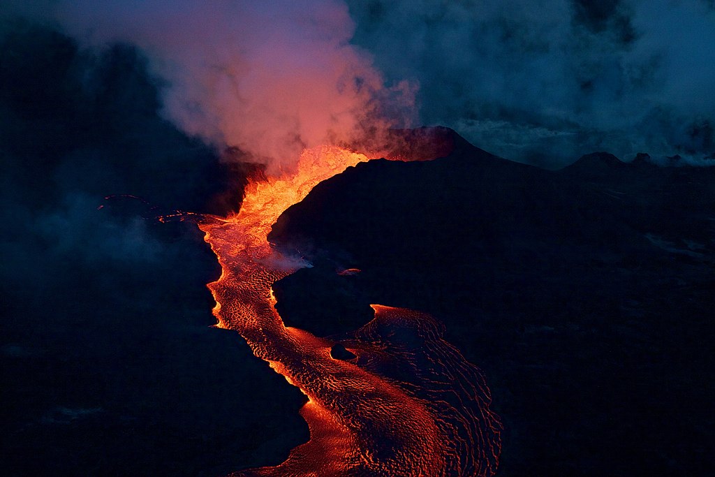
Featured image: A fissure cone of Kīlauea (Hawaii) erupting during the 2018 eruptive episode. via Wikimedia commons (Public domain)

Paper: Role of volatiles in highly explosive basaltic eruptions.

Authors: Giuseppe La Spina, Fabio Arzilli, Mike R. Burton, Margherita Polacci, Amanda B. Clarke

When we think of Hawaii or Iceland, the first thing that comes to mind is volcanoes. Lava fountains spew out basaltic lava, which silently meanders its way to the ocean. The notion that basaltic eruptions are always less explosive compared to other types like rhyolitic and andesitic eruptions is not entirely true. For example, Mount Etna in Italy has produced highly explosive basaltic eruptions such as the 122 BCE Plinian Eruption and another in 1669. Because highly explosive basaltic eruptions are not very common, they’re not fully understood leaving scientists wondering “What could be the reason behind this erratic behaviour?”

Continue reading “Understanding highly explosive basaltic eruptions using simulations”

Ancient Explosive Volcanoes on Mars

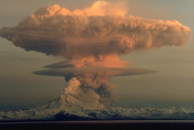
Featured image: a mushroom shaped volcanic plume arising from the explosive activity of Redoubt volcano, Alaska in 1990. Credit: R. Clucas.

Paper: Caldera Collapse and Volcanic Resurfacing in Arabia Terra Provide Hints of Vast Under-Recognized Early Martian Volcanism

Authors: Yin Yau Yoyo Chu, Joseph R. Michalski, Shawn P. Wright, A. Alexander G. Webb.

Mars is a planet of extreme highs and lows containing the solar system’s largest volcano – Olympus Mons – and the largest canyon system – Valles Marineris. Tharsis and Elysium, the planet’s two largest volcanic provinces, are young surface features that were built by basaltic volcanism throughout the Amazonian, the most recent geological era on Mars.

Continue reading “Ancient Explosive Volcanoes on Mars”

It’s LeviOsa, Not LevioSA: The Science Of Levitating Mud On Mars

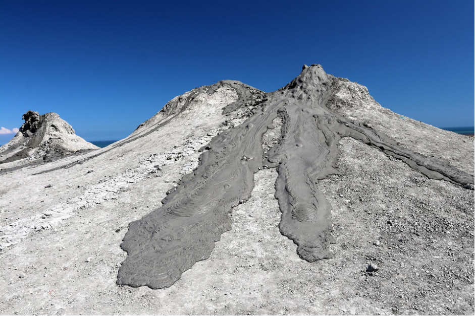
Featured image: A mud volcano and mud flows in Azerbaijan. Credit: CAS/ Petr Brož/ CC BY-SA 4.0.

Paper: Mud flow levitation on Mars: Insights from laboratory simulations

Authors: Petr Brož et al.,

The Mariner spacecraft’s first images of Mars in the 1960s and 70s showed large volcanoes and flow features, most likely lava or mud. These features were largely interpreted to be lava flows because they look similar to those seen on Earth. However, a 2020 study by Brož et al., shows that mud flows may be more prevalent on Mars than first hypothesized. 

Continue reading “It’s LeviOsa, Not LevioSA: The Science Of Levitating Mud On Mars”

Iceland’s constantly changing landscape: A Book Review

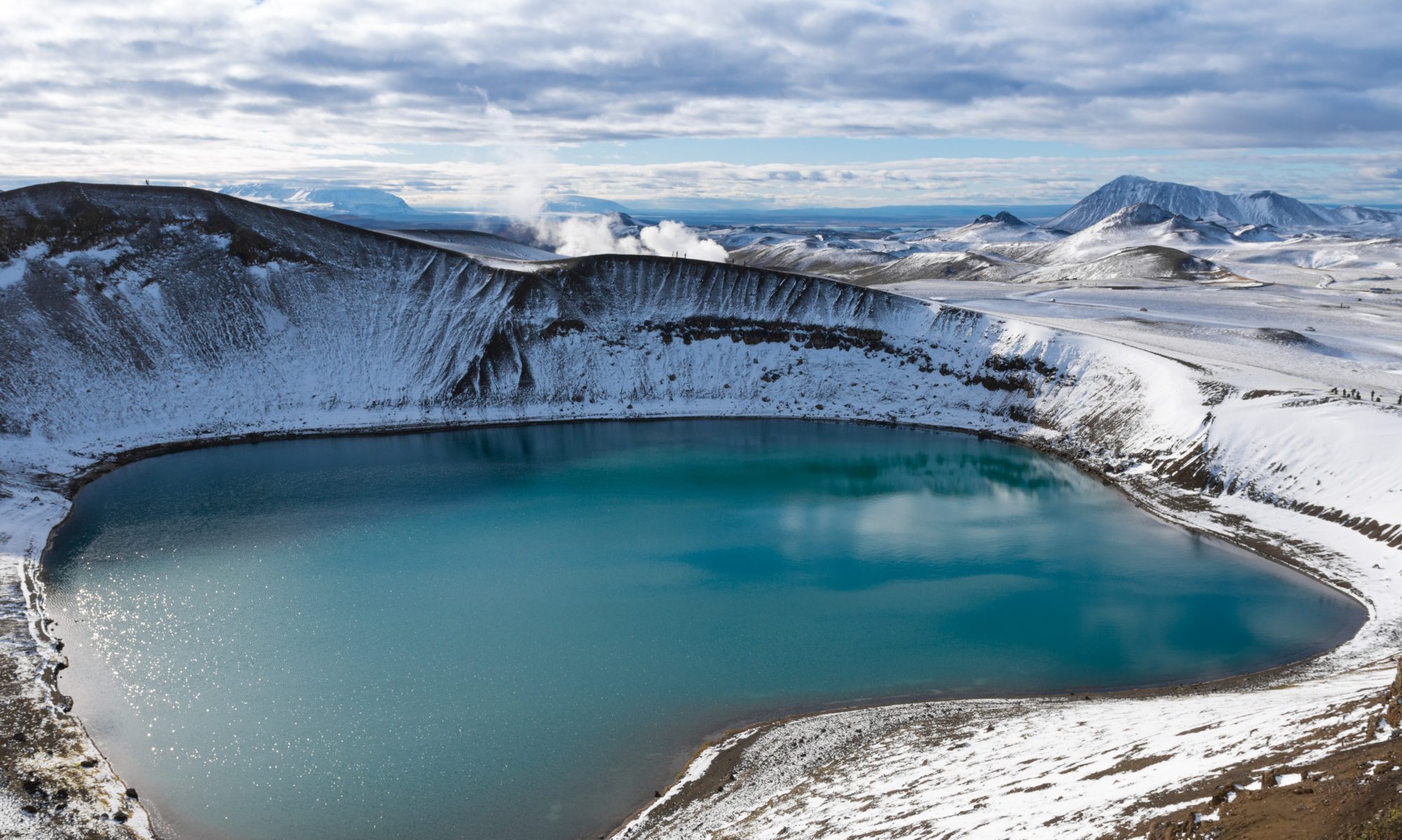
Featured Image: Lake in a volcano’s crater at Mývatn, Iceland. Photo by Philipp Wüthrich on Unsplash.

Book: Iceland: Tectonics, Volcanics, and Glacial Features, Geophysical Monograph 247 (First Edition, 2020)
Author: Dr. Tamie J. Jovanelly
Figure Illustrations: Nathan Mennen
Additional Text:
Emily Larrimore
Publisher:
American Geophysical Union, John Wiley & Sons, Inc.

I have always wanted to go to Iceland and travel the countryside marveling at the island’s unique geology and icy wonder. Reading through Iceland: Tectonics, Volcanics, and Glacial Features by Dr. Tamie J. Jovanelly, I felt like I got my chance to tour Iceland; this time with a very experienced guide. Dr. Jovanelly has been to Iceland more than ten times since 2006 to explore and study and her familiarity with the place and the people who live there is engrained in this text.

Continue reading “Iceland’s constantly changing landscape: A Book Review”

What lies beneath: tracing human migrations through stone tools, India

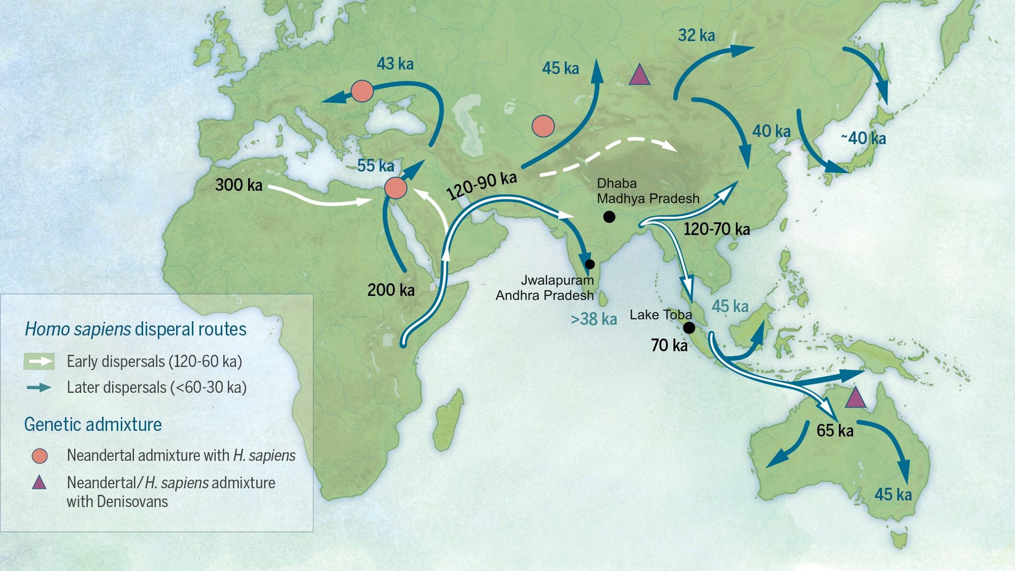
A map demonstrating possible migration routes of modern humans

Featured image: Katerina Douka, Michelle O’Reilly, Michael D. Petraglia – On the origin of modern humans: Asian perspectives; Science 08 Dec 2017: Vol. 358, Issue 6368, DOI: 10.1126/science.aai9067 [1], CC BY-SA 4.0 (Wikimedia Commons) with minor edits

Paper: Human occupation of northern India spans the Toba super-eruption ~74,000 years ago

Authors: Chris Clarkson, Clair Harris, Bo Li, Christina M. Neudorf, Richard G. Roberts, Christine Lane, Kasih Norman, Jagannath Pal, Sacha Jones, Ceri Shipton, Jinu Koshy, M.C. Gupta, D.P. Mishra, A.K. Dubey, Nicole Boivin & Michael Petraglia

Modern humans evolved around 200,000 years ago in Africa, and dispersed from there to other parts of the globe. The Out of Africa theory is a well-established model that explains the early dispersal of Homo sapiens or modern humans from Africa, into Asia and Oceania. Among the routes proposed is the Southern Route migration from East Africa to the Near East, across the Red Sea, and around Arabia and the Persian Plateau to India, and then finally with modern humans settling in Asia and Australasia. 

India’s geographic location is a key piece of this puzzle. Mitochondrial DNA of contemporary populations in India indicate that the country was an important stepping stone in the colonisation of Australasia. However, the timeline for the proposed Southern Route migration is still a matter of debate – could dating the arrival and settlement of modern humans in India provide some clues?

Continue reading “What lies beneath: tracing human migrations through stone tools, India”

Tiny but Mighty! Nanosized Drivers of Explosive Volcanism

Paper: Can nanolites enhance eruption explosivity?

Authors: F. Cáceres, F. B. Wadsworth, B. Scheu, M. Colombier, C. Madonna, C. Cimarelli, K-U. Hess, M. Kaliwoda, B. Ruthensteiner, D. B. Dingwell

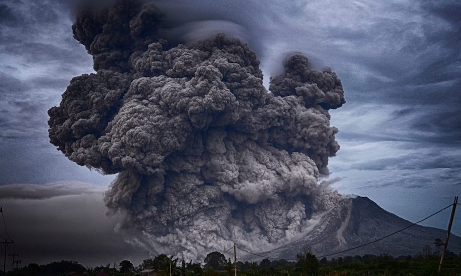
Explosive volcanic eruptions have punctuated our planet’s geological record for millions of years. The explosive nature of these eruptions can lead to thousands of cubic kilometers (that’s a billion Olympic swimming pools) of material travelling hundreds of miles across our landscapes and into our atmosphere. Approximately 630,000 years ago, the most recent eruption from the Yellowstone volcanic center sent ash and dust from Wyoming to southern Texas, USA. More recently, the 1815 eruption of Mt. Tambora, Indonesia, led to 1816 being historically known as the “Year Without a Summer”. The “Year without a summer” was started when volcanic materials entered the atmosphere and induced a volcanic winter, which led to extreme weather, agricultural stresses, and food shortages across the globe.

Continue reading “Tiny but Mighty! Nanosized Drivers of Explosive Volcanism”

Pioneering plants tell us when volcanoes last erupted

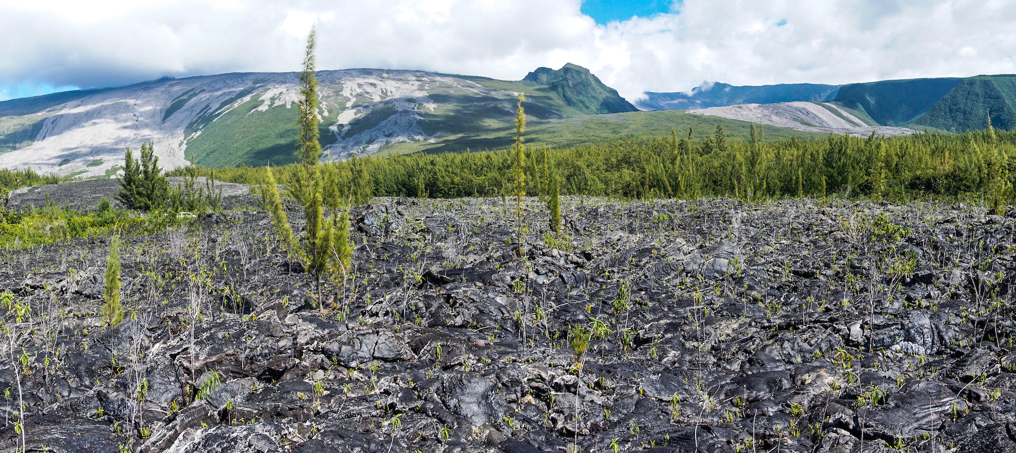
Featured image: vegetated lava flows on Le Grand Brûlé, with the profile of Piton de la Fournaise behind. Image credit: Mickaël Douineau on Flickr (CC BY-NC-ND 2.0).

Paper : Dating young (<1000 yr) lava flow eruptions of Piton de la Fournaise volcano from size distribution of long-lived pioneer trees Authors: Sébastien Albert, Olivier Flores, Laurent Michon and Dominique Strasberg

A newly formed lava flow may appear to be a sterile environment: devoid of vegetation and humus. But within years, the rocky wasteland erupts into life as a host of tenacious plants take hold. The size of plants rooted on solidified lava is now being used by volcanologists working on Piton de la Fournaise, a shield volcano on the Indian Ocean island of Réunion, to date past eruptions.

Continue reading “Pioneering plants tell us when volcanoes last erupted”