
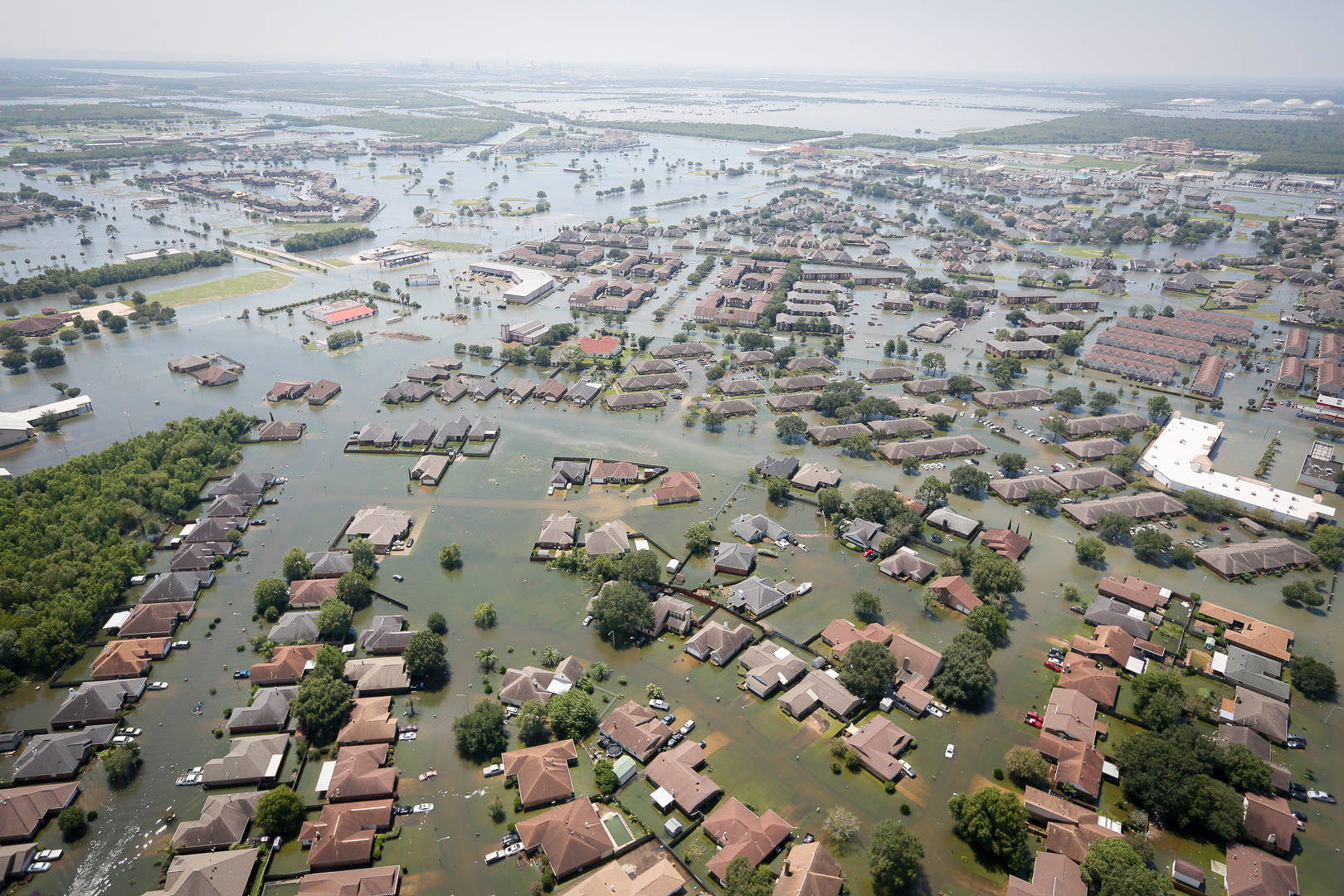
Feature Image: Flooding in Port Arthur, Texas on August 31, 2017 from Hurricane Harvey. Image from Wikimedia.
_(50).jpg)
Article: Assessment of Future Flood Hazards for Southeastern Texas: Synthesizing Subsidence, Sea‐Level Rise, and Storm Surge Scenarios
Authors: M. M. Miller and M. Shirzaei
Residents of southeastern Texas are not strangers to hurricane landfalls, including Hurricane Harvey in 2017, which caused 80 fatalities and damaged over 80,000 houses without flood insurance. With the population of coastal areas in the United States expected to continue to grow, understanding how hurricane-associated flooding will change in the future is essential for informing policy decisions and flood resilience strategies. Unfortunately southeastern Texas is facing a triple threat of factors that increase the risk of flooding during hurricane landfalls: land subsidence, sea level rise, and more intense hurricanes.
Land subsidence, or sinking, increases the risk of flooding because water from the ocean or bays can more easily wash over land that is at lower elevation. The subsidence in southeastern Texas is mainly due to the depletion of underground aquifers for water supply, a problem that may only worsen as more people move into the area. Sea level rise, mainly caused by anthropogenic climate change, is occurring at a global-average rate of 3.3 mm per year, but recent studies indicate that this rate is speeding up. Sea level rise isn’t uniform everywhere, and due to the land subsidence and other factors, the sea level in southeastern Texas is rising faster than the average. For example, sea level rise on Galveston Island is estimated at 6.6 mm per year (https://tidesandcurrents.noaa.gov/sltrends/sltrends.html).
While the combination of land subsidence and sea level rise worsen flooding on their own, adding the impacts of hurricane landfalls greatly increases the land area at risk of flooding. Hurricanes can cause flooding through both heavy rainfall and storm surge — the abnormal rise in sea level caused by the hurricanes’ high winds. Climate change is expected to cause hurricanes to dump larger amounts of rainfall and also to increase their average intensities (measured by wind speed), which may worsen storm surge as well. While scientists are unsure whether more, less, or the same number of hurricanes will hit southeastern Texas in the future compared to today, the combined impacts of land subsidence, sea level rise, and greater hurricane rainfall will certainly increase the risk of flooding when one does make landfall. As climate change and land subsidence continue, how far inland will hurricane flooding extend?
To explore the risk of hurricane-related flooding under different climate change scenarios, Miller and Shirzaei used computer models to project the areas of southeastern Texas that will be at risk of flooding from different levels of storm surge in 2030, 2050, and 2100. Note that these model simulations do not include the impacts of potential changes in hurricane rainfall or intensity in the future. First, they ran the models only including the impacts of land subsidence and sea level rise, and they found that while urban areas in Galveston and Texas City are at risk of major flooding, most of Houston is unaffected. However, adding in storm surge changes the picture as more of Houston is flooded by progressively higher storm surges and at years farther into the future. For example, under a “moderate” climate change projection scenario (known as RCP4.5), in the year 2050 a 0.5 meter storm surge would cause about 200 km2 of land to be inundated with water, while an 8 meter storm surge would cause about 1,000 km2 to be inundated. For comparison, the entire city of Houston covers about 1,550 km2, and the highest storm surge during Hurricane Harvey was about 3.7 meters. While an 8 meter storm surge is rare, it is possible. Hurricane Katrina in 2005 produced an 8.5 meter storm surge that devastated New Orleans.
This study’s model simulations covered a wide variety of scenarios, including both “best case” and “worst case” climate change scenarios and a range of storm surges from 0.5 meters to 8 meters. Since we are unsure how exactly climate change will proceed in the future, having a variety of scenarios is helpful when making decisions about flood risk planning and future urban development. This study should serve as a warning for those living in southeastern Texas and all hurricane-prone coasts that climate change is already impacting them and they must prepare for worsening flooding in the future.
The growing threat of hurricane-associated flooding in southeastern Texas by Alyssa Stansfield is licensed under a Creative Commons Attribution-ShareAlike 4.0 International License.