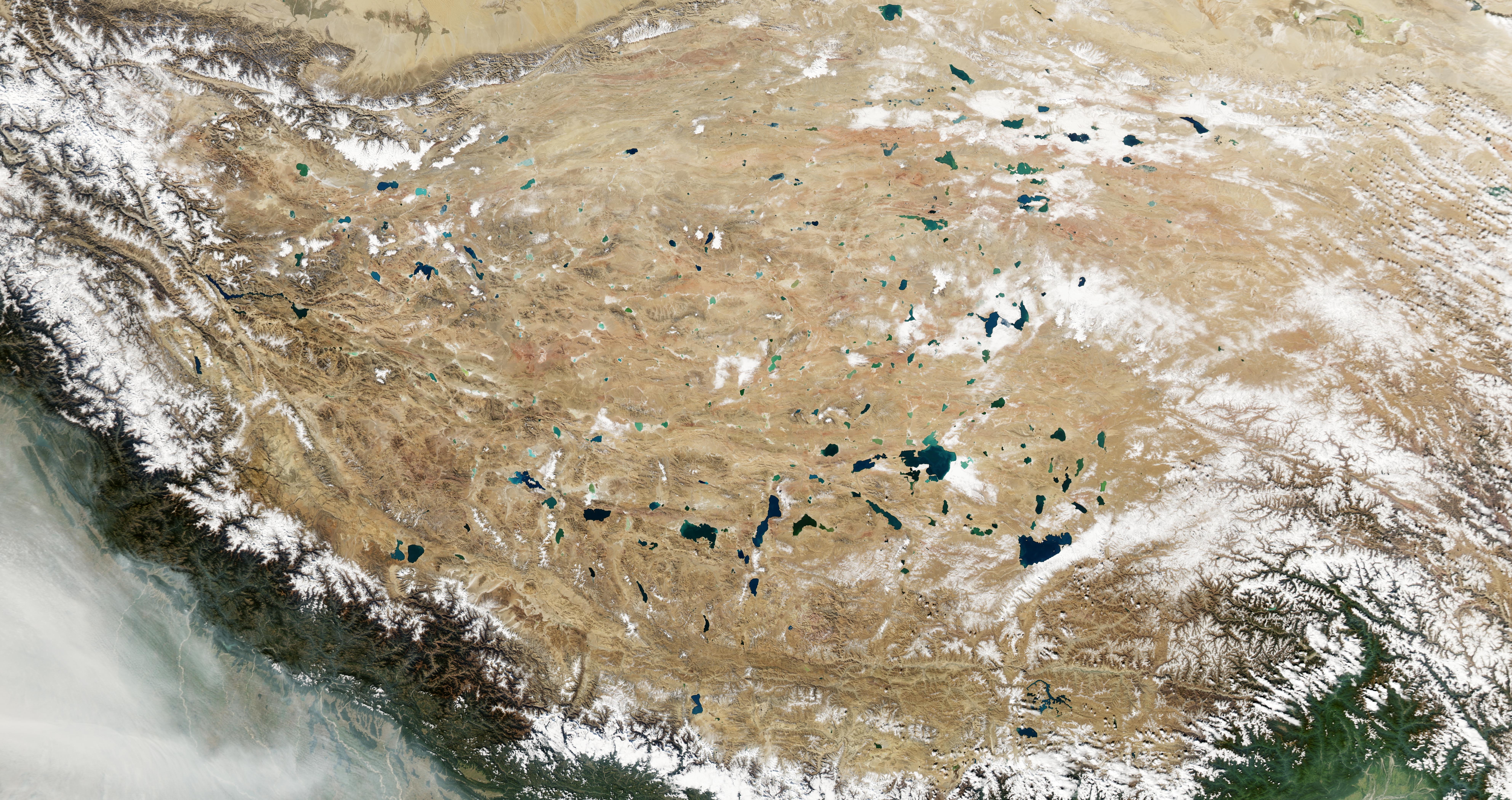
Featured image: MODIS-Aqua image of the Qinghai-Tibet Plateau via NASA Earth Observatory, created by Jesse Allen.
Article: Ongoing drainage reorganization driven by rapid lake growths on the Tibetan Plateau
Authors: Kai Liu, Linghong Ke, Jida Wang, Ling Jiang, Keith S. Richards, Yongwei Sheng, Yunqiang Zhu, Chenyu Fan, Pengfei Zhan, Shuangxiao Luo, Jian Cheng, Tan Chen, Ronghua Ma, Qiuhua Liang, Austin Madson, Chunqiao Song
Whether we recognize it or not, the land surface around us is organized into watersheds or drainage basins–areas that share a common outlet for precipitation. On human timescales, drainage basins are typically fixed, because they are defined by the slopes and contours of topography that change very slowly or very infrequently. In the Tibetan Plateau, however, rapid climate change is altering drainage basins before our eyes. Recently, Liu and colleagues from China, the United States and the United Kingdom used satellite data to identify dramatic changes in drainage basins over a period of only 18 years.
The Tibetan Plateau is the world’s largest and highest plateau, sometimes called Earth’s “Third Pole” for its extensive glaciers that contain the largest supply of freshwater outside of Earth’s poles. While it is home to the headwaters of many of Asia’s largest rivers, it is also home to many lakes with no outlets at all. These endorheic lakes fill with meltwater from glaciers and snow on surrounding mountains, and only lose water by infiltration through the lakebed and evaporation from the lake surface to the atmosphere. As climate change has dramatically increased the pace of glacial melt, many lakes in this region have been growing rapidly. As lakes fill, they can change the drainage patterns around them, either through the merging of lakes or through the formation of new channels between lakes as water spills over from one to another. While changes in lake level are often gradual, outburst floods have been observed to rapidly raise the water level in lakes on the Tibetan Plateau by over 10 meters, inundating surrounding land in the process.
Liu and colleagues used satellite-derived imagery and digital elevation models to look for changes in lake area and drainage patterns. Between 2000 and 2018, they identified 11 episodes of drainage reorganization: in eight cases lakes had merged, while in three cases new connections formed between lakes. Based on current rates of lake volume increase, 11 more drainage basins on the Tibetan Plateau are expected to merge or become connected by 2030.
In all of the cases discussed so far, the lakes remained endorheic, without any outlet to a river that drains to the ocean, but this may change in the future. Projections show that Lake Yanhu, which is currently rising at a rate of 1.7 meters per year, could overtop a topographic boundary by 2030, connecting its drainage basin to the Chumar River. The Chumar in turn drains to the East China Sea via the Yangtze River. Such an event could have devastating consequences for settlements and infrastructure downstream and would alter the supply and timing of water and sediment in the upper Yangtze River. In 2019 the Chinese government built an artificial channel to manage the connection between Lake Yanhu and Chumar River to pre-empt major damage to infrastructure.
With climate projections indicating increased warming on the Tibetan Plateau, we should expect the current trends of expanding lakes and changing drainage basins to continue, at least while meltwater remains available. Observations like these are both fascinating in that they show us clear evidence of how climate change is transforming landscapes, and critical for protecting human lives and livelihoods as the risk of disaster increases.
Rapidly growing lakes are changing the drainage of the Tibetan Plateau by David Litwin is licensed under a Creative Commons Attribution-ShareAlike 4.0 International License.

